Fastest Turnaround Times In The Surveying Industry!


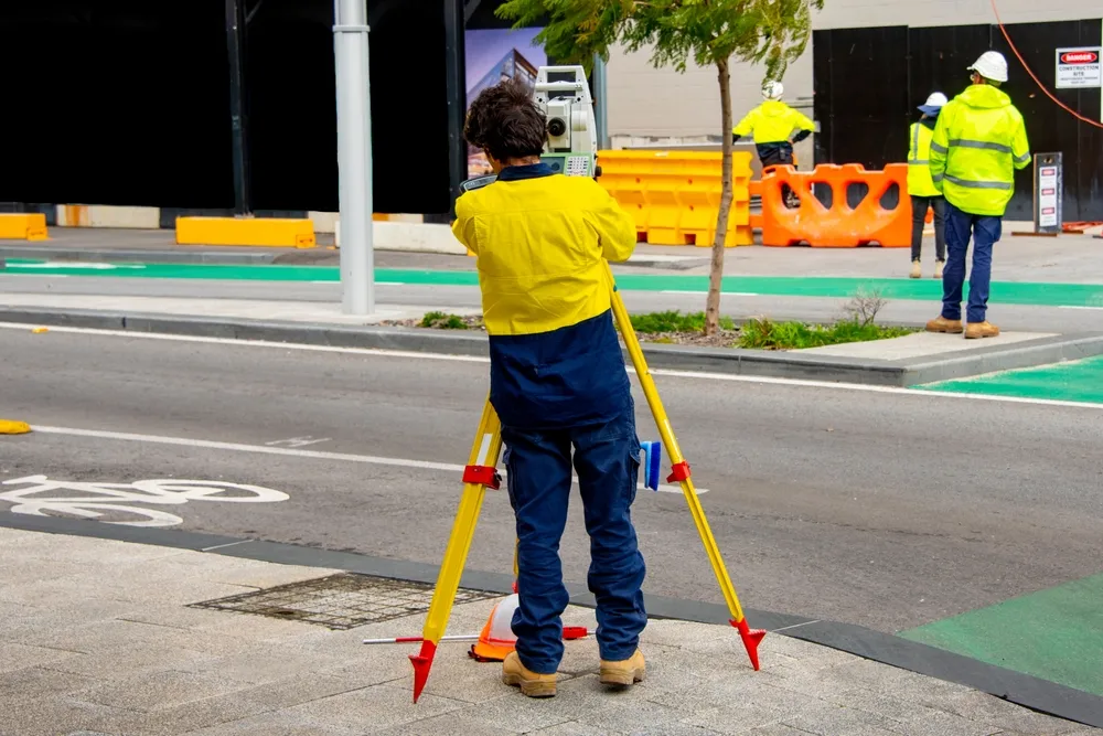
Landscaping projects in Shellharbour have shifted into a period where technology is moving faster than traditional fieldwork ever could. Clients expect quicker results with clearer reporting and more accurate measurements that help them make better project decisions. These expectations continue to grow as surveyors in Shellharbour adopt tools that deliver instant insights while keeping projects coordinated and simple to manage. Our team at MCS Surveyors knows how these digital tools shape workflows that used to take days and turn them into efficient systems that support better planning and development outcomes.
Our team has been part of these changes, and we know how much value these innovations bring to builders as well as developers and property owners. Digital tools help reduce small errors that can quickly turn into large problems while keeping each project step connected from start to finish. They also allow us to provide more transparency for clients so they can feel confident about the information they receive. The shift to digital workflows is not slowing down, and businesses like ours continue to evolve with the technology that sets new industry standards.
The move towards digital workflows reflects a clear need for accuracy with speed and reliable communication across the entire project team. Many older systems struggled to keep up with modern demands and created delays that could stall progress for extended periods. Digital tools solve this by connecting office teams with field teams in real time so information can be reviewed and confirmed instantly. These improvements allow everyone to work from the same data, supporting consistency and raises the quality of project outcomes.
Paperless systems have replaced the slow and outdated methods that once required repeated manual checks and back-and-forth coordination. Real-time mapping has changed how information is shared by providing faster clarity around boundaries or structures and elevations. Compliance requirements are easier to manage when everything is captured digitally, reducing missed details and delays in reporting.
Modern platforms now allow complete visibility of field measurements as soon as they are taken, helping office teams respond quickly to any project needs. Everyone works from the same information, removing uncertainties while keeping communication sharp and efficient. This level of collaboration ensures that decisions can be made promptly with confidence in the data presented.
Digital workflows make it easier to manage sensitive information and maintain secure records for years to come. Modern systems store data safely in controlled environments where it can be accessed by approved users at any time. This improves project continuity, especially for long developments that require accurate historical information.
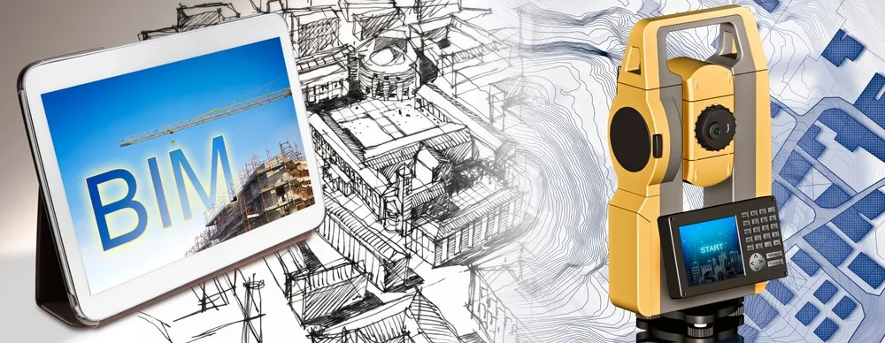
Equipment continues to evolve at a pace that reshapes how survey work is approached, with each upgrade providing new levels of accuracy and efficiency. Tools that were once used only for large industrial sites are now accessible for everyday development projects. These advancements allow more detailed mapping to be completed in less time, benefitting both field teams and clients. As equipment becomes smarter, projects run smoother with fewer delays and less uncertainty.
Automation has helped remove the repetitive parts of fieldwork so teams can focus on tasks that require expert judgement. Smart sensors now gather information faster and more precisely, minimising manual adjustments. UAV (Unmanned Aerial Vehicle) technology adds another layer of capability by capturing high-quality information from above, improving site clarity.
New tools reduce the need for lengthy manual steps and keep teams moving confidently through each task. These improvements help produce reports sooner (which clients appreciate), especially when decisions rely on tight timelines. As technology improves, so does the speed of processing and analysing data.
Advanced equipment reduces inconsistencies in measurements, which means fewer adjustments or site visits are required. This leads to smoother project stages because data remains reliable from the first capture. Improved accuracy helps minimise disputes and provides a clear baseline for all stakeholders.
Development projects now rely heavily on detailed visual information that supports coordination between many different professionals. Integrating GIS (Geographic Information System) with BIM (Building Information Modelling) and 3D modelling creates a clearer picture of how a site behaves both above and below ground. These tools allow issues to be identified early, helping teams plan smarter and avoid unnecessary changes later. The combination of mapping and modelling leads to more predictable results and supports faster decision-making.
Visual tools create a detailed representation of a site which helps everyone see how different project elements interact. This improves communication because all stakeholders view the same information. Better visibility helps identify problems early so adjustments can be made with minimal disruption.
Early detection of design issues helps prevent costly construction delays and redesigns. GIS and BIM integration allow teams to see where underground utilities and structures may conflict. These tools assist in refining plans before work begins, supporting smoother project execution.
Accurate data supports councils and developers in managing assets well beyond the initial construction period. GIS and BIM models form the foundation for reliable long-term maintenance strategies. These tools help track structural changes over time, improving future planning.
Digital surveying makes it easier for every stakeholder to access accurate and timely information. Councils spend less time reviewing unclear documents because modern tools improve the clarity of submissions. Developers can make quicker decisions because they receive reliable data that highlights opportunities and constraints. Builders also benefit from reduced delays because site information stays consistent throughout each construction phase.
Clear information reduces review times and helps keep development applications moving efficiently. Digital reports reduce errors, which helps avoid resubmissions that slow progress. Councils appreciate consistent formatting because it supports smooth processing.
Developers rely heavily on accurate data to plan budgets and timelines. Digital systems provide ongoing visibility, which helps track changes quickly. A more organised workflow means fewer disruptions during planning.
Builders depend on reliable measurements to avoid complications during construction. Digital information helps crews work with confidence because they know exactly what to expect on site. Property owners also benefit from reduced risks and clearer outcomes.
Modern methods remove many of the uncertainties that once affected development projects. Improved accuracy means fewer disputes and fewer costly adjustments. Digital tools keep all information aligned, which reduces misunderstandings between stakeholders. Better results support safer planning and stronger long-term outcomes.
Boundary disputes and incorrect measurements can lead to significant delays. Digital tools help identify these issues before they escalate. Early detection saves time and reduces stress for all parties involved.
Legal documentation depends on high-quality information that leaves no room for uncertainty. Modern tools provide reliable results which help meet these obligations. Clients appreciate the reassurance that their records are accurate and compliant.
Accurate information improves safety planning on active construction sites. Modern methods help teams understand terrain behaviour and structural locations more clearly. This helps reduce hazards and creates safer workplaces.
Surveying technology is entering a phase where automation and integrated platforms will become the new standard. Systems will continue to connect in ways that improve accuracy and communication. Tools will evolve to deliver more detailed data with less manual effort, which supports better project outcomes. The industry will become increasingly efficient as these technologies continue to grow.
AI technology will help teams analyse data faster and detect inconsistencies instantly. This improves the reliability of results and reduces the time needed to finalise reports. AI will continue to refine how information is managed.
Future tools will provide even stronger connectivity between field and office teams. Data will move instantly through platforms that keep everyone updated without extra steps. This connected approach will strengthen collaboration.
Augmented and mixed reality tools will provide clearer visual representations for on-site planning. These technologies help teams see potential design outcomes before construction even begins. They support stronger decision-making and reduce uncertainty.
Digital technology continues to transform surveying in ways that benefit everyone involved in land development. These innovations help produce faster results with clearer insights which support better decisions at every project stage. MCS Surveyors remains committed to using the latest tools so clients receive reliable outcomes that help their projects move forward with confidence.
As technology evolves, the industry will keep gaining new tools that improve communication and safety across all types of work. Clients can look forward to better visual clarity with stronger reporting systems and quicker turnaround times. These improvements strengthen planning and construction outcomes which deliver long-term value for property owners and everyone involved in the project.