Fastest Turnaround Times In The Surveying Industry!
Flood-Affected Land and Duplex Builds: How a Surveyor Protects Your Investment
July 17, 2025
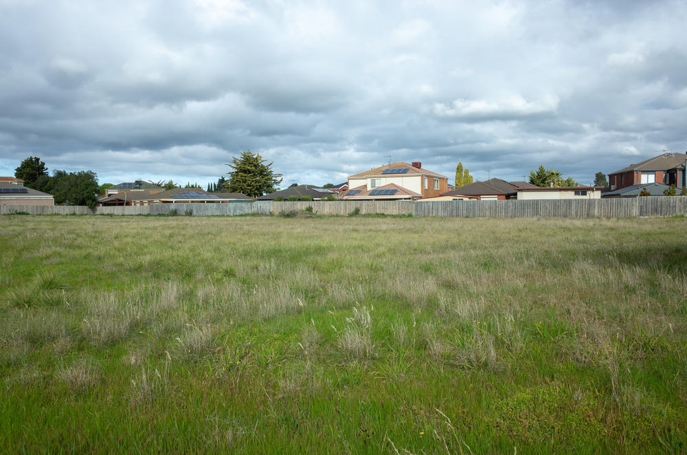
Areas that are impacted by floods present distinct challenges that demand careful analysis before moving forward with any residential project. From personal experience, understanding the interplay between seasonal water movement and surface conditions helps target critical points where water might accumulate, endangering structures. Expert evaluation ensures that potential hazards are identified early, reducing the risk of costly revisions or retrofits long after construction begins.
Duplex developments amplify these concerns, as two dwellings share common site conditions yet often have differing design requirements. Accurate measurements of elevations and site features inform tailored solutions for each unit, whether adjusting finished floor levels or repositioning building footprints. By providing reliable data, professionals safeguard both the structural integrity of each home and the homeowner’s peace of mind.
Flood Zones and Risk Categories in NSW
Authorities classify land according to how often and how severely it may flood, guiding builders and designers towards appropriate safeguards. Risk categories reflect both extreme meteorological events and everyday overland flows that may not make headlines yet still cause damage. Recognising the full spectrum of water hazards helps align site plans with official guidelines and community safety objectives.
NSW flood zoning explained
Flood zoning describes how likely a particular area is to experience inundation from different sources under defined return periods.
Areas with a 1‑in‑100‑year designation are at risk of being submerged during exceptionally rare but severe storms that drop large volumes of rain in short periods. These zones often require elevated design features to keep interiors dry when floodwaters surge beyond natural barriers.
Overland flow mapping captures more frequent events where rainwater that cannot absorb into the ground or drainage network flows across the surface. Understanding these transient pathways helps planners prevent minor waterlogging that, over time, can degrade building materials and foundations.
Combining both categories gives a complete picture, as 1‑in‑100‑year flood zones address extreme events while overland flow zones guard against everyday surface water movement. Together, they ensure that every rainy season is accounted for, from heavy downpours to prolonged soaking.
Council flood mapping and what it means for development
Councils provide digital flood maps to guide site selection and design parameters, helping applicants prepare robust development applications.
These maps often incorporate past flood records, hydrological models, and terrain data to show likely extents of inundation during various flood events. By overlaying building footprints on these maps, designers can adjust positioning to minimise interference with natural watercourses.
Areas labelled as flood fringe typically sit on the outer edges of major channels and may only see shallow water depths during moderate storms. Development within these zones can proceed with precautionary measures, such as raised floor levels and flood-resistant materials.
True floodway zones represent channels or depressions where water flows with force, carrying debris and sediment. Building in these areas usually requires specialist solutions or may be discouraged entirely to avoid blocking critical water escape routes.
High, medium, and low-risk classifications
Risk classifications refine broad flood mapping into manageable categories that correspond to tailored design responses.
High-risk zones are those in which floodwaters can exceed significant depths or velocities, often obliging a higher finished floor level and reinforced building components. Designers must consider both structural loads from water movement and potential impacts on access roads or services.
Medium-risk areas experience flooding that is less intense or of shorter duration, yet still capable of causing water ingress or minor structural damage. Standard flood mitigation measures, like non-return valves and ground-floor water barriers, are typically sufficient in these locations.
Low-risk areas face minimal chance of water pooling or flowing at damaging speeds, generally requiring only basic allowances for drainage connections and swale integration. While not immune to extreme events, these zones benefit from natural grading that channels flows away from buildings.
Council Requirements for Flood-Prone Development Applications
Development applications for flood-affected sites must satisfy a suite of local government conditions that protect both residents and neighbouring properties. Understanding these stipulations in advance streamlines approval and reduces the need for extensive revisions. By meeting clear benchmarks, applicants display due diligence and contribute to safer neighbourhood outcomes.
Common DA conditions for flood-affected sites
Local councils attach specific conditions to any approval on land identified as flood-prone, ensuring that construction does not worsen flood behaviour or residents’ vulnerability.
Finished floor levels for habitable spaces often must sit a prescribed height above the relevant flood event level, plus a freeboard allowance to account for uncertainties in modelling. This buffer guards against underestimation of flood heights or waves hitting building façades.
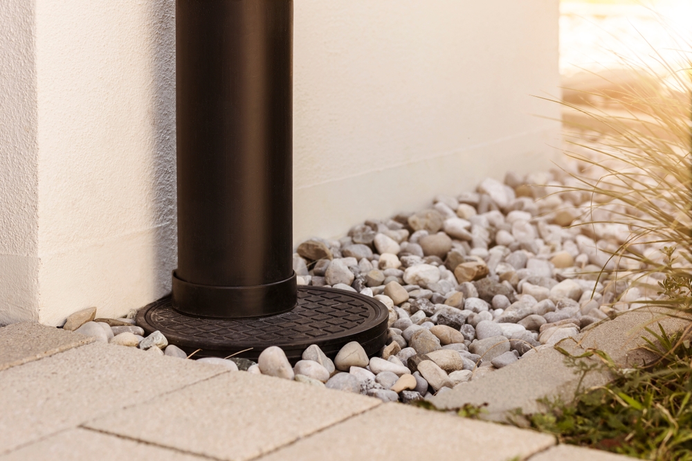
Stormwater must be managed on site, typically via detention systems that slow peak flows to pre-development rates, preventing downstream flood aggravation. Retention basins, permeable paving, and infiltration trenches all contribute to modulating runoff before it enters public drains.
Temporary works such as site compounds and spoil stockpiles require careful placement and containment to avoid obstructing flow paths, with erosion and sediment controls mandated during construction. Failure to comply risks washouts that carry silt into waterways, harming both property and the environment.
Mandatory reports and evidence required
Applications for flood-affected land generally need to include technical studies proving that risks have been fully assessed and mitigated.
A flood impact assessment examines how proposed buildings, driveways, and hard surfaces alter flood patterns, often requiring hydraulic modelling to quantify changes in water depths and velocities. Accurate ground surveys feed precise elevations into these models for credible conclusions.
A geotechnical report evaluates soil characteristics, as saturated soils can lose strength and bear less load, potentially triggering settlement or instability. Recommendations guide foundation types, drainage layers, and retaining structures suited to local ground conditions.
Certification from a qualified professional confirms that survey data are current and that design drawings incorporate all necessary flood levels and contours. Binding documentation reduces the council’s liability and clarifies responsibility for site accuracy.
How survey data supports approval
High-precision survey data form the backbone of every flood mitigation strategy, ensuring that design responses match on-site reality.
Detailed topographic surveys capture contours, pits, gullies, and existing structures within the floodplain, enabling engineers to calibrate their models against exact terrain features. Discrepancies between mapped and actual ground levels can drastically affect water velocities and pooling, making accurate data indispensable.
Site feature surveys record the location of drainage pits, pipes, and retention structures, clarifying how existing systems interact with new development. Without this information, proposals may inadvertently overload existing infrastructure or block critical flow paths.
As-constructed surveys verify that contractors adhered to design levels, confirming finished floor positions, pad elevations, and landscaping grades. Final certification then allows occupation, providing councils with confidence that flood safeguards are in place as approved.
Flood Level Verification Surveys
Flood level verification is an exacting process that proves finished structures meet or exceed specified flood clearance benchmarks. By measuring critical levels on-site, professionals validate that design factors translate into real-world outcomes. Such surveys underpin compliance and minimise future disputes or insurance complications.
What flood verification surveys measure
These surveys focus on crucial height markers relative to defined flood events, ensuring building components resist water intrusion.
The finished floor level of every habitable space is measured and compared against the relevant design flood level plus mandatory freeboard. Even slight variations can expose interiors to water damage during peak floods.
Surveyors also record the elevation of ground levels surrounding the building, confirming that grading slopes direct water away from walls and foundations. Proper landform contours prevent water from ponding against structures or saturating perimeter walls.
Key external fittings such as hot water systems, electrical metres, and control panels are checked to ensure they lie above prescribed heights, reducing the risk of service disruption and costly replacements following a flood event.
RLs, habitable floor levels, and design requirements
Reduced levels (RLs) provide a common reference frame, aligning on-site heights with formal specifications detailed in development approvals.
Each RL corresponds to the Australian Height Datum, forming a national reference that ensures consistency across projects and regions. When a DA calls for a habitable floor level of RL 10.5, all stakeholders know exactly where that sits relative to mean sea level.
Surveyors use precise instruments to set building pads and guide formwork to within a few millimetres of target RLs, minimising errors that could compromise flood safety margins.
Subsequent checks during construction confirm that no inadvertent settlement or concrete shrinkage has caused floor heights to deviate below required values, triggering remediation before walls are closed in.
Avoiding noncompliance penalties
Failure to verify flood levels accurately can lead to enforcement actions, costly modifications, or even demolition orders.
Councils routinely audit new builds in flood-prone areas by inspecting site certificates and matching on-ground conditions. If floor levels fall short of approvals, owners face orders to raise floors or add structural defences at their own expense.
Insurance companies may refuse to cover flood damage if survey certificates are absent or inaccurate, leaving homeowners liable for full repair costs. A clear chain of documentation from design through verification is essential to secure coverage.
Disputes with neighbours can arise when poorly graded sites redirect water onto adjacent properties, generating legal claims and fraught relations. Thorough flood level surveys protect all parties by demonstrating that works complied with approved plans.
Site-Specific Height and RL (Reduced Level) Requirements for Duplexes
When two dwellings occupy a single site, each must satisfy flood clearance at its habitable areas, yet both share the same base landform. Balancing these needs demands careful planning to avoid one unit encroaching on another’s safe levels. Coordinated elevation strategies make sure both halves of the duplex remain compliant without compromising aesthetics or access.
Minimum RLs for habitable areas
Regulations stipulate minimum heights for living spaces to remain above flood thresholds, adapting to each site’s local flood data.
For a 1‑in‑100‑year flood event with a freeboard of 500 mm, habitable floors often must be set at least 600 mm above modelled peak water marks. Such rules ensure water cannot enter living rooms, kitchens, or bedrooms under design floods with some allowance for wave action.
Garages, storerooms, and carports may sit lower, provided any flooding there cannot breach habitable spaces. Designers frequently position non-habitable areas as sacrificial buffers, protecting core living areas from direct inundation.
Separate RLs for balconies, decks, and stair landings guarantee that all points of entry remain dry and usable, even when floodwaters approach site boundaries. Each transition point must maintain a step or ramp above flood levels to prevent ingress.
Protecting properties through elevation planning
Aligning pad heights across neighbouring properties prevents water from seeking unintended routes during storms.
Surveyors map relative elevations at each lot boundary, ensuring that one side is not significantly higher, which could funnel water towards a lower neighbour. A balanced site grading plan smooths these differences and prevents water pooling.
Controlled earthworks taper land up from the street to front entries, channelling runoff into designated retention areas rather than private yards or neighbouring driveways. Such solutions often include swales or rock-lined channels to slow flows safely.
Where a duplex sits on a gentle slope, split levels within each dwelling can maintain flood safety while minimising excavation and retaining wall heights. Survey data guides these transitions to keep floor levels consistent with regulatory minimums.
Surveyor’s role in ensuring compliance
Ongoing surveying throughout construction confirms that elevation plans are correctly executed, from initial earthworks to final floor slabs.
Initial site setup relies on benchmarks tied to local datum, from which all levels are offset. Surveyors transfer these marks to the site pegs plumbers and carpenters use, guaranteeing that critical heights are visible during construction.
Regular check surveys at key milestones such as after pad formation, slab pouring, and backfilling allow any deviations above tolerance to be caught and rectified promptly. Without these checks, errors can compound, making later fixes far more disruptive.
A final as-built survey records all RLs and floor levels, producing the documentation councils require before issuing occupation certificates. This snapshot of completed works backs up claims that each dwelling meets flood safety conditions.
Surface water that runs off during rainfall events can follow unexpected paths, especially where artificial fill or landscaping has altered natural grades. Overlooking these subtle channels can lead to ponding, erosion, or house flooding long after construction finishes. Detailed mapping of overland flow paths reveals hidden vulnerabilities that demand tailored design responses.
Detecting natural or artificial flow paths on land
Precise topographic surveys expose dips, minor ridgelines, and swales that govern how water travels across a site.
Surveys with high point density capture micro-topography, such as shallow depressions that might only fill on extended wet days yet still undermine foundations over time. Awareness of these features informs decisions on subsoil drains or cut-and-fill operations.
Artificial changes (like garden beds, paths, or retaining walls) can interrupt established flow lines, causing water to pool unexpectedly or erode unprotected slopes. Early detection lets designers incorporate drainage outlets or regrade areas before walls and landscaping are locked in.
Overlaying historic photos or LiDAR (Light Detection and Ranging technology) data with current site scans may reveal former creek lines or swamps now hidden underground but still exerting influence on water movement. Recognising legacy flow paths prevents repeated remediation work.
Risks of obstructing flow paths during duplex construction
Blocking natural flow channels not only creates on-site problems but can also shift risks to neighbours or public land.
Dumping spoil or positioning structures in former flow corridors may push water onto adjacent yards, sewers, or roads, provoking disputes and liability. Local councils take a dim view of development that increases flooding off-site.
Compacted subgrades under driveways can act as barriers, diverting runoff towards building trenches or garden beds and saturating footings. Specifying permeable pavements or subsoil collectors mitigates this effect while preserving access.
Neglecting to cater for roof runoff connections and surface drains can overload drainage pits, leading to localised flooding during heavy storms. Coordinated downpipe layouts and overland flow controls share the burden between stormwater infrastructure and natural paths.
Surveying solutions to mitigate risks
Once trouble spots are identified, targeted interventions restore or emulate natural flow regimes in built environments.
Designers may install shallow vegetated swales to guide excess water safely along the site perimeter, using the survey data to set accurate gradient controls. These swales can double as landscape features that slow water and filter sediments.
Subsurface drains placed along high-flow lines capture water before it reaches vulnerable areas, directing it into stormwater systems or engineered retention basins. Survey markers ensure correct pipe fall for reliable performance.
Where fill is essential, stepped terraces with cut-off drains intercept downslope migration, preventing saturation underneath retaining walls or slabs. The surveyor’s input guarantees that each cut and fill matches design angles and levels.
Stormwater Drainage Surveys Protect Your Future Property
Stormwater management is about controlling the quantity, quality, and timing of runoff leaving your site, ensuring neither the property nor surrounding areas suffer undue stress. Surveys provide the detailed base information required to design detention and retention measures that comply with local policies. A well-executed drainage plan prevents erosion, safeguards structures, and minimises maintenance headaches.
Mapping existing stormwater infrastructure
Understanding the current network of pits, pipes, and open drains uncovers capacity constraints and connection opportunities.
Surveys pinpoint each inlet’s invert level, pipe diameter, and material, forming an accurate as-built map of public and private systems. Designers can then assess whether old pipes have adequate capacity or need upgrading.
Identifying mains and easement boundaries prevents accidental work over critical assets, avoiding repairs or penalties. A clash between new foundations and allowable pipe setbacks can stall construction without proper mapping.
Recording maintenance access points ensures that future cleaning or inspection vehicles can reach stormwater assets without damaging landscaping or fences. A clear infrastructure map supports well-informed proposals.
Planning compliant drainage solutions
Councils enforce minimum requirements for detention volume, release rates, and water quality controls to protect downstream catchments.
Site surveys feed into volume calculations, where the difference between pre- and post-development runoff must be stored temporarily on site. Accurate catchment boundaries and slope data determine the size of detention tanks or basins needed.
Councils often mandate first flush diversion systems or rain gardens to trap sediments and pollutants before they enter waterways. Survey elevations guide the placement of inlets and outlets to ensure proper hydraulic head for treatment devices.
Overflow arrangements must channel excess stormwater safely towards public systems during extreme events, requiring clear delineation of overflow paths on survey plans. This attention to detail prevents accidental channelling of water towards buildings.
Avoiding flooding, erosion, and neighbour disputes
A robust drainage scheme addresses immediate site needs while respecting the broader catchment’s health and stability.
Controlling peak flows reduces the risk of erosion along property boundaries, where uncontrolled water might carve gullies or undermine fences. Properly graded spillways and erosion mats secure vulnerable surfaces.
Flooding in basement garages or cellars often stems from inadequate external drainage; surveys that capture local groundwater levels help designers set basement slabs above seasonal high water tables. Preventing groundwater ingress is just as crucial as surface runoff control.
Drainage plans that consider neighbouring lots ensure that no party is unexpectedly burdened by diverted flows, preserving good relations and avoiding legal claims. Shared infrastructure may even be formalised through easements or joint maintenance agreements based on survey-demarcated zones.
Flood Mapping vs. On-Site Survey Data: What Developers Need to Know
Broad flood maps provide a valuable starting point, but they cannot replace detailed on-site investigations. Relying solely on large-scale data invites rounding errors that become significant when applied to individual building elements. Investors and designers must combine council resources with precise measurements to achieve both compliance and cost efficiency.
Limitations of broad flood maps
While they offer region-wide insights, flood maps cannot capture every local nuance or recent site change.
Cartographic scales smooth out microtopography, potentially overlooking shallow channels or elevated knolls that alter water paths. Even a 200 mm obstruction can turn a dry corner into a pond during heavy rain.
Flood maps may be updated infrequently, meaning that recent land use changes, such as new roads or subdivisions, are not reflected, causing misalignment between predicted and actual conditions. Developers who rely only on outdated maps risk noncompliance.
Design flood levels on council maps incorporate conservative allowances but might not include detailed considerations such as wave run-up or localised debris impact, both of which can raise water elevations locally.
Why on-site, high-accuracy data is essential
Surveyors deliver centimetre-level accuracy, turning regional risk zones into practical building envelopes.
Topographic surveys capture the true shape of the land, enabling flood modelling with realistic boundary conditions and reduced uncertainties. By integrating this data, engineers avoid overly cautious designs that inflate costs.
Ground truthing confirms whether assumptions about existing drainage align with reality, revealing broken pipes, blocked pits, or unauthorised modifications. Detecting these issues early avoids unpleasant surprises during construction.
Precise elevations allow for accurate calculation of earthworks volumes and fill requirements, ensuring that material orders match actual needs. Overordering or underordering wastes resources and inflates budgets.
Combining council mapping with real-world site surveys
The most effective flood management strategies arise when official datasets meet fresh site information, delivering both scope and detail.
Overlaying high-resolution survey contours onto digital flood maps refines inundation extents, isolating only the areas truly at risk for targeted mitigation. Such hybrid approaches save money by limiting expensive defences to where they’re needed.
Survey-based verification of council flood levels gives confidence that local features—like levees or raised roads—are correctly factored into design floods, preventing inadvertent reliance on outdated or approximate data.
Continuous collaboration between mapping authorities, engineers, and surveyors fosters shared responsibility for flood safety, ensuring that each party’s insights complement rather than duplicate efforts.
Flood-prone land and duplex developments carry inherent challenges that require thorough, multidisciplinary coordination. By engaging qualified professionals to perform detailed flood zoning analyses, site surveys, and verification measurements, developers gain the confidence to proceed with robust design strategies. Accurate data not only streamlines council approvals but also minimises the risk of future damage, insurance disputes, and costly retrofits.
Ultimately, protecting a property from flood hazards safeguards both financial and personal investments. Well-executed flood risk assessments and elevation controls maintain structural integrity and occupant safety, while carefully planned drainage systems preserve neighbourhood harmony and environmental health. With the right blend of broad mapping insights and precise on-site data, each duplex project can achieve long-term resilience and peace of mind.