Fastest Turnaround Times In The Surveying Industry!


Digital surveying is transforming how complex projects are planned, designed and delivered across Sydney. From dense CBD developments and transport corridors to waterfront infrastructure and steep harbour suburbs, surveyors in Sydney now operate with levels of accuracy and real-time insight that were not achievable with traditional methods. Building information modelling, high-definition 3D laser scanning, UAV and drone mapping and advanced monitoring systems provide a continuously updated understanding of site conditions rather than a static snapshot.
These technologies work together to reduce risk, control cost and support more informed decision-making at every project stage. Improved coordination between architects, engineers and contractors allows tighter urban constraints to be managed more effectively while supporting compliance with evolving planning and construction requirements. Digital data integrates directly into design platforms and project management systems, enabling faster clash detection, clearer staging strategies and more reliable progress verification. This results in fewer surprises on site, more predictable delivery programmes and a clearer pathway from feasibility through to completion.
Complex projects are being forced into tighter sites, closer to existing structures and above or around critical underground assets. In this environment, traditional survey information is often not detailed enough or fast enough to support confident decision-making. Better survey data is no longer a “nice to have” but a core control on cost, time and risk.
Higher-density data, captured more frequently and in formats that integrate directly with engineering and BIM platforms, allows project teams to understand exactly what exists on site and how it is changing during construction. This improves design accuracy, coordination and compliance from planning through to handover.
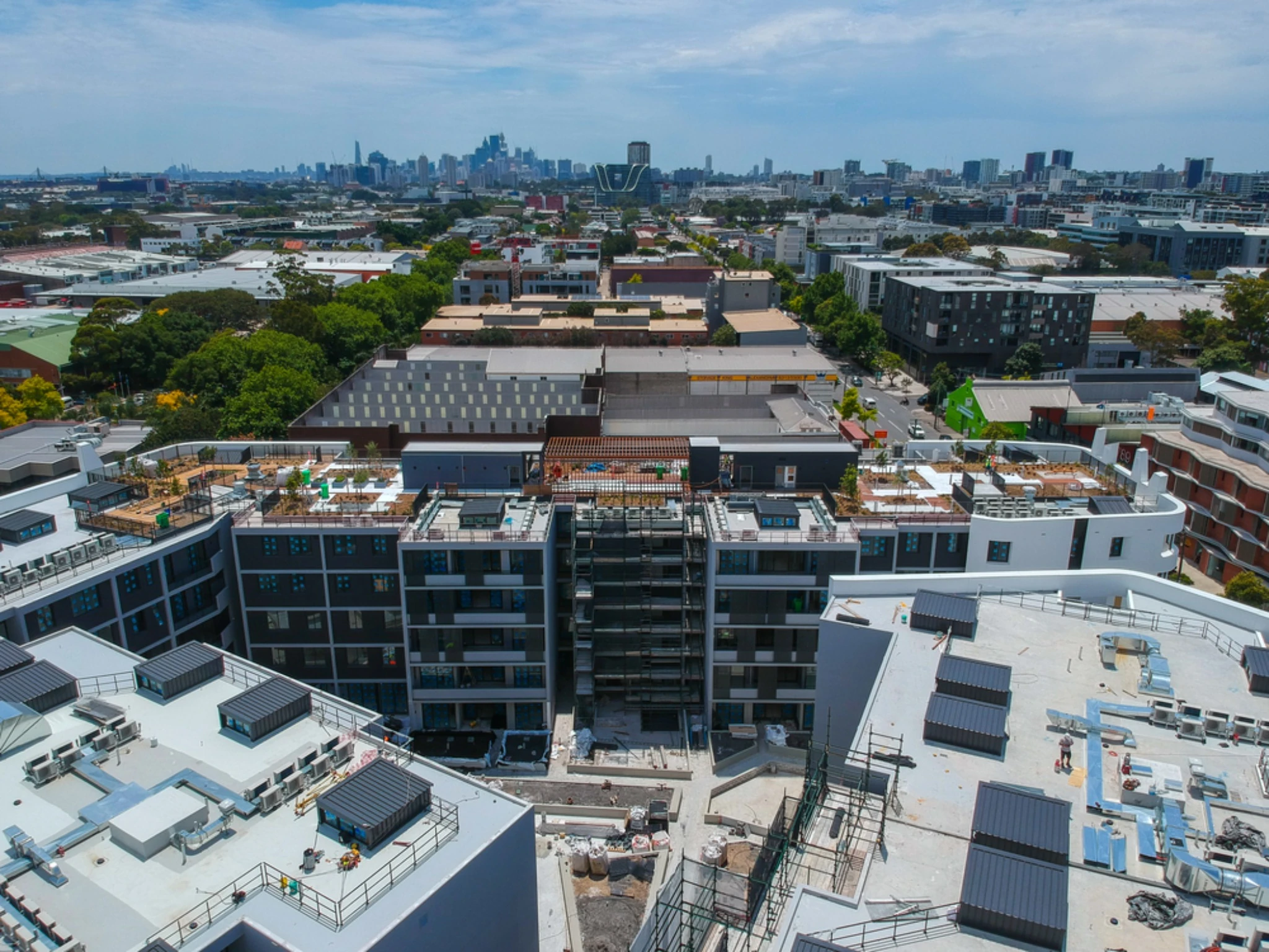
Sydney’s CBD and inner suburbs contain a dense mix of heritage buildings, transport corridors, utilities and new high-rise developments. A clash or inaccurate assumption about levels or boundaries can stop a project or trigger expensive redesign.
High‑resolution survey data reduces that risk by:
For example, a tower straddling a rail corridor or tunnelling near existing foundations needs 3D reality‑grade information, not just 2D plans with sparse spot levels. Better survey data turns potential unknowns into measurable parameters that can be engineered around.
Modern projects rely on multidisciplinary digital models. If the base survey is incomplete or inaccurate, every subsequent model inherits those errors, which later appear as clashes, rework or site variations.
Richer survey datasets improve design outcomes by providing full 3D surface and structural information for federation into BIM, allowing designers to test clearances, crane positioning and staging virtually and enabling rapid re‑survey when design changes are issued so models stay current. On constrained infill sites, this level of detail can determine whether a structure can be built without temporary road closures or impact on neighbouring properties. Better survey data support more realistic sequencing and more reliable cost plans at tender and delivery stages.
Local authorities, transport agencies and utility owners increasingly require precise as‑built information and clear proof that work complies with corridors, height limits and offsets. At the same time, neighbours and asset owners are more aware of their rights and more willing to challenge discrepancies.
High‑quality survey information helps complex projects to:
In a city where projects are often built directly over rail, near tunnels or besides ageing structures, the ability to measure and report accurately at every stage has become essential to gaining approvals, protecting reputations and avoiding disputes.
Digital surveying tools are transforming how complex projects are planned, coordinated and delivered. Instead of relying solely on isolated measurements and 2D plans, project teams now work from rich, accurate spatial datasets that can be revisited and re‑analysed throughout the life of a development.
From dense inner-city infill sites to large infrastructure corridors along transport networks, these technologies reduce rework, compress programmes and provide decision-makers with clear visual information. The following are the key technologies reshaping complex surveying tasks.
3D laser scanning captures millions of precise points in minutes to create a point cloud that represents existing conditions in three dimensions. For constrained Sydney CBD sites, this provides:
Point clouds are commonly used as the basis for 3D models in design software. Designers can test options against real site constraints instead of relying on assumptions. This reduces design changes during construction, where access and staging are already difficult.
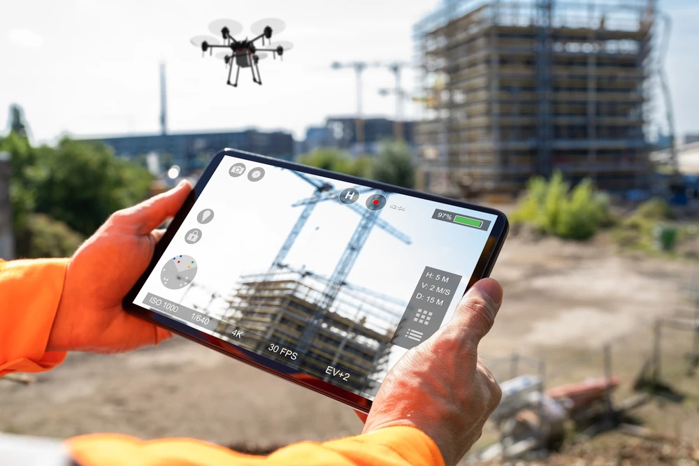
Unmanned aerial vehicles are now routine on large or complex projects. Drone surveying provides rapid coverage of areas that would be slow or unsafe to survey on foot, such as steep cuttings, active quarries or major interchange works. Photogrammetry converts aerial imagery into geo‑referenced orthophotos and 3D terrain models. These support progress tracking and volume calculations on bulk earthworks, verification of design grades and drainage pathways and early identification of access and staging constraints.
On coastal and riverside projects, drones assist with monitoring shoreline change, structure movement and asset condition. When combined with ground control and traditional surveying techniques, aerial data reaches engineering‑grade accuracy suitable for design and certification tasks.
Digital surveying now feeds directly into building information modelling processes rather than sitting apart from design. Survey data establishes the project coordinate system, cadastral boundaries and critical control points. Point clouds and terrain models are imported into BIM platforms so architects, engineers and service designers all work from a common spatial reference.
During construction, real‑time kinematic GPS and total stations linked to digital design models guide the setout. Field crews can:
In dense environments, where vertical alignment, clearances and service corridors are tightly constrained, this real‑time feedback reduces cumulative tolerance errors and improves assurance for asset owners and certifiers.
Digital surveying technology is transforming how complex projects are planned and delivered by providing faster, richer and more reliable spatial data. High‑definition measurements captured in the field flow directly into design and construction workflows, which reduces guesswork, rework and conflict on site.
From city‑shaping transport links to tight infill developments, the combination of laser scanners, GNSS, total stations, drones and advanced software is delivering measurable gains in accuracy, coordination and programme certainty.
Modern total stations, GNSS receivers and 3D laser scanners capture highly accurate positions and levels that can be relied upon for critical design decisions. Dense point clouds record millions of measured points on existing structures, façades and services so design teams are not working from outdated or approximate base plans.
In a constrained urban environment, accurate representation of boundary positions, road alignments and existing utilities is essential. Digital surveying supports this by:
This level of precision helps avoid clashes with existing assets and supports compliance with local authority tolerances.
Digital survey outputs are now structured for direct integration with BIM and CAD platforms, improving coordination across consultants and contractors. Instead of flat 2D plans, design teams can work with 3D surfaces, point clouds and intelligent models that reflect actual site conditions. Common benefits include the use of existing 3D conditions models, service locational data and shared coordinate systems that keep architectural, structural and civil designs aligned.
Design reviews become more visual and issue‑focused because teams can see where proposed structures interact with utilities, overland flow paths or neighbouring properties. This reduces RFIs and design changes once construction has begun, which is critical where access windows and possession times are limited.
Digital surveying shortens the time from field capture to usable information. Robotic total stations, mobile laser scanners and UAVs can survey large or hard‑to‑access areas in fewer site visits, which minimises disruption to traffic, businesses and residents.
Equally important is the efficiency gained in the office. Automated processing converts raw measurements into surfaces, models and deliverables with fewer manual steps. Cloud platforms allow project teams to access up‑to‑date survey information without waiting for multiple file transfers.
Routine tasks such as progress monitoring, quantity checks and as‑built verification are completed more quickly because the same digital datasets support both design and construction phases. This compression of survey and coordination cycles supports faster approvals, tighter programmes and more predictable costs on complex Sydney projects.
New digital surveying tools deliver the greatest value where projects are complex, tightly constrained and highly regulated. This typically means locations with limited access, overlapping services and high expectations on delivery time and compliance. The benefit is measured not only in improved accuracy but also in fewer site visits, fewer clashes on site and fewer redesigns once construction starts. By capturing more information more quickly, technologies transform how data is shared.
In the CBD and inner suburbs, sites are often narrow, built out to the boundary and surrounded by heritage or critical infrastructure. Traditional methods struggle to capture all the detail hidden in laneways, overhangs and irregular façades.
High‑resolution laser scanning records complete building envelopes, awnings, parapets and adjoining structures so design teams can assess real clearances for cranes, scaffolding and hoardings. Accurate 3D models of streetscapes help avoid conflicts with awnings, trees, power lines and public transport assets when planning, staging or façade retention.
Subterranean conditions are equally critical on brownfield sites. Digital surveying combined with subsurface utility information gives a coordinated picture of existing basements, retaining walls and buried services. This reduces the risk of piling into unknown structures or sewer mains and supports realistic excavation volumes and shoring design from the outset.
Road, rail and utility projects cover long, complex corridors where even small alignment errors can become expensive. Mobile laser scanning and UAV surveys allow rapid capture of roads, rail corridors and utility easements with minimal disruption to traffic or operations.
For road upgrades, digital terrain models derived from LiDAR support accurate earthworks calculations, drainage design and pavement tie‑ins to existing levels. In rail environments, detailed 3D data of platforms, overhead wiring, masts and signals is essential to satisfy clearance envelopes and safety standards without multiple night possessions.
Utilities frequently share congested corridors. Coordinated 3D mapping of pits, ducts and above‑ground assets minimises clashes when adding new conduits or relocating services for major works. Designers can test trench routes and pit locations in a federated digital model before any excavation takes place, reducing change orders once construction begins.
High‑rise residential and commercial towers and intricate public buildings rely on precise set‑out and continuous verification. Digital surveying aligned with BIM models supports millimetre‑level control of structural grids, cores and façade systems.
During construction, rapid as-built scans of slabs, columns and cores identify cumulative tolerances before they compromise fit-outs or façade installation. Curved or non‑orthogonal geometry, such as feature atria, complex roof forms or irregular façades, benefits from 3D scanning since fabrication models can be checked directly against surveyed point clouds. In refurbishment or vertical extension projects, reality capture of existing structures provides accurate as‑built information where legacy drawings are missing or unreliable. This allows engineers to verify load paths, penetrations and connection points before committing to new steelwork or service penetrations, shortening design cycles and reducing on‑site rework.
High-precision laser scanning, UAV mapping, BIM integration and real-time data capture provide a level of accuracy, speed and risk visibility that traditional methods cannot match. This shift extends beyond technology adoption and reflects a broader change in how decisions are made throughout the project lifecycle, with greater reliance on accurate, continuously updated spatial data. As project complexity increases and regulatory expectations continue to evolve, the role of digital surveying becomes central to achieving compliant, efficient and well-coordinated outcomes. Reliable survey intelligence supports better planning, reduces rework, improves safety and strengthens confidence across all stakeholders. Firms that combine technical expertise with advanced digital capability are positioned to support successful delivery on challenging sites while ensuring that completed assets perform as intended long after construction is complete.