Fastest Turnaround Times In The Surveying Industry!


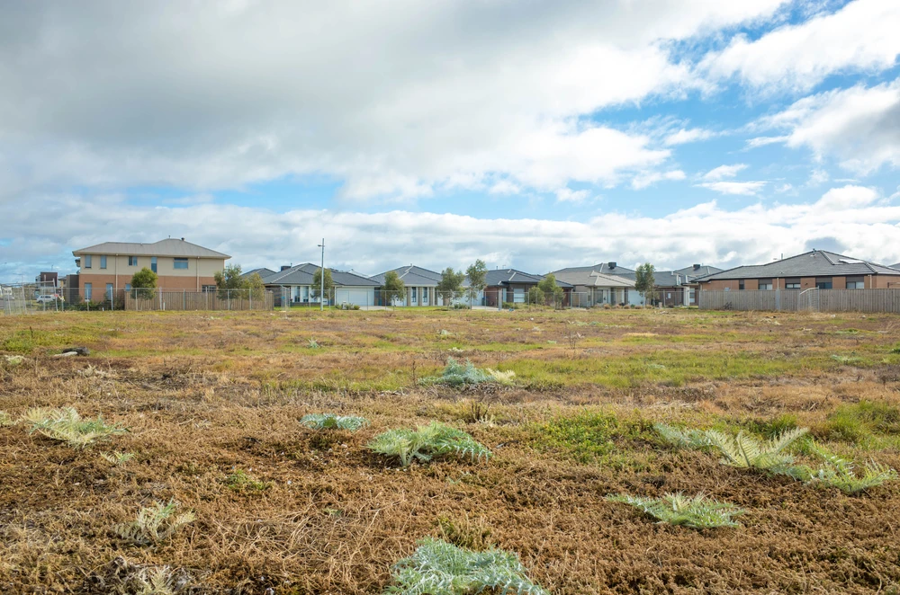
Before starting an extension, secondary dwelling, new fence, retaining wall or major landscaping project, confirming the true position of property boundaries is one of the most important early steps. At MCS Surveyors, boundary uncertainty is often seen creating neighbour disputes, redesigns, approval complications and expensive corrective works after construction has already begun.
In this article, MCS Surveyors explores the role of accurate boundary identification, including how title documents and deposited plans should be interpreted, why physical features such as fences and walls are not always reliable and how land surveyors in Sydney help reduce risk before building or renovation work proceeds. By understanding how measured survey information and supporting evidence are used to establish defensible boundary positions, property owners can approach construction projects with greater certainty and avoid issues that may otherwise delay or compromise the final outcome.
Confirming the exact line of legal ownership is one of the most important early checks before any extension, outbuilding, retaining wall or major landscaping project. An accurate understanding of boundary positions affects what can be built, where structures can be placed, how close work can come to neighbouring land and whether the proposal is likely to satisfy council or complying development requirements.
Overlooking boundaries can result in work having to be altered or even removed at significant cost. It can also trigger neighbour disputes that delay projects and sometimes require legal advice or formal dispute resolution. Early clarity on boundaries helps projects proceed with fewer interruptions and protects the long-term value of the property.
Property boundaries influence whether a proposal complies with planning controls, council requirements and development standards. Many residential and commercial projects rely on accurate setbacks from side, rear or front boundaries. If the boundary position is wrong, the design may also be wrong.
For example, extensions, garages, retaining walls, swimming pools, secondary dwellings and outbuildings often need to meet setback, height, site coverage or access requirements. These requirements may apply through a development application, a complying development certificate or relevant local planning controls. Misjudging the boundary by even a small amount can create problems if a structure is too close to neighbouring land or sits outside the owner’s title.
Front boundaries can also affect driveway access, parking layouts, footpath crossings, visibility and works near council land. If development unintentionally extends onto neighbouring land, road reserve or an easement, it may lead to objections, approval delays, enforcement issues or costly redesigns.
A common source of conflict is encroachment, where a fence, wall, footing, gutter, eave, retaining structure or part of a building extends beyond the legal boundary. Once concrete is poured or walls are built, any error quickly becomes expensive to correct.
Incorrect assumptions often arise from long-standing fences that do not align with the legal boundary or from informal arrangements made by previous owners. These arrangements may have existed for years but may not be reflected in the registered title, deposited plan or survey evidence.
Boundary checks before work starts help identify:
Clarifying these issues in advance reduces the risk of trespass claims, neighbour objections and demands to alter or remove completed work. It also supports better communication between property owners before construction begins.
Structures built in the wrong position can create long-term problems even if no dispute arises during construction. When a property is later sold, a buyer’s solicitor, conveyancer or lender may question any uncertainty about the title, boundary location or encroachment risk.
Common issues raised during a sale include:
Boundary uncertainty can delay settlement, reduce buyer confidence or require further reports before the transaction proceeds. In some cases, unresolved boundary issues can affect property value or limit future development options.
A fence often looks like a clear and convenient indicator of where one property ends and the next begins. In reality, many fences sit slightly inside or outside the legal boundary. Some were built for convenience, some have shifted over time and others were replaced using an older inaccurate fence line as the guide.
Relying on a fence line alone before building or renovating can lead to costly disputes, approval issues or completed works being placed in the wrong position. A fence should be treated as physical evidence that may assist interpretation, not as definitive proof of the legal boundary.
Many fences were erected decades ago by previous owners, builders or contractors who may not have referred to a registered survey plan. A fence might have been placed where it was easiest to build, such as around a tree, drain, slope or old garden feature, rather than exactly on the legal boundary.
In other cases, neighbours may have informally agreed to move a fence slightly to create easier access or resolve a practical issue. These arrangements can be useful between those owners, but they do not necessarily alter the legal boundary unless properly documented and registered where required.
Over time, later owners may assume the fence is correct simply because it has been there for many years. This is one reason boundary uncertainty often only becomes apparent when new building work is proposed.
Fence lines can also move through age, weather, ground movement and replacement works. Timber posts rot, metal posts corrode, masonry walls crack and soil conditions change. A leaning fence that is straightened without survey control may be reset in the wrong position.
When fences are replaced, installers often follow the existing line. If the old fence was not on the boundary, the new fence repeats the error. Other improvements, such as sheds, paving, retaining walls and planting beds, may then be aligned with that fence, creating the impression that the boundary is settled when it is not.
The legal boundary is determined by title evidence, registered plans, survey marks, occupation evidence and professional boundary definition. It may or may not coincide with a fence, hedge, wall or garden edge.
A deposited plan or title diagram can provide important information about the land parcel, but it still needs to be interpreted correctly. Boundaries are not always confirmed by simply scaling from a plan or comparing a title diagram with an existing fence. Surveyors consider a range of evidence, including registered plans, survey marks, measurements, adjoining titles and occupation features, to determine the most reliable boundary position.
This is particularly important on older properties, irregular blocks, battle-axe lots, sloping sites, waterfront land and properties with shared driveways or easements.
Property documents are essential for understanding where boundaries should be in law, but they rarely give the complete on-ground answer by themselves. Before building or renovating close to a boundary, these documents should be treated as starting points that guide further investigation.
Most title and legal documents are prepared for ownership, registration and conveyancing purposes. They help identify the land parcel and any registered interests affecting it, but they may not confirm the exact location of a fence, wall or structure on the ground.
In NSW, relevant documents may include the Certificate of Title, deposited plan, registered dealings, easement documentation and historical survey information. These documents help show the legal extent of the land, lot dimensions, registered easements and other notations that may affect development.
A deposited plan can be very useful because it defines the parcel of land when registered. However, it still needs to be interpreted by a qualified professional, particularly where there are old survey marks, changed site conditions or inconsistencies between plans and occupation features.
A survey plan prepared by a registered surveyor provides more reliable site-specific information for design, approval and construction. Depending on the project, it may show boundaries, existing structures, levels, easements, adjoining features, trees, fences and other details relevant to planning and design.
Architectural drawings and site layout plans can show where a designer has assumed the boundaries to be. They are useful for understanding design intent, proposed setbacks and the relationship between new work and existing structures.
However, design drawings are only as accurate as the survey information they rely on. If the boundary position was assumed rather than measured, the drawings may show a compliant design on paper while the actual site conditions tell a different story.
Development consent, a complying development certificate or stamped plans also do not automatically resolve boundary ownership. Approval may confirm that a proposal satisfies planning requirements based on the information submitted, but it does not prove that the assumed boundary line is legally correct or accepted by a neighbour.
Property documents may also reveal easements, covenants, restrictions on title or rights of way. These can significantly affect where work can occur, even if the land is within the owner’s title.
For example, drainage easements, sewer easements, access handles and shared driveways may restrict building, excavation, retaining walls, fencing or landscaping. A property owner may legally own the land but still be limited in how that part of the site can be used.
These documents should be reviewed early because they can affect design, approval pathways and construction methods. Where the location or extent of an easement is unclear, survey input may be needed to confirm how it relates to the proposed work.
Many everyday home improvements rely on the exact line of legal ownership. Unclear or disputed boundaries can delay approvals, force redesigns or lead to the removal of completed work. Before committing to design fees, materials or contractor bookings, it is important to understand which types of projects are most sensitive to boundary positions.
Boundary risk increases wherever work is close to the edge of the block, alters shared structures or affects access, drainage, privacy or neighbouring land.
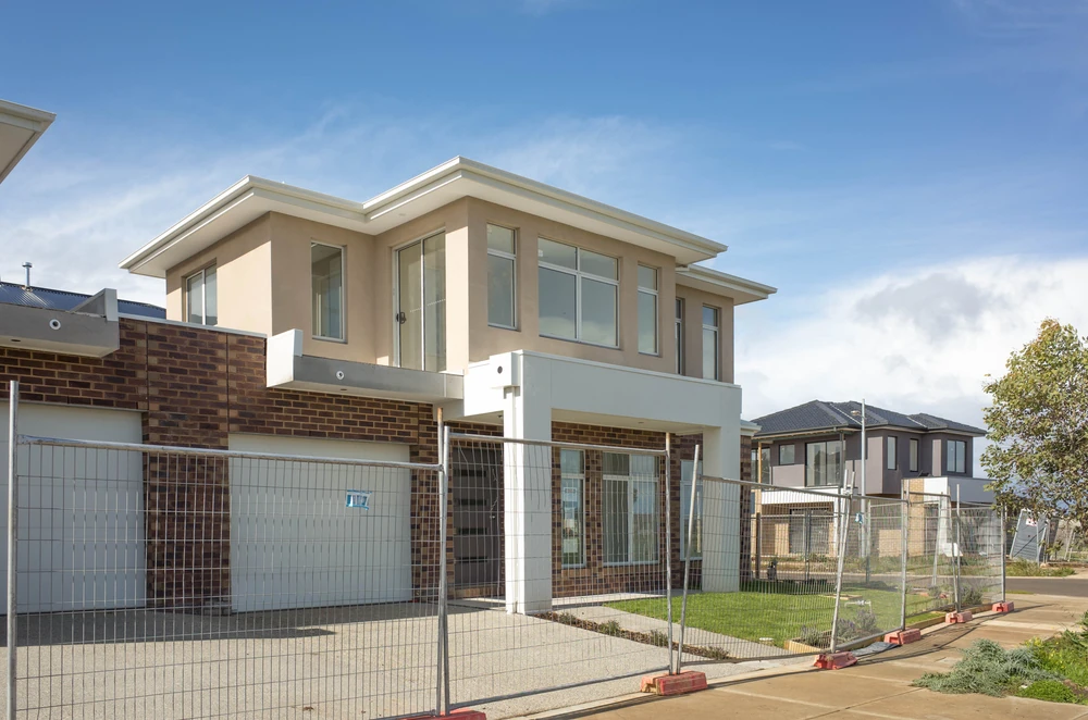
Any permanent structure near the edge of a property can quickly become the focus of boundary disagreement. This is especially true in dense Sydney suburbs, narrow lots, older streets and properties where side setbacks are limited.
Single-storey and two-storey extensions often run along or close to side and rear boundaries. Secondary dwellings, garages, studios and outbuildings can also create issues where space is tight. If the boundary is misjudged, walls, gutters, slabs or footings may end up too close to the boundary or partly on adjoining land.
This can lead to:
A boundary survey helps confirm whether the design fits within the legal title before construction begins.
Boundary structures are one of the most common sources of neighbour disputes because they physically define how each owner uses their land.
Replacing or moving a fence without confirming the legal boundary can shift the perceived boundary away from its correct position. Retaining walls are especially sensitive because they can affect ground levels, drainage, structural support and neighbouring land.
Before work starts, it is important to confirm:
Hard landscaping such as paving, raised garden beds, steps and pool surrounds can also create boundary issues where work occurs close to neighbouring land.
Work that alters access can have significant legal implications when boundaries are uncertain. Widening a driveway, installing gates, building a carport or changing a parking area may affect shared access, easements or neighbouring land.
This is particularly important for battle-axe blocks, duplex sites, terrace houses, shared driveways, private roads and properties with rights of carriageway. Misplaced walls, piers, fences or landscaping can obstruct another owner’s legal access and lead to urgent demands for removal.
Shared yards, side passages and forecourts may also lack clear physical divisions, making accurate boundary plotting critical before installing storage areas, bin enclosures, fencing or landscape structures.
A boundary survey may be needed whenever there is a risk that new work could cross, rely upon or affect a legal property line. It is not only for large developments or disputed sites. Even modest home projects can create expensive problems if the boundary position is assumed rather than measured.
Understanding the typical trigger points for commissioning a survey helps reduce the chance of neighbour disputes, approval delays and construction errors.
Any construction close to the edge of a block should prompt careful boundary checking. This is especially important where the design relies on minimum setbacks or where there is limited space between the proposed work and neighbouring land.
Common examples include:
If planned works sit on or near the boundary line, a measured boundary survey can provide the information needed to design confidently and reduce the risk of later dispute.
A survey is advisable whenever physical features do not clearly match the title or deposited plan. Old fences, crumbling walls, hedges and informal markers rarely provide enough certainty on their own.
Situations that often justify a survey include:
A boundary survey provides measured data that can be compared with title information, registered plans and occupation evidence to help establish the most defensible boundary position.
If a neighbour questions the location of a boundary or alleges encroachment, a formal survey becomes critical. Beginning construction while there is uncertainty can escalate a minor concern into a costly dispute.
A survey may be needed if:
A professionally prepared boundary survey can support legal advice, assist negotiation and provide reliable evidence if the matter proceeds to formal dispute resolution.
Boundary surveys are also valuable in property transactions and land development. Before purchasing, a buyer may request further survey information where the extent of the land, access arrangements or easements appear unclear. Sellers may also commission a survey to address boundary uncertainty before it delays a sale.
Where land is being subdivided, consolidated or adjusted, accurate survey information is essential. New legal boundaries must be properly defined, documented and registered through the appropriate NSW processes. This is particularly important for dual occupancies, strata developments, battle-axe subdivisions and projects involving easements or access handles.
Boundary mistakes can stop a project at the worst possible moment, often just as building work is about to begin or is already underway. An incorrect fence line, a misread plan or reliance on an old assumption can trigger approval problems, neighbour challenges and costly rework.
Once foundations are in the ground or a structure crosses into neighbouring land, options become more limited. What could have been resolved with early survey advice may become a construction, legal and financial problem.
Contractors typically work to the lines shown on project drawings. If those drawings rely on incorrect or unverified boundaries, the built work may extend too close to neighbouring land or beyond the legal title.
Once the issue becomes apparent, work may need to stop while the position is clarified. Consequences can include alteration or removal of:
Demolition, redesign and re-approval can add material, labour and consultant costs. Contractors may also charge delay costs if they are kept waiting while surveying, legal or approval issues are resolved.
Boundary errors frequently damage relationships between neighbours. Even small encroachments can become significant when they affect privacy, access, drainage, views, future development potential or perceived property value.
Disputes can also affect the long-term marketability of a property. Buyers and lenders may be cautious where there is uncertainty about land extent, unresolved encroachments or a history of boundary conflict. What began as a small misplacement of a fence or wall can eventually limit future development options and complicate a sale.
Checking property boundaries before building or renovating is not simply an administrative step. It is a practical safeguard against approval complications, neighbour disputes and costly construction errors. Accurate measured surveys and careful interpretation of legal evidence are often essential to confirm where development can safely proceed without encroachment or future challenges.
Where uncertainty exists, early involvement from a registered land surveyor helps establish a reliable framework for design, planning and construction. For property owners planning extensions, fences, retaining walls, secondary dwellings or major landscaping works, confirming the boundary at the start can prevent far larger problems later.