Fastest Turnaround Times In The Surveying Industry!


NSW land and mining survey standards and the requirements set by the Board of Surveying and Spatial Information shape every legally robust and defensible survey carried out in New South Wales. For landholders, mining operators, infrastructure developers and planning consultants, the way a survey is designed, documented and certified can directly affect project feasibility, risk exposure and long-term asset management. In this article, MCS Surveyors explains how the statutory framework influences professional surveying practice, with a focus on the standards that apply to land and mining surveys in NSW and the role BOSSI plays in regulating registration, competency and professional conduct.
For clients engaging surveyors in Shellharbour and across NSW, understanding these requirements helps clarify how survey regulations, control requirements, accuracy standards and reporting obligations affect the quality and legal standing of spatial data. It also helps explain how BOSSI registration, continuing professional development and compliance expectations influence who is authorised to certify cadastral and mining surveys in NSW. With that context, landowners, consultants and project teams can assess survey proposals more carefully, set clearer project specifications and engage survey professionals whose work aligns with legislative obligations and accepted industry practice.
This section outlines the main legislation and regulatory instruments that govern how land and mining surveys are carried out in New South Wales. Anyone commissioning or relying on a survey should understand that the surveyor is working within a clearly defined legal framework rather than simply following internal company standards or project preferences.
For surveyors, this framework shapes how boundaries are interpreted, how fieldwork is completed, how plans and reports are prepared and how survey information is certified and lodged where required. It also underpins the obligations of registered surveyors and supports the consistency, reliability and legal standing of survey outcomes. The core framework sits under the Surveying and Spatial Information Act 2002, with the current Surveying and Spatial Information Regulation 2024 providing the operative regulatory detail in NSW. BOSSI, established under the Act, oversees registration and professional standards for land and mining surveyors.
The Surveying and Spatial Information Act 2002 is the primary legislation governing surveying practice in New South Wales. It establishes the role of BOSSI and sets the legal framework for registration, professional conduct and the regulation of survey work that carries statutory weight. In practical terms, this means cadastral surveys that define or redefine property boundaries must be carried out under the authority of an appropriately registered surveyor.
The Surveying and Spatial Information Regulation 2024 provides the detailed operational requirements that support the Act. It deals with matters such as survey procedures, survey certificates, accuracy and evidence requirements, plan preparation and the handling of survey marks and reference marks. In day-to-day practice, these requirements affect how surveys are performed in the field, how evidence is documented and how plans are prepared for lodgement or reliance in legal and development contexts.
BOSSI requirements, together with relevant Surveyor-General directions, practice material and professional codes, help translate legislation into day-to-day surveying practice. These documents provide practical guidance on matters such as acceptable survey methods, evidence assessment, tolerances, plan presentation and the level of documentation expected to support a survey outcome.
They are particularly important when surveyors need to deal with issues such as conflicting title and occupation evidence, reinstatement of lost or disturbed boundary marks, or the need to explain assumptions and limitations clearly in plans and reports. They also reinforce the ethical and professional standards expected of registered surveyors when dealing with clients, authorities and the public.
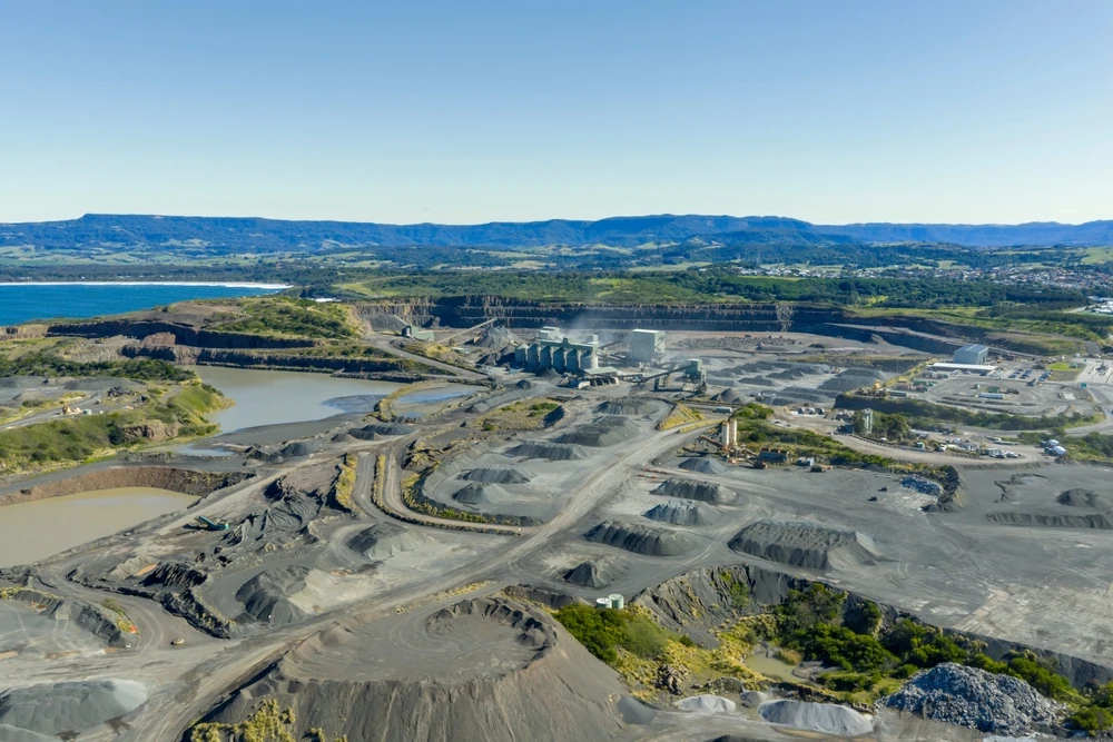
Mining-related surveys in New South Wales are influenced by a separate but overlapping set of legislative and regulatory requirements. In addition to the surveying framework, mine survey work is shaped by the Mining Act 1992, the Work Health and Safety (Mines and Petroleum Sites) Act 2013, the Work Health and Safety (Mines and Petroleum Sites) Regulation 2022, and guidance issued by the NSW Resources Regulator and related authorities.
Together, these requirements affect how mining tenement boundaries, mine survey control, workings, infrastructure and associated spatial records are established, maintained and reported. They also help define responsibilities for appointed mining surveyors, record-keeping, auditing and the preparation of plans and spatial data used for operational safety, compliance and tenure management.
This section explains the practical technical standards that shape how cadastral and mining surveys are carried out in New South Wales. Anyone engaging professionals for land or mining work needs to understand how positions are measured, what level of accuracy is required and how results must be documented to satisfy statutory and project requirements.
Surveyors align field methods, equipment and deliverables with the Surveying and Spatial Information Regulation 2024, relevant Surveyor-General directions, and applicable mining survey directions and guidance. This helps ensure that boundary and mining definition work supports secure land tenure, compliant mine planning and reliable integration with other spatial data.
Cadastral and mining surveys in NSW generally need to adopt compliant control, datum and orientation so they are consistent with the wider survey framework and other authoritative spatial data. In practice, this commonly involves:
For boundary definition, surveyors will often establish a robust local control network tied to permanent marks and recognised control. That control is commonly adjusted using least-squares or comparable rigorous methods so final positions are reliable, internally consistent and traceable to the adopted datum.
Technical standards for cadastral surveys are tied to the accuracy and evidence requirements set by the regulation, relevant directions and the nature of the survey itself. Urban boundary redefinitions and subdivisions generally require tighter control than lower-order rural work or surveys that do not require strict accuracy. Mining lease and mining title surveys also need to satisfy defined tolerances and control standards so lease corners, mine workings and related infrastructure can be relied on for tenure, safety and operational planning.
Surveyors choose methods that will achieve or exceed the relevant standard. For example:
In mining environments, underground traverses and precise levelling may also be used to maintain control between surface boundaries, portals and underground workings.
Cadastral and mining standards place strong emphasis on how boundaries and key points are marked and documented. The Surveying and Spatial Information Regulation 2024 includes prescribed forms and styles for survey marks, including boundary marks, reference marks and permanent survey marks. Boundary corners are marked where required and practical, and where direct marking is not possible, surveyors must document the situation appropriately and use acceptable alternatives under the regulation and directions.
Surveyors prepare plans and digital data in formats that meet NSW Land Registry Services requirements and any other regulator standards relevant to the project type. This includes clear depiction of boundary dimensions, connections to reference marks, title and occupation evidence where relevant, mining tenement boundaries, and any encroachments, easements or related interests that need to be shown. For mining work, survey data is also commonly structured so it can be used within mine planning and GIS systems while remaining traceable to the original survey observations and adopted standards.
BOSSI registration is essential for surveyors who want to carry out and certify regulated land or mining survey work in New South Wales. Clients, regulators and courts rely on that registration as evidence that a surveyor has met NSW competency requirements and is subject to professional oversight and accountability. In practice, cadastral and mining surveys that carry statutory weight must be undertaken under the authority of a suitably registered surveyor.
Although the overall framework is similar, the registration pathways for land and mining surveyors have distinct qualification, experience and examination requirements. Understanding these differences early helps graduates and employers plan the right mix of formal study, supervised practical experience and assessment for the registration being pursued.
To be eligible for BOSSI registration, an applicant must hold a recognised surveying qualification or an equivalent qualification accepted by BOSSI. The exact academic pathway depends on the type of registration sought, but it must support the competencies required for either land surveying, mining surveying or both.
BOSSI also expects applicants to meet character and professional standing requirements as part of the registration process. This is generally supported by references, a record of suitable conduct during training and employment, and compliance with any other requirements relevant to the application.
After completing the required academic component, a surveyor works through a period of supervised practical experience as a candidate surveyor. For land surveyors, this commonly involves cadastral work such as boundary redefinitions, subdivisions, easements and strata plans. For mining surveyors, it involves practical experience in mine survey environments, including control, monitoring, set-out and plan preparation relevant to mining operations.
During this period, the candidate develops and records evidence of competence in fieldwork, calculations, plan preparation, legislation and professional judgement. BOSSI assesses this through prescribed examinations, practical experience records and other required assessment material relevant to the discipline. Land surveyor candidates are assessed against cadastral law, the Surveying and Spatial Information legislation, survey practice requirements and NSW Land Registry Services expectations. Mining surveyor candidates are assessed against mine survey requirements, relevant mining legislation and associated safety and technical obligations.
BOSSI maintains distinct registration pathways for land surveyors and mining surveyors. Some practitioners may pursue competency across both areas where their work spans land development and mining operations, but registration is only granted where the applicant has satisfied the requirements for the relevant discipline.
Once registered, a surveyor must continue to meet BOSSI’s annual registration and Continuing Professional Development (CPD) obligations. BOSSI requires surveyors applying for renewal to demonstrate that they have satisfied the Board’s CPD requirements for the relevant period, helping ensure they stay up to date with legislative, technical and professional changes.
Candidate surveyors are central to maintaining professional standards in both land and mining surveys. For cadastral and mining work, a clear pathway from graduate to registered surveyor is important not only for professional development, but also for protecting the public and ensuring surveys meet legal and technical requirements. Understanding how candidate surveyors are supervised, how competency is developed and how BOSSI assesses readiness for registration helps explain how surveying standards are maintained over time.
A person working towards registration normally enrols with BOSSI as a candidate surveyor while completing the practical experience and assessment requirements for full registration. This applies whether the candidate intends to become a registered land surveyor, a registered mining surveyor or pursue both pathways where appropriate.
Candidates generally need a recognised surveying qualification, or a qualification pathway accepted by BOSSI, before progressing through the registration process. During their training period, they are expected to gain broad practical experience relevant to the discipline they are pursuing. This may include:
Competency is then demonstrated through prescribed practical experience records, examinations and other assessment material required by BOSSI.
BOSSI sets the competency framework, but each surveying practice still needs to provide the structure that allows a candidate to build those skills in a practical setting. In well-run environments, this usually involves a combination of supervised fieldwork, office-based processing, drafting, reporting and increasing responsibility across different project types.
Common approaches include rotations through field and office tasks, early supervised exposure to more complex or safety-critical work, and gradual involvement in the full survey workflow from data capture through to final documentation. This helps candidates understand not only how survey data is collected, but also how legal, technical and procedural requirements affect the final deliverable. When that training is properly supervised and documented, it helps ensure candidate surveyors are developing toward independent practice rather than simply completing isolated tasks.
One small note on your original version: the line “BOSSI also expects evidence of continuing professional development” is better removed from this section unless you want to tie it specifically to registered surveyors, because CPD is more clearly framed as an ongoing obligation of registration and renewal rather than the core summary point for candidate supervision.
Plan preparation and lodgement for land and mining surveys are tightly regulated, particularly where plans must be lodged with NSW Land Registry Services or provided to government agencies and regulators. A key aim is to reduce the risk of requisitions, rejected lodgements or avoidable delays by ensuring the plan, supporting documents and certifications meet the required standards from the outset. Surveyors manage each stage so the final deliverables are technically sound, properly documented and compliant with the relevant statutory framework.
For typical boundary or mining tenure plans, the required content will vary with the purpose of the survey, but generally includes a clear depiction of boundaries, ties to relevant survey control, dimensions and areas, underlying title references, and any subdivision, easement, occupation or encroachment information that must be shown. In mining contexts, plans may also need to show lease identifiers, levels, workings extent and the relationship between mining tenure and surface parcels, depending on the nature of the plan and the applicable regulator requirements.
Digital plans are prepared to the relevant NSW LRS drawing and lodgement standards, including formatting and validation requirements where applicable. Surveyors may also prepare associated administration sheets, reports and other supporting documentation needed for acceptance, registration or regulatory review.
Compliance is not limited to the drawing itself. Registered surveyors must provide the certifications, survey certificates and supporting information required to demonstrate that the work meets statutory and professional standards. Reports commonly explain the survey methodology, adopted datum and connections, control used, boundary evidence considered, reference marks relied on, and how any conflicts in evidence were resolved.
Certificates required for lodgement or formal reliance are prepared and signed by the registered surveyor who takes professional responsibility for the work. Audit and professional review expectations are supported by retaining field notes, GNSS logs, calculation files, digital observations and relevant correspondence in a structured and retrievable form.
Ongoing audits and professional reviews are an important part of maintaining compliance in both land and mining surveying. Anyone engaging a surveyor in these areas should understand that compliance is not a one-off event tied only to plan issue or certification. It is a continuing professional obligation supported by registration requirements, audit processes, internal review systems and proper record keeping. This helps maintain consistent survey quality and supports confidence in cadastral boundaries, mining tenure definition and the spatial data used for critical decisions.
BOSSI conducts audit and professional oversight activities in relation to registered surveyors to help confirm that work meets the requirements of the Surveying and Spatial Information Act 2002, the current regulation and relevant Surveyor-General directions. These reviews may consider completed plans, survey reports and supporting material across different types of land and mining work. Examples can include deposited plans, strata plans, boundary surveys, control surveys and mining-related survey documentation.
In practice, this means a surveyor may need to produce field notes, calculations, calibration records, digital data files and plan documentation in a form that allows the work to be followed, checked and, where necessary, independently reviewed. The key point is not just whether a plan looks correct on the page, but whether the underlying survey process is properly documented and professionally defensible.
Separate from any external audit process, surveying practices usually maintain their own internal quality review procedures to check that plans, reports and supporting data are technically sound before issue. These reviews commonly include checks on survey control, closure, datum and projection, boundary definition reasoning, drafting consistency and alignment with land registry or mining project requirements. This internal review process is an important part of reducing avoidable errors before a plan is lodged, relied on or issued to a client.
Senior registered surveyors are responsible for reviewing and signing off work where required, and equipment used for land and mining surveys should be supported by appropriate calibration, verification and record keeping. Accurate documentation is equally important. Field records need to be retained in a durable form, digital data should be properly backed up, and supporting metadata should be maintained so survey information can be checked, reused or relied on later for extensions, approvals, disputes or future project stages.
Professional responsibilities extend beyond technical accuracy. Registered surveyors are also expected to maintain current knowledge through ongoing professional development and to meet the ethical obligations that come with certification and professional authority. That includes applying independent judgement, disclosing limitations where relevant, protecting confidentiality, managing conflicts of interest and ensuring work issued under the surveyor’s authority has been properly supervised and reviewed. These responsibilities support public confidence in the NSW cadastre, in mining survey practice and in the broader integrity of the profession.
Compliance issues in land and mining surveys often emerge late in a project, when they are more expensive and time-consuming to correct. Many delays can be reduced if compliance requirements are addressed early in the scope, methodology and documentation strategy. Surveyors aim to identify these risks upfront so deliverables are more likely to satisfy regulator and client checks the first time and do not delay approvals, mining operations or title processes.
One of the most common causes of requisitions or compliance concerns is insufficient or poorly documented boundary evidence. If survey marks are not properly connected to recognised survey control, or if cadastral boundaries near mining tenure are not reconciled against the relevant registered plans, titles and supporting evidence, the reliability or acceptability of the plan may be questioned.
To reduce this risk, surveyors usually complete a thorough search of registered plans, dealings, easements, tenure information and other relevant records before fieldwork begins. Decisions on boundary definition, including how survey evidence is weighed against title dimensions and occupation evidence, should then be documented clearly in the plan and supporting report so an external reviewer can follow the reasoning.
Misstating, or failing to demonstrate, the required survey class or level of accuracy is another common compliance issue. If the nominated standard is not supported by the field methods, instrument verification, control design or adjustment process, the reliability of the dataset may be challenged and further review or rework may be required.
Surveyors reduce this risk by implementing a documented quality assurance process that aligns with the relevant technical and accuracy requirements. This usually includes pre-survey equipment checks, current calibration records where required, redundancy in observations, suitable network design and adjustment procedures, and clear evidence that the adopted methods support the standard being claimed.
Operating within the NSW land and mining survey framework demands more than technical skill alone. It requires a disciplined commitment to professional standards and to the legislative and regulatory environment that underpins cadastral and mining survey work in New South Wales. Those requirements are not just procedural hurdles. They form the basis of accurate boundary definition, defensible mine plans, reliable spatial data and survey outcomes that can stand up to scrutiny.
When these standards are applied properly, they help protect the integrity of survey work, reduce regulatory and project risk, and support confidence in the land, mining and infrastructure decisions that depend on accurate spatial information.