Fastest Turnaround Times In The Surveying Industry!


Before any civil construction work begins, the quality of the survey information behind the project will influence how efficiently it progresses. From establishing boundaries and levels to identifying existing services, each stage of design and construction depends on accurate spatial data that has been collected and interpreted correctly. For projects requiring the expertise of surveyors in Sydney, reliable survey information can reduce uncertainty, improve coordination and minimise the risk of costly issues.
This article outlines the survey information that may be required before civil works commence and explains why each element is important. By understanding how these components work together, project teams can reduce risk, support compliance and establish a stronger foundation for construction. MCS Surveyors provides accurate pre-construction survey information to support safe, efficient and well-coordinated civil projects.
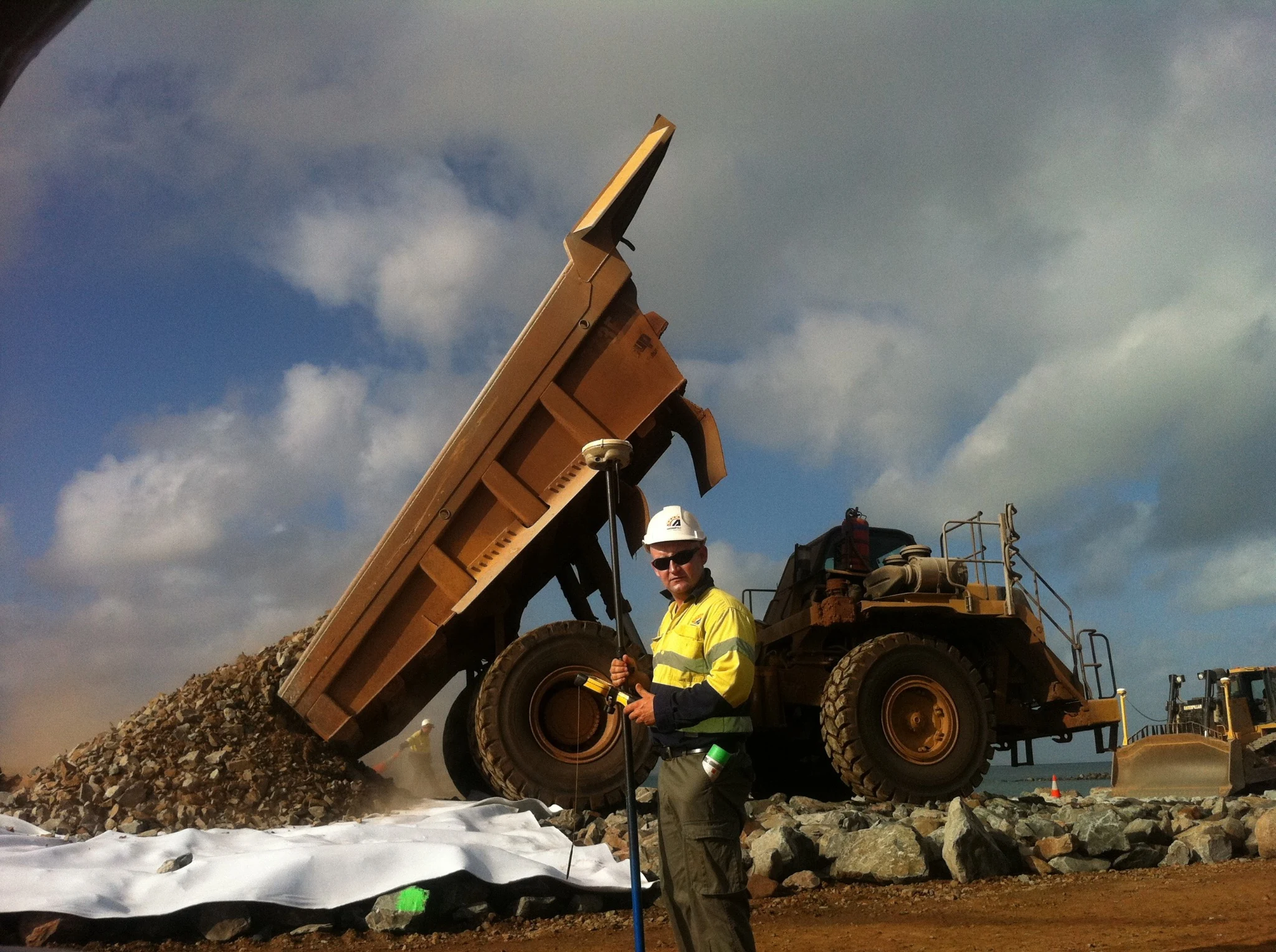
Civil construction projects depend on reliable information about the site before excavation, earthworks or service installation starts. Designers and contractors need to understand existing ground levels, boundaries, infrastructure and physical constraints so proposed works can be planned accurately.
If survey information is incomplete or inaccurate, errors may not become apparent until construction is underway. By that stage, rectification can involve additional survey work, design revisions, delays and costly rework.
Roads, drainage systems, subdivisions, retaining structures and building platforms are designed using information about existing site conditions. Contours, breaklines, boundaries, visible structures and service locations all contribute to engineering drawings and digital terrain models.
Even relatively small errors can affect construction outcomes. Incorrect levels may result in inadequate drainage falls or unsuitable pipe cover. Boundary discrepancies can create encroachment issues or affect compliance with approved plans. Accurate survey data helps designers identify these concerns early, when changes are usually easier and less expensive to make.
Unexpected site conditions can disrupt civil construction programs and increase costs. Reliable survey information can help project teams:
When contractors have access to accurate information, they are better placed to assess the scope of work and plan suitable construction methods. This can reduce the need for large risk allowances and help minimise delays caused by avoidable discrepancies.
Survey information also supports safe work planning and compliance obligations. Depending on the project, this may include confirming boundaries, easements, road reserves, setbacks and access arrangements.
Where civil works are close to property boundaries, easements or road reserves, a cadastral survey completed by a registered land surveyor may be required to confirm the legal limits of the site.
Accurate information about existing topography and services can also assist with excavation planning, machinery access and the identification of high-risk areas. This allows contractors to develop appropriate work methods and controls before construction begins.
Before excavation begins, project teams should also obtain information about underground essential services at the site and in adjacent areas so suitable safety controls can be established.
Survey control provides the framework for setting out and checking construction work. Before relevant construction stages begin, the site needs to be tied to a consistent coordinate system and height datum so each component can be built in the correct position and at the required level.
A reliable control network helps reduce the risk of alignment issues, structural clashes and drainage problems as work progresses.
Primary control points establish the horizontal and vertical framework for the project. They should be positioned in stable locations that are unlikely to be disturbed by excavation, traffic or construction activity.
Secondary working marks can then be established closer to active work areas. These may support the set-out of road centrelines, building corners, drainage lines, utility corridors and other construction features.
Depending on the project, working marks may include:
Design files, survey records and works-as-executed information should use a consistent coordinate system and datum. Where a local project datum is used for convenience, it should be clearly related back to recognised survey control to avoid conflicting measurements.
Control points need to remain reliable throughout the project. Each point should be documented with coordinates, levels, descriptions and sufficient reference information to allow it to be checked or reinstated if required.
Records may include photographs, sketches and measurements to nearby stable features. Regular checks can help identify movement or damage before it affects construction set-out.
A detailed understanding of existing site conditions is essential before civil works commence. The survey should record the visible features, levels and physical constraints that may affect design and construction planning.
The required scope will depend on the project. Drainage infrastructure, retaining walls, basements, road works and earthworks may require more detailed information than smaller or less complex developments.
Accurate levels and contours help designers understand the shape of the land and assess how proposed works will interact with the site. This information can influence drainage design, excavation quantities, retaining requirements and finished surface levels.
A feature and level survey may record:
Visible occupation features, such as fences and walls, should be accurately located so they can be compared with title information and legal boundaries where required.
Survey information can record surface materials, visible signs of instability and the locations of known or suspected buried structures. However, subsurface conditions are generally assessed through separate geotechnical or environmental investigations.
Where boreholes, test pits or in-situ testing are required, their locations should be accurately positioned in plan and height. This allows geotechnical findings, such as soil conditions, groundwater levels and contamination risks, to be incorporated into the broader design model.
Coordinating survey and geotechnical information can help project teams plan earthworks, foundations and retaining structures more effectively.
The legal and physical limits of a site need to be understood before civil works begin. Incorrect assumptions about boundaries, easements or existing infrastructure can result in redesigns, approval delays and disputes.
Boundary identification generally involves reviewing registered title information, cadastral plans and existing survey records. Where required, a registered land surveyor can reconcile these records with survey marks and visible occupation features on site.
If a fence, wall or structure does not align with the legal boundary, the discrepancy should be recorded and shown clearly on the survey plan. This allows designers to respond to the actual legal limits of the site rather than relying on assumptions based on visible features alone.
Easements and other registered interests may also affect where roads, buildings, drainage infrastructure, services or retaining structures can be located. Relevant information may include:
Identifying these constraints early can help avoid layout changes after design work has progressed too far.
Existing services may include water, gas, electricity, telecommunications, stormwater and sewer infrastructure. Available records should be reviewed alongside Before You Dig Australia plans, asset-owner information and visible evidence such as pits, pillars and meters.
These records do not necessarily confirm the exact location or depth of every asset. Where proposed works may affect existing services, additional locating methods may be required.
Depending on the site and the level of risk, this may include:
Verified service information can then be incorporated into the survey model to support design coordination and excavation planning. Understanding the role of land surveys in property development and construction can also help project teams coordinate existing utilities, easements and proposed infrastructure before excavation begins.
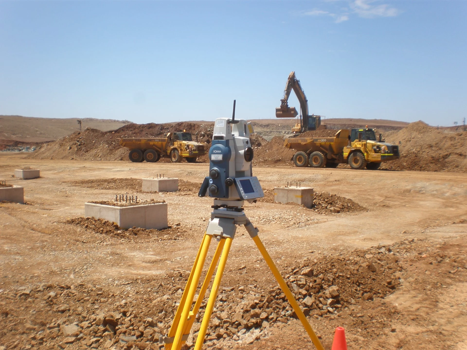
Set-out information translates approved design data into physical reference points that construction teams can use on site. Before each relevant construction stage begins, coordinates, levels and reference marks need to be checked against the latest approved drawings and models.
Accurate set-out information helps ensure earthworks, drainage infrastructure and structural elements are constructed in the intended position and at the correct level.
For earthworks, survey set-out may include:
Cut-and-fill pegs can help operators monitor progress while allowing survey checks to be completed at appropriate stages. On larger projects, digital models may also be used to guide excavation and grading work.
Drainage systems often rely on shallow falls, meaning small level errors can affect performance. Survey set-out information may include:
Offset marks are often used where direct set-out points may be disturbed during excavation. These offsets should be clearly documented so alignments can be reinstated when required.
For structures such as footings, slabs, columns and retaining walls, set-out information may include:
Control points should be placed where they can be reused throughout the relevant construction stages. The set-out should also account for any construction allowances so completed work aligns with the approved design.
Works-as-executed surveys should be considered before construction begins rather than treated as a final administrative step. These surveys document what has been built and allow completed work to be checked against approved designs, legal boundaries and asset-owner requirements.
Early planning is particularly important where services, foundations or other elements will be buried or covered before the project is complete.
Before construction begins, the required survey scope, tolerances and deliverables should be agreed with the relevant stakeholders. Depending on the project, this may include the principal contractor, designers, engineers, councils and asset owners.
The agreed scope should identify:
Defining these requirements early can reduce gaps in the final records and make it easier to meet approval and handover requirements.
Some elements become difficult or impossible to survey after installation. A clear capture strategy should identify:
File naming, version control, coding conventions and document management processes should also be established early. Clear records support approvals, maintenance planning, future upgrades and the resolution of any disputes.
Successful civil construction relies on accurate, coordinated and well-documented survey information. From establishing control points and confirming legal boundaries to mapping existing features, locating services and preparing set-out data, each stage contributes to better planning and reduced project risk.
The survey requirements will vary depending on the size, location and complexity of the works. Completing the appropriate investigations before construction begins gives designers, contractors and asset owners a more reliable basis for decision-making and helps projects progress with greater certainty.