Fastest Turnaround Times In The Surveying Industry!


Before excavation begins, understanding what lies beneath the surface is essential for protecting workers, infrastructure and project budgets. Underground electricity cables, gas lines, water pipes and telecommunications services can be difficult to identify and striking an unknown service can cause serious safety risks, costly damage and construction delays. Experienced land surveyors in Sydney can help establish spatial information about underground services before ground is disturbed.
Underground service locating combines information from Before You Dig Australia (BYDA) with on-site investigation methods. Once services have been detected or exposed, surveying can record their position, depth and alignment so designers and construction teams have reliable information to work from.
MCS Surveyors supports property owners, developers and construction teams with accurate survey information for excavation and development projects. By combining service locating with reliable survey data, they identify potential underground risks, plan works more effectively and make decisions before excavation begins.
Before excavation, a range of public and private underground services can be identified and mapped using utility records, electronic locating, ground-penetrating radar and physical verification. Knowing what may be present helps determine the appropriate locating methods and excavation controls.
Underground infrastructure can include major utility networks as well as private services within individual properties. While some assets can be traced relatively effectively, others may only be identified by combining records, visible site features and different detection methods.
Electrical services are a high priority because of the serious risks associated with cable strikes. These can include street and distribution cables, building supplies and private submains. Electromagnetic locating can help trace conductive cables and identify their approximate alignment and depth.
Communications infrastructure may include NBN fibre, copper telecommunications cables, coaxial networks and private data conduits. These services can require a combination of BYDA records, electromagnetic locating and GPR, particularly where non-metallic infrastructure is present.
Water infrastructure can include mains, property connections and fire services. Metallic pipes may be detectable electronically, while plastic pipes may require tracer wires, accessible fittings or other investigation methods.
Sewer and drainage infrastructure includes sewer mains, property connections, stormwater pipes, culverts and subsoil drainage. Manholes, pits and other surface features can help establish likely routes, while CCTV and sondes may assist with tracing inaccessible drainage lines.
Gas mains and service lines require careful identification because damage can create serious safety hazards and service disruptions. Records are reviewed first, with electronic locating used where the service or tracer wire can be detected. Where its position remains uncertain, physical verification may be appropriate.
Properties can also contain private or undocumented infrastructure such as irrigation lines, fire services, fuel lines, electrical earthing systems and redundant conduits. These may not appear on utility records, making site investigation and multiple locating methods important when assessing the full excavation area.
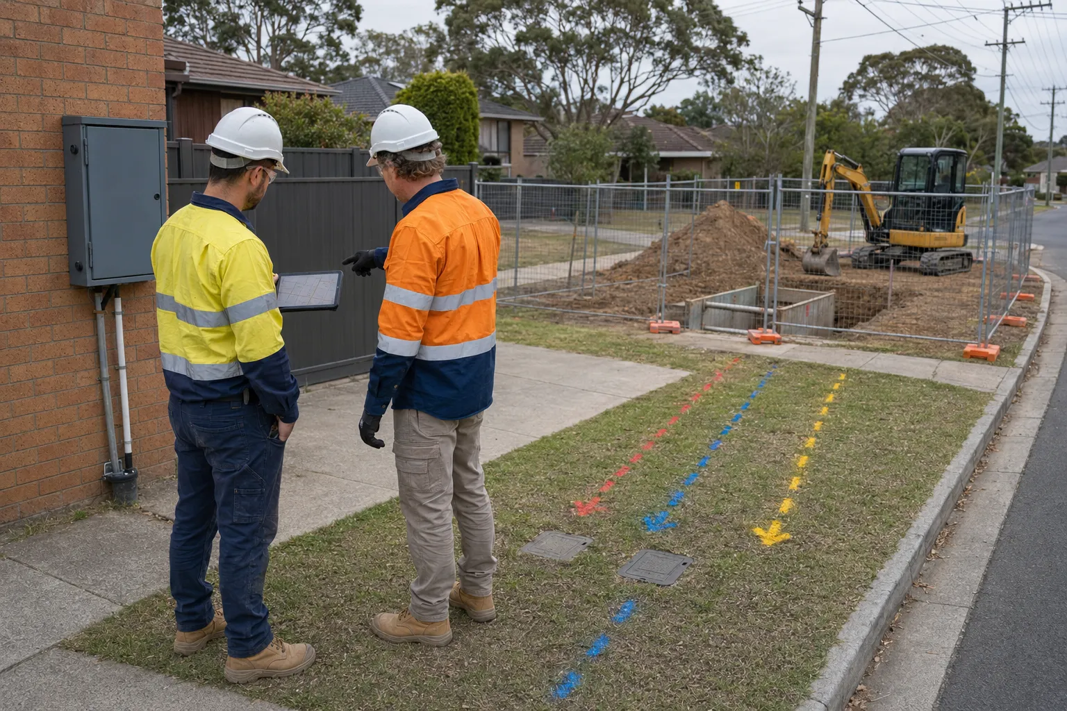
Before underground service locating begins, available records and project information should be reviewed to establish what services may be present and where potential conflicts are likely to occur. This helps determine the most appropriate detection methods and areas requiring closer investigation.
Current BYDA plans are an important starting point. They can provide information about the types of services in the area, their approximate alignments and any asset-owner requirements or warnings.
The plans should not be treated as a precise representation of the actual location of every service. They provide an important reference that needs to be considered alongside site conditions and other available information.
Existing survey plans, engineering drawings, as-constructed information and previous development records can provide additional context. The locating team may also consider:
Older or heavily developed properties may contain private, redundant or undocumented services that are not shown on current utility records. Reviewing this information before fieldwork helps identify areas where additional investigation may be necessary.
No single detection method can reliably identify every type of underground service. Professional locating uses different equipment depending on the service material, depth, ground conditions and complexity of the site.
Electromagnetic locating is commonly used to trace conductive services such as electrical cables, metallic pipes and services with detectable tracer wires. A transmitter may be connected to an accessible service to generate a signal, while passive locating can detect certain existing signals.
This method can provide useful information about a service's alignment and depth, but non-conductive services without tracer wires may require other detection methods.
Ground penetrating radar (GPR) uses electromagnetic pulses to identify buried objects and changes in subsurface conditions. It can assist with locating non-metallic conduits and other services that may not respond to electromagnetic locating.
GPR can be useful where records are incomplete or several services are located close together. Its effectiveness can vary with soil conditions, moisture, depth and surface materials, so results require professional interpretation.
Once a service has been located, GNSS or total station equipment can be used to record its position and levels relative to the project's survey control.
Where additional certainty is required, non-destructive excavation equipment may be used to expose selected sections of a service. The exposed service can then be surveyed to record its verified position and depth.
Underground service locating typically follows a process that combines records, field detection, site observations, verification and surveying.
The process begins with current BYDA plans and other available utility, survey and project information. These records establish where services are expected to be located but are treated as a starting point rather than confirmation of their exact position.
The expected service locations are investigated using appropriate non-destructive methods. Electromagnetic locating can trace conductive services, while GPR can assist with non-metallic infrastructure and other subsurface features.
Accessible pits, manholes, metres, covers and other visible indicators may also be inspected to help confirm service routes. Located services can then be marked on the surface for reference during excavation.
If the location or depth of a service remains uncertain, physical verification may be appropriate. Vacuum excavation or another suitable non-destructive method can expose selected sections of the service to confirm its actual position and depth.
Verification is useful where records conflict with field results, services are closely congested or excavation will occur close to critical infrastructure.
Once services have been located and, where necessary, physically verified, their positions can be surveyed against the project's survey control.
The resulting information may be incorporated into an underground services plan or digital model, showing service alignments, pits, verified locations, depths and any remaining uncertainties.
Where infrastructure is installed, altered or exposed during construction, a work-as-executed survey can record its final position and level before it is covered.
This process creates a clearer spatial reference for designers and contractors before excavation begins.
Underground service locating can provide valuable information about buried infrastructure, but no detection method guarantees the exact location of every service. Accuracy can be affected by the type and material of the service, depth, ground conditions, site congestion and the quality of existing records.
A located service should be treated according to the confidence of the detection and the requirements of the proposed work. Where greater certainty is needed, physical verification can confirm the service at selected points.
Several factors can influence locating results:
Using multiple sources of information can improve confidence. Utility records, electronic locating, GPR, visible site features and survey information can be compared to identify discrepancies before excavation.
More detailed locating and verification may be appropriate for:
Where a service is physically exposed, its actual position and depth can be surveyed and documented rather than relying solely on an inferred location.
Not every underground service can be detected with certainty using surface locating equipment. Non-metallic services, undocumented private infrastructure, abandoned assets and services affected by difficult ground conditions can be challenging.
This is why underground service investigation should not rely on a single source of information. BYDA records, site observations, electromagnetic locating, GPR and physical verification each provide different types of information and can be used together to improve confidence.
Where a service cannot be reliably located or its position is critical to the proposed excavation, further investigation or physical verification may be necessary before work proceeds.
Physical verification, often called potholing or proving, involves exposing an underground service to confirm its actual position, depth and configuration. While utility plans and electronic locating provide valuable information, they may not be sufficient where services are poorly documented, closely spaced or difficult to detect.
Physical verification may be appropriate when:
Non-destructive methods can expose selected sections of a service. The exposed asset can then be measured and surveyed to establish its position, depth, size and other relevant characteristics.
Excavating without identifying underground services can expose workers, the public, property and infrastructure to serious risks. Electricity cables, gas lines, water mains, telecommunications infrastructure and private services may be hidden below the surface even where no obvious signs are visible.
A service strike can result in injury, utility outages, environmental incidents, construction delays and unexpected costs.
Electricity and gas services present some of the most serious hazards. Damaging an underground electrical cable can cause electric shock, burns or arc flash, while striking a gas pipeline can result in leaks, fire or evacuation risks.
Water, sewer and drainage infrastructure can also create hazards if damaged. A ruptured water main may cause flooding or ground instability, while damaged sewer or drainage pipes can create contamination concerns and disrupt surrounding properties.
Damage to telecommunications infrastructure can interrupt internet, telephone or data services, while damage to other utilities can affect surrounding homes and businesses.
A service strike can also stop construction while the asset is isolated, inspected and repaired. Depending on the incident, additional costs may include:
Identifying services before excavation allows the team to manage these risks before they result in disruption or additional costs.
Underground services are also an important workplace health and safety consideration. Project teams need to identify foreseeable hazards and implement suitable controls before excavation starts.
SafeWork NSW explains that underground essential services information should be obtained for the worksite and adjacent areas before excavation begins.
BYDA information, locating results, survey data, surface markings and physical verification records can help document what was identified and how risks were managed. However, these records do not guarantee that every underground asset has been found.
If an unexpected service or obstruction is encountered, excavation should stop and the situation should be assessed before work continues.
Once underground services have been located, their positions need to be clearly marked on site and accurately recorded for design and construction. Marking helps excavation crews identify service alignments in the field, while surveying and mapping provide a more permanent record.
The process involves three steps:
Located services can be marked using paint, flags or pegs to show their approximate alignment. Colour coding can help distinguish different utility types, like:
Labels, arrows and depth information may also be added where relevant. On surfaces where paint is difficult to maintain, pegs or flags can provide additional visual references.
Because surface markings are temporary, located services can be surveyed against the project's existing survey control. GNSS or total station equipment may be used to capture service positions, levels, pits and other relevant features.
Where a service has been physically exposed, its verified position and depth can also be surveyed.
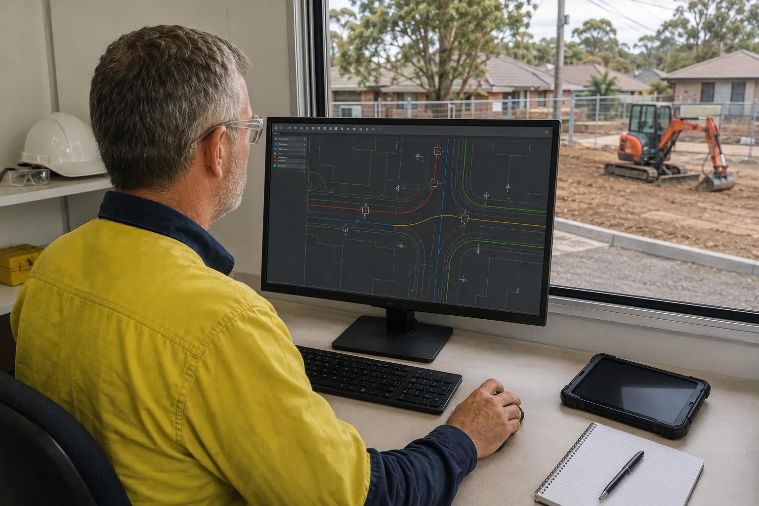
Survey information can then be incorporated into an underground services plan or the project's CAD or digital model. The plan may show service alignments, pits, verified locations, depths and areas where the service position remains uncertain.
Knowing how to read and understand a surveyor’s report can help project teams interpret service locations, recorded depths, survey notes and any limitations identified during the investigation.
Accurate marking and mapping gives designers and contractors a clearer spatial reference for existing underground infrastructure and helps identify potential conflicts before excavation.
Underground service locating should be carried out by suitably trained and experienced professionals with the equipment and knowledge to detect buried infrastructure and interpret the results correctly. More complex developments may require both specialist utility locating and surveying.
Specialist utility locators use methods such as electromagnetic locating and GPR to trace underground services. They should be able to interpret BYDA information, recognise limitations in service records and identify when additional investigation or physical verification may be appropriate.
Where located services need to be accurately mapped for design or construction, a surveyor can record their positions against the project's survey control. This is useful for subdivisions, major developments, roadworks and projects where underground services need to be incorporated into engineering plans.
The party controlling or undertaking the excavation will need to ensure underground services have been adequately investigated before work begins. Depending on the project, this may involve the builder, principal contractor, civil contractor, developer or property owner.
Obtaining utility plans alone does not confirm the exact position of every service, so responsibility for further investigation should be clearly established before work starts.
When selecting a service locating provider, consider their experience with similar projects, available detection methods and ability to provide clear documentation.
Useful questions include:
For complex or high-risk excavation, a specialist utility locator and surveyor may work together to provide both detection and accurate spatial documentation.
Underground service locating should be arranged during the planning stage and completed before excavation begins. This gives the project team time to identify potential conflicts, adjust the design and establish appropriate controls before work starts.
The level of investigation depends on the location, depth and nature of the proposed work. Additional care may be appropriate near road reserves, footpaths, easements, existing pits and other visible service indicators, or where multiple utilities are likely to occupy the same area.
Current BYDA information should be obtained and reviewed alongside available site and project information. Where the plans indicate services in or near the work area, professional locating and physical verification can provide greater certainty before ground is disturbed.
For larger or more complex projects, locating should ideally occur early enough to inform design and tendering. A further investigation may also be appropriate closer to construction if previous information is outdated, site conditions have changed or additional services may have been installed.
Understanding how underground services are located before excavation is essential for safe and efficient work in NSW. Combining Before You Dig Australia information with professional locating methods, site investigation, physical verification and accurate surveying provides a more reliable understanding of what lies beneath the work area. Physically exposing and surveying selected services can help designers and contractors make decisions based on verified information rather than assumptions.
Surveyors help property owners, developers and construction teams establish reliable survey information for projects involving excavation and underground services. By documenting located and verified services, MCS Surveyors supports better planning, safer construction and more informed decisions before work begins.