Fastest Turnaround Times In The Surveying Industry!


Accurate survey information keeps construction and infrastructure projects compliant. For developments, Work-As-Executed (WAE) surveys provide the verified evidence that councils, certifiers and utility authorities rely on to confirm completed works reflect approved designs. When done by experienced land surveyors in Sydney, these surveys help streamline approvals, support asset handovers and reduce the risk of costly compliance issues.
Understanding what a WAE survey involves, when it is required and what information it must contain can help project teams plan survey requirements earlier and avoid delays during certification or handover. MCS Surveyors explains the purpose of WAE surveys in NSW, the situations where they are commonly required and how they support successful project sign-off.
A Work-As-Executed (WAE) survey is a detailed spatial record of how civil, infrastructure or building works have actually been constructed on site, compared with how they were designed. It captures the final position, level and extent of new infrastructure or building elements once construction is complete or at specified stages.
This allows councils, utility authorities and certifiers to verify that the completed works align with approved plans, consent conditions and relevant authority requirements.
WAE surveys are commonly used as part of the compliance and sign-off process for subdivision works, public infrastructure and many private developments. They provide objective evidence of what is physically in the ground or on the site, becoming the authoritative reference for future maintenance, upgrades and dispute resolution.
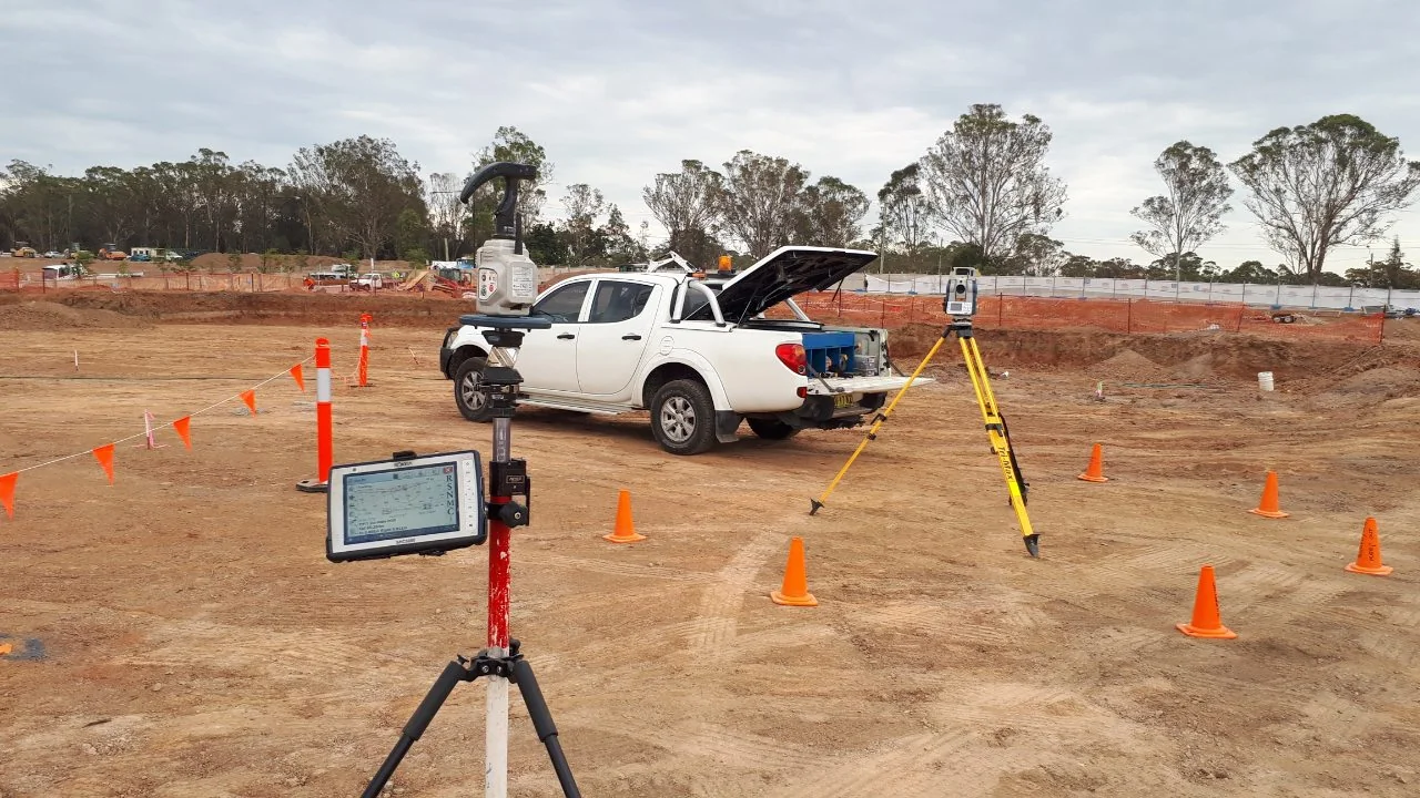
A WAE survey measures and documents the constructed features of a project with survey-grade accuracy. It is typically connected to recognised survey control, such as MGA coordinates and AHD levels, where required by council or authority standards.
The resulting plan or digital dataset usually includes:
The survey is not limited to what is visible above ground. Critical underground infrastructure is often located during or immediately after installation so its position and depth can be accurately recorded before backfilling.
This is especially important for drainage, sewer, water and service infrastructure, where future access, maintenance and excavation safety depend on reliable as-built records.
Design plans show what is intended to be built. A WAE survey shows what has actually been built.
During construction, changes can occur due to site constraints, service clashes, material changes, drainage adjustments or engineering refinements. A WAE survey captures these real-world outcomes and provides a measured record of the completed works.
The surveyor compares the constructed works with the approved engineering, civil or architectural drawings. Any discrepancies in level, alignment, location or extent can then be reviewed by the designer, certifier, council or relevant authority.
For many projects, the acceptance of subdivision works, the issue of compliance certificates or the release of bonds depends on a satisfactory WAE survey. Where works differ from the approved design beyond allowable tolerances, the WAE survey provides the evidence needed to assess whether the work can be accepted or must be rectified.
WAE surveys are widely required across urban development, subdivision and infrastructure projects in NSW. They are commonly used for:
They are also often requested at the completion of upgrades to existing assets. This may include water or sewer main augmentation, intersection improvements, utility relocations or public infrastructure works associated with a development.
Once completed, the WAE survey becomes the long-term reference record for asset owners, regulators, maintenance teams and future project consultants.
A WAE survey is typically required when authorities, asset owners or certifiers need verified evidence that works have been constructed in the correct position and to the approved design.
It is most commonly required as a condition of:
Although the exact requirements vary between councils, certifiers and agencies, WAE surveys are generally required for subdivision works, public infrastructure, in-ground services and works that affect existing utility networks or public assets.
They may be needed before practical completion, subdivision registration, occupation certification or the release of bonds and development securities.
Local councils and private certifiers frequently require WAE surveys as part of the development approval and final sign-off process. These surveys are used to confirm that completed works match the approved plans and comply with consent conditions, engineering requirements and relevant standards.
Councils may request a WAE survey before issuing a subdivision certificate, occupation certificate or final acceptance of civil works. In some cases, they may also require it before releasing bank guarantees, bonds or other development securities.
In many local government areas, the requirement is clearly listed in the development consent, subdivision works certificate, engineering approval or associated conditions. This makes it important to review approval documents early so WAE survey requirements are not left until the end of the project.
Asset owners and infrastructure authorities also require WAE surveys to document new or altered infrastructure. This is particularly important where works occur within road reserves, easements or corridors shared by multiple services.
A WAE survey is often required when:
These surveys support asset management systems, GIS records and future maintenance planning. They also help ensure future upgrades, repairs and excavations can be carried out safely and accurately.
Beyond explicit consent conditions, WAE surveys are frequently required as part of broader project risk management and certification processes. They provide independent verification that helps protect principals, contractors, designers and developers.
Common project triggers include:
Many contracts, authority guidelines and project completion requirements in NSW refer to WAE information as part of final documentation. In practice, this makes a compliant WAE survey a common requirement on engineered land development and infrastructure projects.
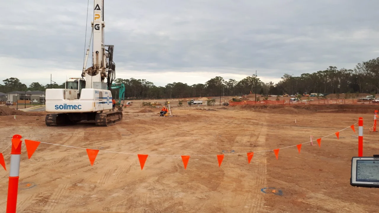
A WAE survey records exactly what has been built on site so it can be checked against the approved design and authority requirements. It documents the final position, level and extent of relevant constructed works in a clear, scaled and verifiable format.
The information included will depend on the project type and the requirements of the consent authority, council, certifier or service provider. However, all WAE surveys follow the same principle: they show the measured as-built condition of the site.
Every WAE survey starts with accurate positional and height data. Typical inclusions are:
Levels are commonly related to a recognised datum, such as Australian Height Datum (AHD), where required. This allows certifiers, engineers and authorities to compare the built work with design levels and confirm whether it meets the approved requirements.
Civil and infrastructure projects require detailed recording of underground and aboveground services. A WAE survey will typically show:
For road and subdivision works, the survey may also capture kerb types, pavement extents, line marking, signage, accessways and other completed civil assets.
Dimensions, pipe sizes, materials, levels and asset identifiers may also be noted where they form part of the authority’s WAE requirements.
A compliant WAE survey is more than a plan with points and levels. It must include the information needed for authorities to accept the works and update asset records.
This usually includes:
Digital data is often supplied in specific formats, such as DWG, PDF or an authority-required GIS format. This allows newly constructed assets to be imported into asset management systems.
Where a critical element differs from the design beyond allowable tolerances, the WAE survey provides the measured evidence used by designers, certifiers and authorities to assess whether the works can be accepted or require rectification.
Set-out surveys and WAE surveys serve different purposes in the life of a project, even though both may be carried out by survey professionals.
A set-out survey is used to position proposed works before or during construction. A WAE survey is used to verify and document completed works after they have been constructed.
Understanding the distinction is important because development consents, construction certificates, subdivision works certificates and occupation certificates may specify both survey types at different stages.
A set-out survey is undertaken before or during construction to physically mark the approved design on the ground. It translates architectural, structural or civil design drawings into pegs, marks or coordinates that builders and contractors can follow.
The purpose of set-out is to help construction occur in the correct location relative to boundaries, easements, height restrictions, design levels and nominated tolerances.
A WAE survey is undertaken after the construction of particular elements or at practical completion. Its purpose is to capture the actual location, level and dimensions of works as they have been built.
In simple terms, a set-out survey guides the work before it is built. A WAE survey verifies the work after it is built.
Set-out surveys focus on transferring design information to the site. The surveyor uses the design model or approved drawings to position key points, lines, levels or reference marks.
WAE surveys capture the finished or partially finished works as a record of fact. This commonly includes:
The level of detail in a WAE survey is usually higher because it may be relied on for compliance checks, asset handover, future design, maintenance and dispute resolution.
Set-out surveys are mainly driven by construction accuracy and risk management. The information is usually used internally by the project team, unless a specific set-out certificate or boundary-related certification is required.
WAE surveys form part of the formal compliance trail. Councils, Sydney Water, Transport for NSW and other utilities may specify WAE requirements in their approval conditions or technical standards. Principal certifiers may also require WAE plans before issuing occupation certificates or accepting completed works.
Where set-out surveys support the building process, WAE surveys provide the documentary evidence that the built outcome matches the approved intent or clearly records any variations.
WAE surveys are important because they create a reliable record of completed works. Councils, certifiers and utility authorities use this record to assess whether infrastructure and building works have been completed in accordance with approved plans, consent conditions and relevant standards.
Without a reliable WAE survey, projects can face delays in subdivision certification, occupation certificates, asset handover or release of development securities. Future design, maintenance and upgrade works can also become more difficult when there is no trusted record of what has been built.
Councils and lead agencies often require WAE surveys as part of the documentation attached to development consents, subdivision works certificates and construction certificates.
Certifiers and council engineers use WAE data to confirm that design intent has been met and that public infrastructure is suitable for acceptance or dedication. If non-compliances are identified, they can be reviewed and rectified before final approvals are issued.
This reduces the risk of delayed subdivision certificates, refused sign-off, unresolved defects or costly rework after residents, tenants or asset owners take over the site.
For assets handed over to councils or utilities, a compliant WAE survey may be a condition of acceptance. Without it, an authority may refuse to take ownership, leaving the developer responsible for ongoing maintenance, liability or further documentation.
A detailed WAE survey creates a defensible record of constructed works at a defined point in time. This is important where there may be future disputes about:
Accurate WAE data can help clarify responsibility between builders, contractors, consultants and developers. It can also assist in demonstrating that works were completed to the required standards at the time of completion, which may be relevant for insurance, warranty and defect claims.
WAE surveys are often the most accurate starting point for future work on a site. Designers, engineers, asset managers and maintenance teams use this information to plan:
Knowing the true location and depth of underground utilities helps reduce service clashes and lowers the risk of damaging existing assets during excavation. For long-term asset managers and facility owners, WAE data supports safer maintenance planning and better decision-making without relying on guesswork or outdated drawings.
WAE survey requirements should be considered before construction begins, not only at the end of the project. Some assets need to be surveyed while they are still exposed, especially underground pipes, pits, conduits, service crossings and drainage structures.
Leaving WAE surveys until after backfilling or practical completion can create problems if critical elements are no longer visible or accessible. This may lead to delays, additional investigation, potholing, rework or incomplete documentation.
Project teams can reduce these risks by reviewing approval conditions early, confirming authority requirements and coordinating survey attendance at key construction stages.
This is especially important where multiple authorities are involved, such as council, Sydney Water, Transport for NSW, utility providers or private certifiers.
Work-As-Executed surveys are an important part of the compliance process for construction, subdivision and infrastructure projects. By recording what has actually been built, they help councils, certifiers and asset owners confirm that completed works align with approved designs and authority requirements.
Planning WAE survey requirements early and engaging qualified survey professionals throughout construction can help reduce approval delays, support asset handover and create reliable records for future maintenance or upgrades.