Fastest Turnaround Times In The Surveying Industry!


Before any room layouts are imagined or finishes selected, a clear and accurate understanding of the site is essential. The success of a new home depends on what exists above and below ground long before the first design sketch is produced. Working with experienced land surveyors in Sydney helps ensure critical site information is captured early, so design decisions are based on measured data rather than assumptions. Factors such as site levels and topography, access and boundaries, underground services, ground conditions, planning constraints and environmental features all shape what is realistically achievable on a given plot.
This article outlines the key types of site information required before detailed design begins. It explains why a measured topographical survey is vital for correctly siting a house, how clear boundary definition helps prevent disputes, how drainage and utilities influence layout and how ground conditions and flood risk affect foundations and long-term performance. With accurate site data in place, design potential can be better understood, costly surprises can be reduced and compliance with local requirements can be addressed from the outset.
.webp)
Accurate site information forms the foundation of any successful new home design. Without a clear understanding of levels, boundaries, ground conditions and physical constraints, even a well-considered concept can become difficult to build, more expensive than expected or non-compliant with council and statutory requirements. Good design depends on knowing exactly what exists on and around the site before the layout is developed.
This early understanding improves decision-making across the project. It gives architects, designers, engineers and owners a more realistic picture of what the land can accommodate, how the building should respond to it and what challenges may need to be addressed before approval or construction begins.
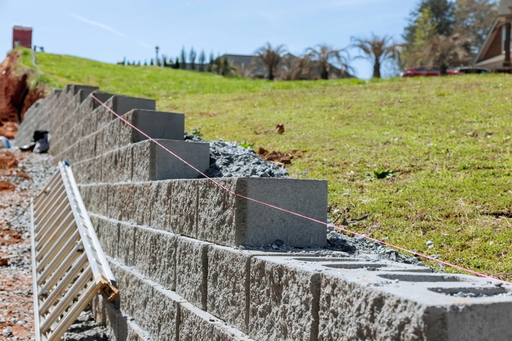
Ground conditions and topography directly influence how a home must be built. A steeply sloping site, for example, may require split-level design, retaining walls or stepped foundations. If the slope and levels are not measured accurately from the beginning, the structural solution can become more complex once the home is set out on site, increasing costs and potentially affecting the design.
Information on buried services, existing structures and access routes is equally important. A home that clashes with a sewer easement, underground cable or drainage line may require redesign, service relocation or approval from relevant authorities. Identifying these issues during the design phase allows the building footprint, driveway and service runs to be planned in practical and compliant positions.
Soil conditions and groundwater levels also affect foundation design and drainage performance. Reactive clay, fill, rock or a high water table can all require specific engineering responses. When these conditions are understood early, the structural design is more likely to suit the site from the start rather than being revised once excavation begins.
Design proposals need to respond properly to the site and its surroundings. Surveyed levels, boundary positions and neighbouring features help ensure the proposed home sits appropriately on the block and aligns with local planning controls. Incomplete or inaccurate information can lead to delays during assessment, design amendments or conditions that could have been addressed earlier.
Precise boundary information is especially important. It helps keep the development within legal ownership and reduces the risk of encroachment onto neighbouring land, shared access areas or public land. Clear measurement of fences, walls and other boundary features also gives designers greater confidence when applying setbacks and positioning the home on the site.
Site information is not only about identifying restrictions. It also helps unlock the site’s design potential. Orientation, views, neighbouring buildings and existing features all influence where the home should be placed for natural light, privacy and outdoor living. Understanding how the site works allows the layout to be developed more intelligently.
Accurate topographic information also supports better cost planning. Earthworks, retaining walls, drainage requirements and site access can all be estimated more realistically when levels and physical features are known from the start. This gives builders and clients a clearer basis for pricing and reduces the chance of unexpected variations caused by conditions that were not properly identified early on.
Site levels and slope influence how a house sits on the land, how water moves across the block and what type of foundations, retaining and drainage solutions may be needed. Accurate contour information at the beginning of the design process helps prevent avoidable excavation costs, drainage problems and issues with building height or siting controls.
A detailed survey of existing levels provides a three-dimensional picture of the site rather than a flat plan. This gives architects, engineers and planners the information needed to design a home that responds to the natural ground, minimises unnecessary cut and fill and works within local council requirements.
Contours are lines that join points of equal height. On a site plan, they show how steep the land is, the direction of fall and where the natural high and low points sit. Closely spaced contours indicate a steeper slope, while widely spaced contours show a gentler fall.
For residential design, a survey should typically include spot levels at key locations such as boundaries, corners, existing structures and notable changes in grade, together with contour intervals that accurately reflect the shape of the land. On smaller or more complex sites, a 0.25 metre or 0.5 metre contour interval may be appropriate. On larger or more uniform sites, a 1 metre interval may be sufficient. This information directly informs:
Without reliable level data, a design can appear workable on paper but require significant changes once construction begins.
The natural slope of the land affects how stormwater can be managed. A site that falls towards the street may allow gravity drainage to the kerb, while a site that falls to the rear or to an internal low point may require a more complex solution such as charged lines, pumped systems or on-site detention.
Designers need to understand:
Accurate levels allow hydraulic design to be coordinated properly with the building layout, driveway, finished floor levels and landscaping. This reduces the risk of ponding, seepage, erosion and drainage conflicts during construction.
Site slope has a direct influence on the type of home that is practical. A relatively flat block may suit a slab-on-ground dwelling with minimal retaining. A moderately sloping site may be better suited to a split-level design that follows the contours and reduces excavation. On steeper land, suspended floors, stepped retaining or terraced construction may be more practical than trying to create one large level platform.
Level information is also critical for:
Even small inaccuracies in assumed levels can affect ramp lengths, retaining wall heights and the perceived bulk of the home. For that reason, the initial contour survey needs to be precise and referenced to a recognised datum.
Accurate knowledge of legal boundaries, existing easements and setback requirements is fundamental before any home design begins. These constraints determine where a building can sit on the land, how much of the site can be developed and which areas must remain clear or accessible. Overlooking them early can result in redesign, refusal during assessment or serious compliance issues later.
Understanding these controls from the beginning allows the home, driveway and outdoor areas to be positioned more confidently. It also helps identify any issues that could affect privacy, access, future additions or serviceability.
A current cadastral survey or title plan is the starting point for understanding legal boundaries. Fences, hedges and existing walls are often assumed to mark the boundary but can be inaccurate. The legal boundary is determined by survey, not by what appears on site.
A detail and level survey should identify boundary positions in relation to visible features such as fences, retaining walls and buildings. This can reveal encroachments, including sheds, garages or other structures that do not align with the legal title boundary. Any discrepancy between the title and the physical situation on site needs to be understood before design work proceeds.
Old or disturbed boundary pegs should not be relied on without verification. A registered survey provides the correct basis for design, setout and construction.
Title documents and deposited plans should also be reviewed for easements and restrictions. Common examples include drainage easements, sewer lines, water infrastructure, electricity assets, access easements and restrictions on use. These often limit where permanent structures can be built or require clear access to be maintained.
The location and width of each easement should be clearly understood during design. A rear drainage easement, for example, may restrict where extensions, detached structures, pools or deep footings can be placed. Authority requirements may also specify minimum offsets from underground assets, which can influence building location, landscaping and driveway design.
Existing features and access conditions strongly affect how a new home can be designed and built. Before meaningful design work begins, it is important to understand what is already on or around the site and how people, materials and construction equipment will reach it.
Ignoring these factors can lead to planning issues, construction inefficiencies or design decisions that are difficult to deliver in practice.
Existing buildings and structures should be accurately located and measured. This includes houses, garages, sheds, retaining walls, fences, patios, driveways and hard landscaping. Their position, height and proximity to boundaries can influence setbacks, overlooking considerations and the available building area.
Other features that should be captured include:
These elements may constrain the design, but they can also present opportunities for better views, privacy or outdoor use if they are understood early.
Trees can be one of the most significant design constraints on a site. A survey should identify tree locations, trunk diameters, canopy spread and levels around likely root zones. In many cases, existing trees may be protected under council controls or may require arborist input before any removal or construction near them is considered.
Mature landscape features, retaining terraces, rock outcrops and established screening can also affect levels, drainage and building placement. These features often shape the most practical position for windows, private open space and external living areas.
Access considerations start at the street. The location, width and visibility of access points influence both planning outcomes and day-to-day usability. A narrow frontage, shared access arrangement or steep approach can affect garage placement, turning areas and driveway design.
Construction access is just as important. Narrow side access, tight corners, overhead powerlines, nearby buildings or restricted manoeuvring space can affect how materials are delivered and what equipment can be used on site. These conditions may influence construction methodology, staging and cost, so they should be understood before the design is advanced too far.
Before a new home is designed in detail, the availability and capacity of site services should be investigated carefully. Utility connections, stormwater options and ground conditions all affect layout, floor levels, structural design and overall feasibility. Early investigation helps confirm what the site can support and whether extra works or approvals may be needed.
A practical review should consider not just what exists at the boundary, but how new services will be brought onto the site and coordinated with the proposed building.
Key services to investigate include electricity, water, sewer, stormwater, telecommunications and, where relevant, gas. The design team needs to understand whether the site:
Available service plans and authority information can help identify the location of mains, easements, overhead lines and other constraints. These may affect where the building can sit, how deep excavation can occur and where driveways or service trenches should be located.
Drainage strategy is a critical early design issue because it affects levels, external works and foundation planning. Information should be collected on:
Where gravity connection is possible, drainage design may be relatively straightforward. Where it is not, alternatives such as pumped systems, detention or more complex pipework may be needed. These requirements can influence finished floor levels, driveway layout and landscaping.
Ground conditions influence both structural design and drainage performance. Site investigation may identify reactive soils, fill, rock, shallow groundwater, contamination or other conditions that affect footing design and cost. Difficult ground does not necessarily prevent development, but it does need to be understood early so the design can respond appropriately.
Other conditions to document include flood risk, existing culverts or drainage channels, signs of historic site use and constraints such as narrow lanes, steep approaches or load-limited access routes. These factors can influence everything from service installation to excavation methods and construction logistics.
Many design changes during planning or construction can be traced back to incomplete site information. These changes often lead to extra consultant fees, delayed approvals and avoidable redesign work. Most problems arise not because the site is impossible to build on, but because important conditions were assumed rather than measured.
Reliable survey information and early coordination between surveyors, designers and engineers greatly reduce this risk.
One of the most common mistakes is progressing the design before the site’s physical constraints have been fully mapped. Underground services such as sewers, water mains, stormwater lines and electrical infrastructure can directly affect footing locations and building placement. If they are only identified after drawings are prepared, the design may need to be shifted, reduced or reworked.
Above-ground constraints are just as important. Overhead powerlines, significant trees, retaining walls and neighbouring structures can all limit where the home can sit and how it can be built. If these features are not clearly shown on the survey, the early design may not reflect what is actually possible on site.
Assuming fences or hedges represent the legal boundary is another frequent error. Once a proper boundary survey is undertaken, the buildable area can change, sometimes enough to affect setbacks, driveway widths or the overall layout.
Design changes also commonly occur when local planning controls and neighbouring context have not been properly considered. Height limits, floor space restrictions, setbacks, landscaped area requirements and privacy controls all need to be understood early. If the design pushes too close to these limits, council may require changes to height, form, siting or glazing.
Neighbouring impact is another common issue. Window placement, terrace design and building height can all affect privacy, overshadowing and visual bulk. Without accurate site information and proper context, these issues may only become obvious once the proposal is reviewed, leading to further design amendments.
The quality of a new home design is shaped by the quality of the site information available at the beginning of the process. Accurate levels, boundary definition, easement identification, service mapping, drainage understanding, access assessment and ground investigation all play a direct role in determining what can be built and how efficiently it can be delivered.
When this information is established early, the design process becomes clearer and more reliable. Decisions around siting, layout, structure, drainage and compliance can be made with greater confidence, reducing the likelihood of redesign, delays and unforeseen costs. A well-documented site does not just support better drawings. It supports a better outcome from the ground up.