Fastest Turnaround Times In The Surveying Industry!


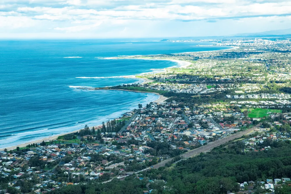
Surveying coastal and tidal areas requires a highly specialised approach, especially as ecologically fragile conditions, regulatory frameworks and digital technologies continue to evolve. At MCS Surveyors, we’re aware of how rapidly shifting coastlines and complex approval requirements demand stronger methodologies than ever before. For any landowner, developer or consultant planning a coastal boundary survey in Wollongong, understanding the time-sensitive nature of tide periods, legal boundary definitions and constraints is essential. Below, we outline the 2026 best practices shaping the future of coastal and tidal surveying.
Surveying coastal and tidal boundaries presents a level of complexity that far exceeds what surveyors face on typical urban or inland projects. For surveyors, this means working within compliant tidal timing, responding to rapid changes and ensuring the data collected remains legally defensible and responsible. To deliver an accurate and compliant assessment, surveyors need to navigate the layered challenges of conditions, government controls and safety risks.
Wollongong’s coastline is not only visually striking; it is also one of the most carefully managed and conservation-controlled zones in NSW. Before any coastal survey begins, surveyors must undertake comprehensive research to understand the overlays and regulatory requirements that may influence the site. This involves analysing long-term erosion data, identifying hazard zones and reviewing local and state controls that protect marine ecosystems and shoreline stability.
Unlike inland projects, coastal regulations can change quickly as new erosion studies or hazard lines are released by the council or the NSW Government. Surveyors must therefore remain current with updates and advisory notes to ensure that every interpretation aligns with the latest planning and standards. These directly affect how fieldwork is conducted, how boundaries are defined and how long the approval process may take.
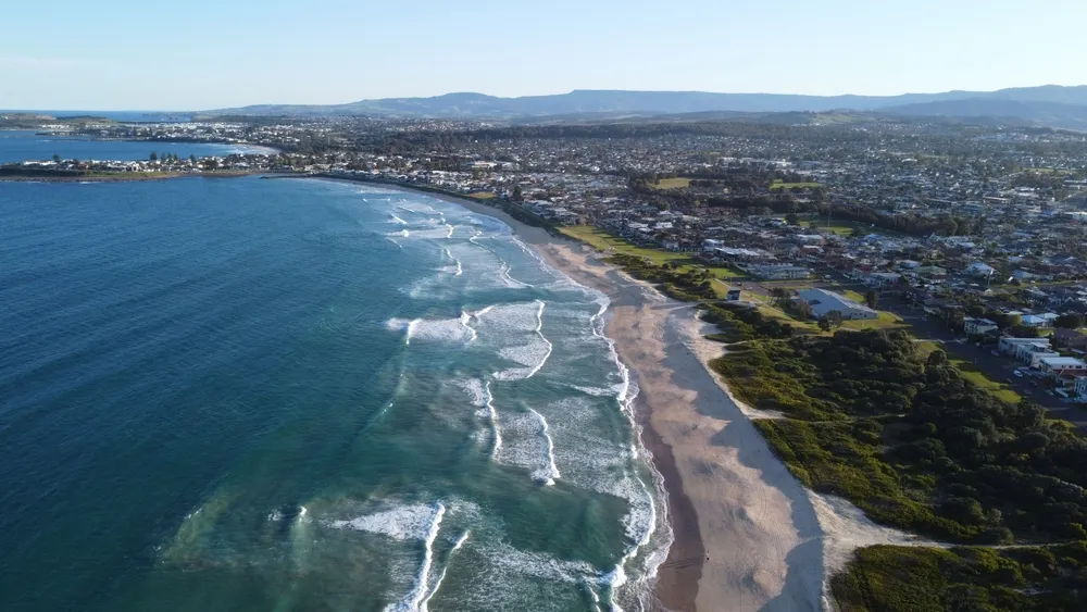
Wollongong’s coastal landscapes are in a constant state of motion, influenced by weather patterns, geological processes and the daily rise and fall of the tides. Surveyors must understand how these natural forces affect the short-term and long-term position of coastal features. Because these movements affect reliability, surveyors must plan their fieldwork around the most tide-dependent scheduling and favourable weather conditions. This often means coordinating fieldwork at specific times of day or during particular seasons to capture data that truly reflects the physical reality of the site.
Coastal zones experience rapid and sometimes unpredictable changes, making them some of the most demanding for correct measurement. Unlike stable inland parcels, these sites exhibit constant movement caused by water action, sediment transport and natural erosion processes. Even small variations can lead to incorrect boundary placement. Cross-checking from different time periods is essential to supporting a defensible boundary and reducing the risk of future disputes or redesigns.
Coastal surveys often take place in environments where physical access is limited, unpredictable or potentially hazardous. Cliffs, slippery rocks, unstable dunes and fast-moving tides can make it difficult to navigate the site. Surveyors must carefully assess these risks before stepping onto the field, ensuring they are equipped with the right tools and protocols.
Planning for access may require timing the site visit during low tide, using specialised equipment or adopting alternative surveying techniques to avoid unsafe areas. Proper preparation not only protects the survey crew but also enhances quality by reducing rushed or compromised fieldwork.
By 2026, high-definition 3D data, precision GNSS and integrated digital modelling will have become essential tools for producing legally defensible and exact coastal surveys. These allow surveyors to reduce site disturbances and better understand long-term coastline behaviour. The shift towards digital coastal surveying not only improves outcomes but also aligns with modern expectations for transparency, repeatability and long-term asset management.
Surveying in marine and tidal environments requires tools that perform reliably under constantly changing conditions. This system offers unparalleled accuracy in these zones, even when visibility is hazardous or terrain poses challenges. The ability to capture real-time positional data allows surveyors to work efficiently during compliant tidal timing, reducing time on site and improving the precision of water-related interpretations such as the Mean High Water Mark (MHWM).
3D laser scanning has become one of the most powerful documentation tools available to coastal surveyors. Unlike traditional methods, it generates a dense and highly specific point cloud of the coastal vulnerability. This comprehensive dataset acts as a permanent digital record, allowing planners, developers and regulatory authorities to revisit the exact conditions of the site long after fieldwork is completed.
Drones provide extensive aerial coverage, capturing high-resolution imagery and topographic detail from angles that would otherwise be unreachable. Ground scans, meanwhile, deliver the high-precision data required for legal and cadastral purposes. When these datasets are merged, surveyors can produce comprehensive 3D models and digital terrain maps that offer a full representation of the ecosystem-sensitive areas. This supports a wide range of applications, making it one of the most effective modern methodologies for coastal surveys.
The Mean High Water Mark (MHWM) determines coastal property boundaries, yet it remains one of the most technically complex and frequently misunderstood elements of subdivision planning near the shoreline. The MHWM is influenced by natural tidal behaviour, long-term change and legislative requirements that must be strictly adhered to.
Determining the MHWM requires far more than taking a single tide reading or estimating based on visible water lines. Modern surveying best practice involves a combination of data, advanced positioning technologies and adherence to strict state guidelines. Surveyors must examine years of tidal records and historical hydrographic charts to understand how the shoreline behaves. This thorough approach ensures interpretations reflect the true tidal environment.
The placement has a direct impact on how a coastal subdivision is designed and what future land uses are permitted. Because the MHWM serves as the dividing line between private property and Crown land, any shift in its position can affect the legal boundaries of proposed lots. A misinterpreted MHWM can result in lost developable land, restricted access or unexpected tenure reclassification. Getting it right supports a smoother approval process and ensures the subdivision complies with both planning legislation and constraints.
Misinterpreting can lead to some of the most serious legal and financial complications in coastal development. Councils may refuse subdivision applications that rely on incorrect MHWM data, forcing costly redesigns or resurveys. Furthermore, a poorly defined MHWM undermines the defensibility of determinations, leaving landowners vulnerable to future claims, disputes or forced corrections. Ensuring the MHWM is calculated, documented and clearly represented in survey plans is essential for approval success and for protecting property rights in the long term.
Coastal and tidal developments are subject to some of the processes due to the sensitivity of shorelines and the legal complexities. Navigating these layers of regulation requires a deep understanding of how to assess submissions. Every coastal survey must demonstrate that it meets legislative expectations, incorporates MHWM determinations and reflects real-world coastal behaviour.
Councils rely heavily on surveys to determine whether a proposed development or subdivision is safe, compliant and appropriately positioned in relation to coastal hazards. Because shorelines can predictably and unpredictably shift, councils often scrutinise coastal submissions more closely than typical land surveys. They expect evidence-backed precision, up-to-date information and clear justification for MHWM placement.
Working with Crown Lands introduces a separate layer of responsibility, as this agency manages coastal public land and ensures that private developments do not encroach on Crown-owned areas. Crown Lands approvals often require a deeper investigation of historical title boundaries and long-term coastal behaviour, particularly when a site is near the MHWM or has a history of erosion or accretion.
Fieldwork is only part of successful compliance; the supporting documentation is equally critical. This means surveyors must compile a comprehensive submission package that demonstrates transparency and alignment with coastal planning frameworks. Well-organised documentation improves the clarity of the submission and helps authorities perform their assessments more efficiently. Thorough preparation also reduces the likelihood of requests for additional information, which can significantly prolong timeframes.
Coastal projects rarely involve a single authority or discipline. Instead, they often require collaboration among planners, engineers, specialists, marine scientists and government agencies. Each brings a different perspective, and the survey becomes the common thread that ties all assessments together. When it is clear and defensible, stakeholders can make confident decisions, reducing confusion and improving project outcomes. Effective coordination also strengthens the overall statutory pathway.
Coastal environments are some of the most ecologically delicate landscapes in Australia, and surveying these sites requires far more than technical precision; it demands a commitment to sustainability. Areas such as dunes, rock shelves, estuarine zones and marine habitats can be easily disturbed by excessive foot traffic, heavy equipment or poorly timed fieldwork. As regulations tighten and community expectations rise, surveyors must prioritise methods that protect natural ecosystems while still delivering the high-quality data needed for legal and planning purposes.
Surveying coastal sites requires careful planning to minimise disruption to vegetation, wildlife and natural landforms. Traditional surveying methods can unintentionally cause erosion, disturb habitats or damage fragile dune systems, which is why modern best practice focuses heavily on reducing ground disturbance. Surveyors must assess site conditions beforehand, choose the most appropriate routes and adjust their field approach depending on seasonal risks.
Low-impact fieldwork is not merely about reducing physical presence; it’s about ensuring long-term protection of the landscape while still achieving defensible results. By limiting their footprint, surveyors help maintain the natural processes that allow coastlines to function and regenerate.
Sustainable surveying extends beyond physical field practices to encompass how it is collected, recorded and reported. Ethical documentation ensures that the survey reflects the true conditions of the site without omission, exaggeration or manipulation. Surveyors ensure honesty in the recording process. This means clearly stating the limitations of data, documenting field conditions and avoiding shortcuts that could misrepresent the site’s risks or constraints. Ethical data supports sustainable coastal management and protects surveyors and clients from future disputes.
Choosing the right equipment can reduce a survey’s impact. Modern technology has made it possible to gather precise data using compact, quiet and energy-efficient tools that minimise intrusion into habitats. Equipment allows surveyors to work efficiently without contributing to noise pollution, habitat disruption or unnecessary carbon output. These choices reflect a broader industry shift towards responsible surveying that avoids unnecessary disturbance while still meeting technical requirements.
Coastal surveys involve far more variables than standard land assessments, which is why the planning stage is just as important as the fieldwork itself. Before any surveying begins, landowners, developers and consultants must clearly understand the purpose of the project, the conditions affecting the site and the requirements that may influence interpretations. Asking the right questions early ensures realistic timeframes and full compliance.
Project success hinges on having a well-defined scope from the very beginning. Coastal sites can be influenced by numerous factors, including land tenure, changing shoreline conditions and development constraints. Understanding the purpose of the survey and the decision-makers involved provides a foundation for selecting the right surveying approach and determining a realistic timeline. Surveyors rely on these early planning questions to identify constraints, gather preliminary information and advise on the best methodology for the project. Clear objectives also ensure that the final deliverables meet the requirements and expectations.
Identifying risks ensures that the survey is conducted safely and within regulatory requirements. Various considerations also influence routes, timing and the type of equipment used. By discussing these factors upfront, surveyors can avoid unnecessary disturbance, comply with conservation guidelines and prepare for potential weather or tidal interruptions.
Coastal and tidal surveying in 2026 demands a level of precision, planning and technological capability far beyond traditional land assessments. The right surveying approach not only protects property interests; it ensures full legal compliance, reduces delays and supports sustainable coastal management for decades to come. If you’re preparing for a coastal or tidal project, the right surveying partner makes all the difference. Here at MCS Surveyors, we specialise in advanced coastal surveying, MHWM determination and approval-ready documentation tailored to Wollongong and the NSW coastline. Contact us today to discuss your site, request a detailed proposal or book a coastal survey consultation.