Fastest Turnaround Times In The Surveying Industry!


Coastal landscapes are among the most dynamic environments on Earth. They are constantly shaped by the natural forces of the wind and the waves, as well as by human development. Over time, these influences can cause significant erosion and habitat loss, which threaten both natural ecosystems and built environments. Our team at MCS Surveyors knows how precise, data-driven surveying plays a crucial role in safeguarding coastlines and building resilience against these shifting challenges.
Understanding how coastlines evolve allows communities to plan smarter and respond faster to environmental change. Through advanced technology and environmental insight, surveying helps shape policies and projects that balance preservation with progress. By combining science and local knowledge, survey professionals are not only mapping the present but also forecasting the future of coastal resilience.
Modern coastal surveying has evolved well beyond traditional tools and methods. Today’s technologies allow experts to capture real-time data and model future shoreline scenarios with exceptional accuracy. These innovations make it easier to monitor erosion and design long-term protection strategies that are both effective and sustainable. Precision and adaptability are key to managing such fast-changing environments.
Accurate elevation and terrain data are essential for identifying erosion patterns and sediment movements. LiDAR (Light Detection and Ranging) and drone mapping technologies provide high-resolution imaging that helps track even the smallest shifts in the coastal landscape. These tools enable surveyors in Wollongong to analyse how elements and infrastructure affect the coastline over time.
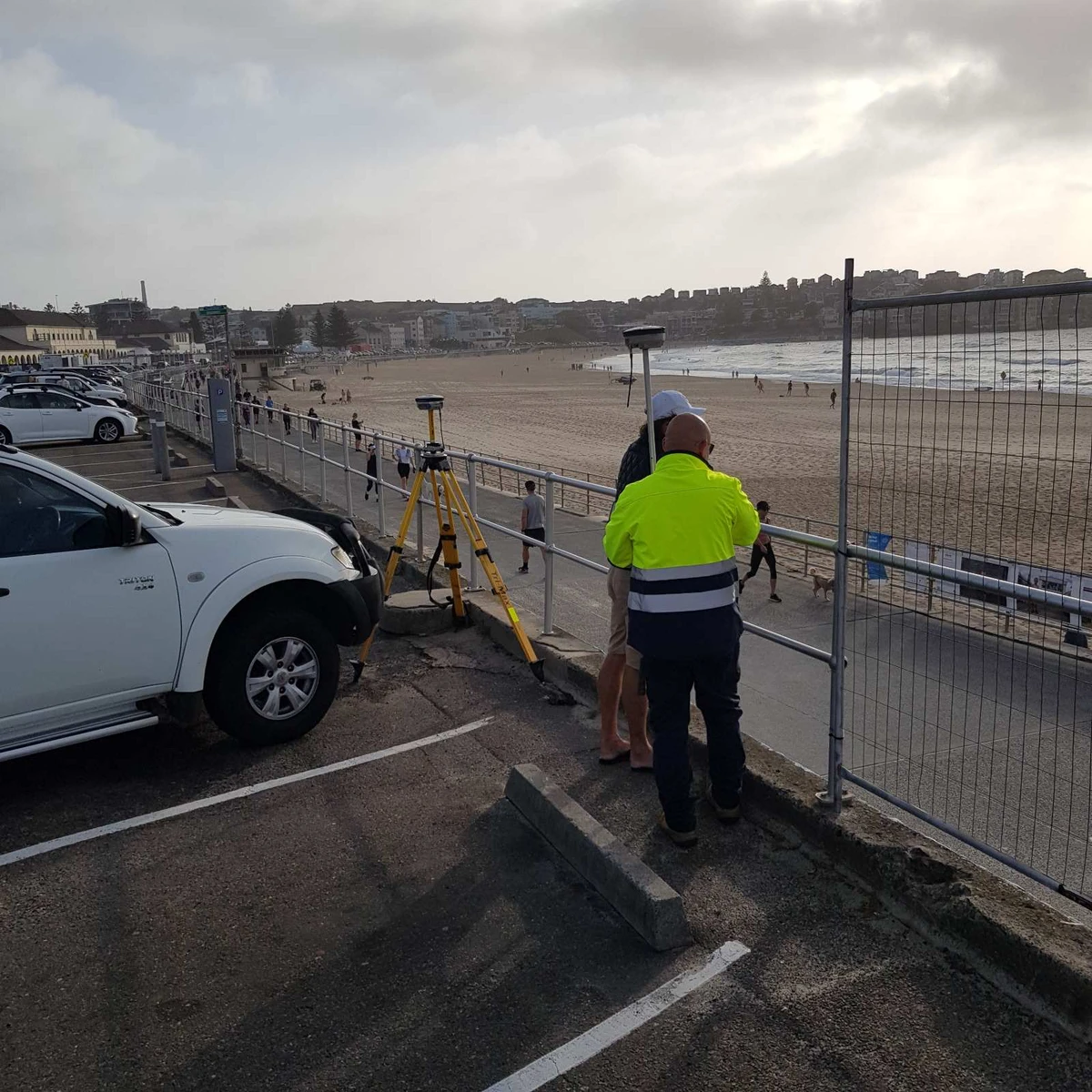
Global Positioning Systems have revolutionised coastal mapping accuracy. By using both GPS and GNSS networks, surveyors can achieve centimetre-level precision even in remote or dynamic shoreline environments. This accuracy ensures all project boundaries and management zones remain reliable over time.
Understanding what lies beneath the water’s surface is as important as tracking land changes. Bathymetric surveys map underwater terrain and submerged structures. This knowledge supports the design of effective erosion control and habitat restoration strategies.
Coastal projects extend beyond physical measurements, as they require a profound understanding of environmental and cultural values. Integrating diverse data sets ensures that development decisions respect both the ecosystem and the community. This holistic approach strengthens project outcomes by aligning them with sustainability and cultural awareness. It’s about seeing the coastline not just as a boundary, but as a shared living environment.
Surveying plays a vital role in supporting environmental protection and biodiversity. By integrating ecological assessments into project planning, professionals can identify sensitive areas that need preservation. This proactive approach prevents unnecessary harm while maintaining natural resilience.
Coastal regions often hold deep cultural and historical significance. Acknowledging and protecting Indigenous heritage during survey planning fosters mutual respect and community collaboration. It ensures that traditional knowledge informs modern environmental management.
Coastal management must cater to diverse public and private interests. Surveying provides the objective data that helps planners balance accessibility and environmental conservation. Striking this balance is key to achieving social and ecological harmony.
Sustainable shoreline management thrives on collaboration among diverse stakeholders. Various communities and entities bring valuable insights that shape practical, long-term solutions. When these groups work together, outcomes are more adaptive and resilient. Shared knowledge builds stronger coastal strategies that can withstand both time and tide.
Public agencies play a key role in regulating and funding coastal projects. Partnering with them ensures that survey data aligns with planning objectives and policy requirements. This coordination leads to consistent and compliant outcomes.
Surveying provides the foundation for engineering and infrastructure design. Collaboration with coastal engineers and planners ensures technical data is accurately interpreted for construction and environmental works. These partnerships turn complex data into actionable insights.
Community and industry participation enhances the success of coastal projects. Public engagement builds ownership and understanding, while industry collaboration supports innovation and efficiency. These partnerships help align short-term projects with long-term coastal visions.
Working in coastal areas presents unique challenges that require adaptability and experience. Constantly shifting conditions like the tides and sediment movement demand flexible survey approaches. Equipment must be durable, and data collection must be precise under pressure. Meeting these challenges head-on ensures accurate insights even in unpredictable conditions.
Tides and weather conditions can drastically alter data accuracy and site accessibility. Surveyors must account for these changes through careful planning and real-time monitoring. Preparation and adaptability make fieldwork both safe and efficient.
Erosion and sediment shifts can quickly change ground conditions. Accurate surveying in such environments requires both skill and the right technology. Reliable results depend on continuous validation and recalibration.
Coastal environments are harsh on equipment due to salt and moisture exposure, as well as corrosion. Maintaining tools and sensors is critical to reliable long-term performance. Regular maintenance prevents data loss and operational downtime.

Effective coastal resilience depends on continuous data collection and interpretation. Long-term monitoring helps detect subtle changes and predict potential risks before they become major issues. Data-driven planning ensures resources are used efficiently and decisions are based on factual evidence. This approach builds confidence and continuity in environmental management.
Fixed monitoring sites are essential for tracking ongoing shoreline evolution. They provide consistent reference points for comparing historical and current data. These stations become the backbone of long-term coastal studies.
Predictive models combine scientific and geographic data to forecast coastal changes. They help decision-makers plan adaptive infrastructure and disaster mitigation measures. This forward-looking approach is key to resilience.
Open-access data encourages collaboration between researchers and local industries. Shared information improves collective understanding and supports unified coastal strategies. Transparency strengthens both science and trust.
Regulatory compliance remains a central part of all coastal surveying work. Projects must align with environmental and safety laws, as well as planning frameworks. Balancing compliance with innovation ensures coastal developments remain both lawful and forward-thinking. A proactive approach to regulation helps prevent costly delays and protects community interests.
Understanding the legal framework governing coastal zones is essential. Surveyors help ensure that development and restoration projects follow environmental policies and permit requirements. This prevents legal disputes and ensures responsible land use.
As environmental conditions shift, compliance strategies must evolve. Incorporating climate resilience into regulatory processes ensures coastal developments remain sustainable under future scenarios. This integration helps protect both property and ecosystems.
Ethical practice underpins all professional surveying work. Transparency and accountability respect ensure that all outcomes serve both people and the environment. Upholding these values reinforces industry credibility and trust.
Building resilient coastlines requires more than technology because it demands collaboration and respect for the land and its communities. MCS Surveyors understands that every shoreline tells a story of balance between nature and human influence. By combining advanced technology with environmental awareness and community engagement, professionals can deliver solutions that not only preserve the present but also protect the future.
Coastal change will always be part of nature’s rhythm, but how we respond defines our resilience. Through careful surveying and adaptive planning, communities can thrive alongside their shifting shorelines. With reputable surveyors leading the way, coastal environments can be both protected and prepared for generations to come.