Fastest Turnaround Times In The Surveying Industry!


Modern surveying sits where technology, regulation and precision meet. Every dataset and boundary mark affects safety, cost and approval outcomes. At MCS Surveyors in Sydney, we’ve learned that project success depends as much on governance and foresight as on field skill. Risk control isn’t an afterthought; it’s built into every stage to protect accuracy and profit.
Let’s explore how modern surveying firms can embed adherence, manage risk effectively and use digital tools to deliver accurate, safe and submission-ready outputs.
Conformity starts at planning. We build legal, safety and quality controls into every survey and report, so outputs meet standards before a project begins. As professionals, we ensure that every procedure, from field setup to report delivery, meets legislative and industry requirements before a project even begins. This early planning saves time, protects reputations and reduces rework.
Consistency is the backbone of meeting requirements. In modern surveying, where multiple teams, technologies and contractors interact, a lack of standardisation can quickly lead to data errors. Reports, drawings and digital files follow one verified format so nothing drifts from national standards. Teams set and maintain those workflows from day one.
QA and QC are how we prove accuracy. Legal checks confirm conformity; quality checks prove precision. Together, they prevent small errors from turning into costly rework. Our QA frameworks operate in parallel with every field and office process, ensuring that errors are detected and corrected before they escalate into adherence breaches. Components of a strong QA framework include:
Systems work only when people take ownership. Every team member is responsible for data integrity and safety, not just ticking procedural boxes. Accountability ensures ownership, transparency and professional pride in delivering error-free, regulation-ready work. To foster this culture:
Surveying faces technical, environmental, financial and regulatory threats. Strong risk management turns those threats into controlled, measurable factors. Here, we treat risk assessment as a dynamic and continuous process, tailored to the complexity and size of each project. The objective is not just to prevent problems but to anticipate them and act early.
Before any project begins, identifying and classifying potential risks is critical to preventing setbacks. In surveying, these risks can emerge from various dimensions. By categorising risks early, project teams gain clarity on which areas need constant monitoring and which require contingency planning.
Once risks are identified, the next step is defining the controls that will prevent them, or the measures that will correct them when they occur. Preventive and corrective actions form the operational core of risk management, helping maintain project stability. These measures are embedded in every stage, from pre-site mobilisation to data delivery. Preventive actions focus on avoiding the problem altogether:
Corrective actions, on the other hand, deal with swift recovery and process adjustment:
Effective communication is a cornerstone of risk mitigation. When clients, contractors and surveyors operate in silos, even minor misunderstandings can cascade into breaches or costly disputes. Transparency is built into every communication channel, from project kick-off meetings to digital report sharing. To strengthen communication:
Even with detailed planning, unexpected events are inevitable. Scenario planning allows teams to anticipate “what-if” situations and test their readiness before real challenges occur. We use simulations and predictive modelling to evaluate project resilience under different stress conditions, helping clients see beyond current variables and prepare for contingencies. Examples of scenario-based risk exercises:
Rules change constantly, and every update can affect cost, timing and feasibility. We act as technical specialists and advisers to guide clients through those shifts. We help clients navigate evolving obligations across state, local and national levels, translating complex legislation into actionable project strategies.
The NCC governs the design, performance and safety requirements that underpin every stage of development. For surveyors, staying aligned with NCC standards is not optional; it’s fundamental. As professionals, we prove that every project adheres to the latest provisions while also factoring in the distinct requirements of local councils and planning authorities. Because these regulations evolve regularly, survey teams and clients must remain vigilant about changes that could impact their project’s design, approvals or documentation.
Safety and environmental adherence are integral to every surveying operation. Modern legislation demands that both people and the planet are protected from unnecessary risk or harm during construction and development activities. We’ve embedded Work Health and Safety (WHS) and Environmental Protection Authority (EPA) standards into every part of our process to validate zero harm and full legal conformity. This extends beyond mere adherence to law; it forms part of a responsible, ethical approach to surveying practice.
As surveying becomes increasingly digital, data oversight has emerged as a priority. Every point cloud, boundary file or digital elevation model carries not only spatial information but also personal and proprietary data. We guard data as carefully as we measure it. Our system protects every dataset: encrypted, traceable and managed under the Australian Privacy Principles.
Certification serves as the final layer of validation that a surveying project meets both regulatory and professional standards. Every dataset, report and plan produced must be verifiable by certified credentials. Certification obligations vary depending on project type and jurisdiction, but the underlying principles remain the same: transparency, documentation and verification.
Technology now drives accuracy, traceability and reporting. Modern tools make collaboration seamless. Digital proof sits at the heart of our strategy. By using AI, blockchain and cloud systems, we enhance auditability while simplifying collaboration between clients, engineers and certifiers.
Modern surveying projects generate enormous volumes of data, from geospatial coordinates to client correspondence. Managing this efficiently requires a digital-first approach. Cloud-based project management platforms have become central to how we collaborate, track progress and maintain transparency across all stakeholders. These eliminate version confusion, streamline approvals and provide real-time access to the most current information.
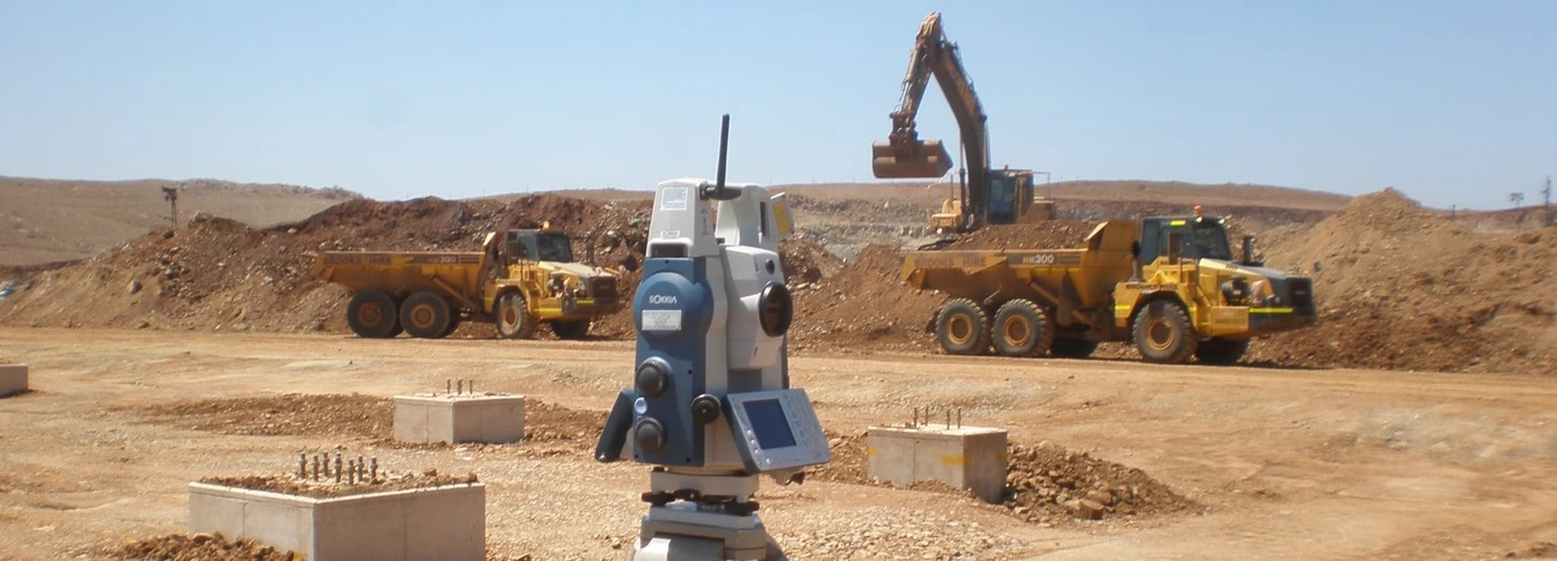
Surveying has entered a new era of precision through drone and LiDAR (Light Detection and Ranging) technology. These tools enable rapid data capture over large or complex areas, improving accuracy and safety while reducing time spent on-site. Use drone and LiDAR systems to improve precision and create a verifiable audit trail for every project. Drones capture high-resolution imagery, while LiDAR sensors produce detailed topographical models that support design and regulatory submissions.
Digital twins are transforming the way projects are governed and maintained. A digital twin is a living, virtual model that mirrors a physical asset. We use digital twin technology to provide clients and regulators with unparalleled visibility into progress, accuracy and long-term asset performance. These combine data from drones, LiDAR and IoT sensors to create dynamic 3D models. These models are continuously updated as the physical project evolves, making them invaluable for risk oversight.
The surveying industry doesn’t operate in isolation; it’s deeply influenced by shifts in the economy, technology, environment and global standards. Market volatility and emerging innovations all shape how projects are delivered and governed. The key to long-term success lies in adaptability. Whether it’s forecasting regulatory changes or embracing automation, our focus is to keep clients ahead of risk, ahead of demands and ahead of competitors.
Economic cycles and environmental factors have always influenced construction timelines, costs and project feasibility. But today, their effects are magnified. Rising material costs, labour shortages and extreme weather events create unpredictable variables that demand flexible project strategies. Address these uncertainties through planning, robust risk frameworks and digital modelling tools that allow for scenario-based forecasting.
The pace of technological advancement in surveying is reshaping how professionals capture, process and deliver spatial information. Automation, artificial intelligence (AI) and machine learning (ML) are moving the industry beyond traditional data collection into the era of predictive insight. Technology disruption isn’t viewed as a threat; it’s an opportunity to elevate accuracy, efficiency and client trust.
Environmental, social and governance (ESG) principles are reshaping client expectations across Australia’s property and infrastructure sectors. Surveying has a role in meeting sustainability goals, ensuring developments are both environmentally responsible and ethically managed. Remember, sustainability isn’t an add-on; it’s embedded in how we plan, measure and advise.
The move towards globalisation and digital consistency means that Australian surveyors must align with international standards to remain competitive. Data interoperability and standardised frameworks are now key expectations in major projects and multinational developments. We align our systems with international best practices, ensuring compatibility and recognition across borders.
Complex projects require more than standard surveying procedures. They demand foresight, coordination and disciplined risk management. Every decision, from initial scoping to final certification, carries the potential to affect time and cost outcomes. Our approach combines technical precision, structured planning and clear communication, ensuring that even the most demanding sites are delivered safely, accurately and on schedule.
Strong risk control begins long before the first peg is driven into the ground. Early-stage planning establishes the foundation for accuracy and coordination. We collaborate closely with clients, engineers and developers during the pre-survey phase to identify constraints, align expectations and ensure that all technical and legal requirements are clear from the outset.
The transition from planning to field execution is where many projects encounter risk. Field execution controls provide a real-time framework for maintaining precision, safety and accountability during on-site operations. We combine digital tools and practical protocols so every survey adheres to performance expectations.
Every completed project presents lessons that can enhance future performance. Post-project reviews transform experience into improvement by analysing what worked, what didn’t and how systems can evolve. We treat every project as part of a continuous learning cycle, refining methodologies to align with client feedback and emerging industry standards.
Independent verification adds a layer of verification for high-risk or high-value projects. Third-party reviews and certification processes confirm that survey data and methodologies meet the strictest professional and legal standards. We partner with accredited verification specialists to validate our results, ensuring clients receive defensible, fully documented outputs.
Risk control now defines project success. At MCS Surveyors, we turn these from obligations into advantages, guaranteeing accuracy, transparency and long-term trust. In a future defined by precision, transparency and accountability, the firms that embed alignment and risk awareness into every step will lead the industry forward with confidence.