Fastest Turnaround Times In The Surveying Industry!


Drones and artificial intelligence (AI) are no longer experimental tools; they’re redefining precision, safety and project efficiency. At MCS Surveyors, we’ve seen how technology continues to reshape the surveying profession across Wollongong and NSW. These advancements are not only helping surveyors capture more accurate data but also turning complex terrain analysis into faster, safer and more cost-effective operations.
For developers, councils and construction firms, this means quicker decision-making and stronger environmental compliance. From aerial LiDAR to automated site analytics, the future of surveying is already here and surveyors in Wollongong are at the forefront of this transformation. Let’s get started!

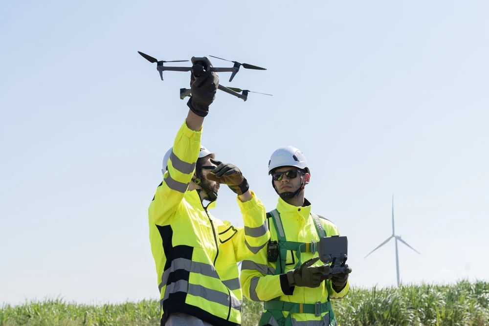
Next-generation drone systems are doing more than replacing tripods and total stations; they’re rewriting the rules of what’s possible in surveying. With high-resolution imaging, real-time data streaming and integrated sensors, drones can cover more ground and deliver high-fidelity datasets.
Drone-based LiDAR (Light Detection and Ranging) technology represents one of the biggest leaps forward for modern surveyors. Using rapid laser pulses, LiDAR sensors capture millions of elevation points, generating dense, accurate 3D terrain models even through vegetation or difficult topography. These models don’t just look impressive; they deliver practical insights that support everyday decision-making, such as:
With photogrammetry, every flight turns into a detailed visual record. Advanced software stitches hundreds of drone images together, giving us accurate, true-to-scale maps and 3D models clients can actually use. This approach isn’t just technical; it’s practical. Each flight captures hundreds of overlapping aerial images, later processed into orthomosaic maps that developers and planners can measure, analyse and present with confidence.
Beyond visible imaging, drones equipped with thermal and multispectral sensors allow surveyors to see what the human eye can’t. These tools measure temperature variations, light reflection and vegetation health, giving deeper insights into environmental or structural conditions.
Artificial intelligence isn’t replacing the surveyor; it’s amplifying their capabilities. By using algorithms to detect patterns and process massive datasets, AI reduces both data-handling time and manual effort.
Machine learning is a branch of AI that “learns” from data patterns. It is transforming how surveyors interpret aerial and spatial information. Instead of manually classifying land types or measuring volumes, AI systems now automate these tasks with exceptional accuracy. They streamline workflows for developers, engineers and environmental managers alike.
As survey data becomes more complex and automated, maintaining reliability is essential. Surveying is about trust and AI ensures that trust is backed by data integrity. This approach helps prevent costly reshoots and guarantees compliance with strict survey accuracy standards.
One of AI’s most promising applications lies in predicting future issues before they happen. By comparing current data with historical baselines, AI can identify subtle shifts or deformations in structures, embankments and utilities. For infrastructure projects, this means safer asset management, longer lifespan and reduced maintenance costs. These are all critical advantages for councils and developers seeking long-term resilience.
Data is only valuable when it’s well-organised and easy to interpret. Geographic Information Systems (GIS) tie together drone imagery, LiDAR scans and AI analytics into one cohesive spatial platform, turning raw data into practical decision-making tools.
In places where urban expansion meets coastal conservation, GIS integration plays a critical role in planning responsibly. By layering drone-captured topography, land-use data and AI-processed analytics, surveyors can visualise potential impacts before construction begins. This data-rich approach helps planners and environmental officers make decisions about zoning and ecological preservation.
Modern projects depend on seamless teamwork. Shared GIS dashboards keep everyone aligned in real time. This level of transparency reduces miscommunication, supports regulatory approvals and ensures every team member is working from the latest version of the truth.
One of the most exciting applications of drone-AI-GIS integration is the creation of digital twins. These replicas continuously update as new drone data is captured, giving asset managers a live view of condition changes and usage trends. Whether it’s tracking a bridge’s expansion joints or monitoring a stormwater system, digital twins provide actionable intelligence that drives efficiency and compliance.
Drone and AI technologies are revolutionising how industries gather, process and act on spatial data. For surveyors, these innovations open doors across agriculture, infrastructure, environmental science and smart-city development.
Gone are the days of flat, static survey plans. Clients now expect dynamic, interactive deliverables that combine visual clarity with data depth.
The tangible benefits of drone and AI integration can be measured in improved safety records, faster project timelines and reduced operational costs, all while enhancing precision and client satisfaction.
Surveyors no longer need to physically access hazardous environments such as cliffs, rooftops or contaminated zones. Drone systems perform the work remotely, while AI meets strict measurement tolerances.
With AI-powered automation, data collection and processing are exponentially faster.
The pace of innovation in surveying is accelerating. The next generation will be powered by systems that not only measure the world but also anticipate how it will change. Predictive analytics, automation and advanced integration are ushering in a smarter era of surveying where data doesn’t just describe reality; it shapes decisions before problems arise.
Predictive analytics uses algorithms to identify trends and forecast future conditions based on historical data. For surveyors, this means turning the vast amount of spatial information we collect into forward-looking intelligence that prevents risks and improves planning outcomes.
Automation is redefining productivity in surveying. From flight planning to data processing, repetitive tasks can now be handled by intelligent systems, freeing surveyors to focus on higher-level analysis and client consultation. Autonomous drones, equipped with pre-programmed flight routes, obstacle avoidance and real-time data streaming, are the next step in this evolution. These systems can execute missions with minimal human intervention while maintaining survey-grade accuracy. Practical examples of automation include:
The future of surveying lies in the integration of all data sources into a unified ecosystem. This convergence allows surveyors, engineers and planners to collaborate using live, interconnected information. These smart data ecosystems will transform how projects are managed and maintained. Developments include the following:
Beyond automation and analytics, AI is rapidly advancing into decision support. Future surveying platforms will analyse data and recommend actions, helping project teams make faster, more informed decisions. Imagine AI dashboards that can:
As sustainability becomes a priority across industries, drone and AI technologies will play a major role in reducing the environmental footprint of surveying. Future workflows will integrate eco-conscious practices by:
The next frontier also calls for a new generation of professionals. As AI and automation take hold, human expertise remains the differentiator. Surveyors must evolve into data analysts, drone operators and technology integrators, understanding how to interpret AI insights and validate automated results. To stay future-ready, survey firms should:
The fusion of drones and AI is redefining what’s possible in modern surveying, turning data into foresight and precision into performance. We use drone LiDAR, AI analytics and GIS integration to make surveying more precise, efficient and dependable. The surveyors who embrace these technologies today will shape tomorrow’s standards. Ready to future-proof your next project? Contact us here at MCS Surveyors to experience intelligent surveying.