Fastest Turnaround Times In The Surveying Industry!


Easements can affect how a property is accessed, developed and used, making professional surveying important when an easement needs to be created, varied or removed. Whether it relates to a shared driveway, drainage infrastructure or essential services, an easement needs to be clearly defined so the rights and restrictions affecting the land are understood.
MCS Surveyors assists with the surveying requirements involved in easement matters, from reviewing existing title information through to preparing accurate plans. For property owners seeking surveyors in Wollongong, early survey advice can help identify potential issues with boundaries, existing easements, services and proposed development.
Knowing when a surveyor is required and what the process involves can make it easier to plan the work and avoid unnecessary delays. Depending on the circumstances, an easement matter may involve survey work, legal documentation, consents and registration with NSW Land Registry Services.
An easement is a legal right that allows a person, authority or other party to use or access part of another property for a specific purpose. Some examples include rights for access, drainage, sewerage, electricity, telecommunications and other services, with the registered easement continuing to affect the land after ownership changes.
An easement may need to change when the property's use, services or development requirements change. Variation or removal may be considered where:
Before an easement is created, varied or removed, the existing title, plan and physical conditions need to be considered. A registered surveyor can assess the relevant boundaries and prepare the survey information needed for the proposed change.
A surveyor is commonly involved when a new easement needs to be accurately defined and registered against a property. The survey work establishes the easement's position in relation to the relevant property boundaries and site features, which is important for subdivisions, developments and new access or service arrangements.
A surveyor may be required where an easement involves:
The surveyor can review existing title and survey information, confirm the relevant boundaries and prepare the plan needed to define the proposed easement. NSW Land Registry Services requires the site of a proposed easement to be sufficiently defined on the plan, with the easement description and width consistent with the associated documentation where applicable.
Early surveying can also identify conflicts with buildings, fences, driveways, services or proposed works before the easement documentation is finalised.
Varying an easement involves changing an existing registered right, which may affect its location, extent or other terms. The requirements depend on the particular easement and proposed change, but an updated survey plan may be needed where the physical area affected by the easement is changing.
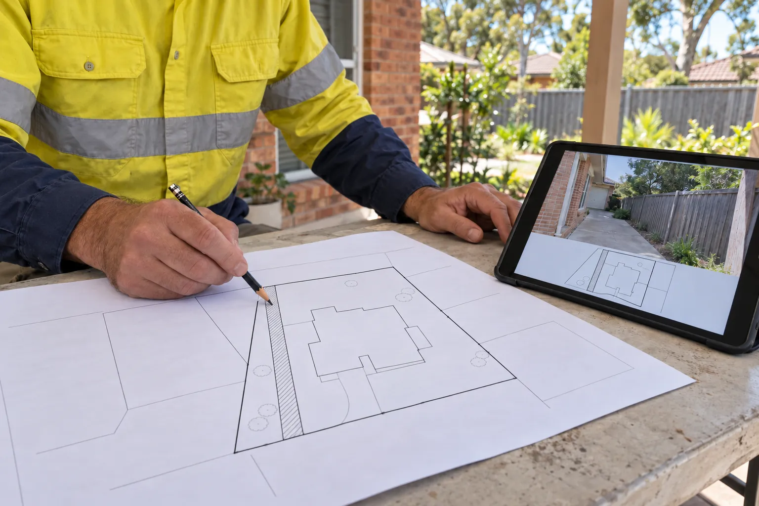
The existing title, deposited plan and registered easement instrument should first be reviewed to establish the current legal position. A surveyor can compare the registered easement with the property boundaries and relevant features on the ground.
Where required, boundary surveys can help confirm the relevant property boundaries and show how the registered easement relates to features on the ground.
Where the physical extent or location of the easement is changing, the relevant area can be surveyed and shown on an updated plan. The plan needs to clearly define the proposed easement and comply with the applicable requirements.
The updated survey information can then be used alongside the relevant legal documentation for the variation.
Depending on the circumstances, affected proprietors, mortgagees, chargees or other parties with relevant interests may need to sign or consent to the documents. NSW LRS guidance notes that plans and associated instruments require execution by the relevant parties in accordance with the applicable requirements.
Once the required plan and legal documentation are prepared, they can be lodged with NSW Land Registry Services for examination and registration.
An easement may be removed when it is no longer required, has become obsolete or no longer serves its original purpose. The appropriate process depends on the type of easement, the registered interests involved and whether the affected parties agree to the proposed release.
Removal may be considered where the easement no longer provides a necessary benefit or unnecessarily affects the use of the burdened property. Common circumstances could be the following:
Where the relevant parties agree, an easement may be released using the appropriate legal and registration process. NSW LRS provides mechanisms for the release of easements, including releases recorded through the relevant dealing or through a deposited plan and associated section 88B documentation in applicable circumstances.
Where agreement cannot be reached, section 89 of the Conveyancing Act 1919 gives the Court power, in specified circumstances, to modify or wholly or partially extinguish an easement. The Court must be satisfied that the relevant statutory grounds have been met.
A surveyor can assist by confirming the existing easement and preparing accurate survey information where a plan is required for the proposed release or change.
Creating, varying or removing an easement requires documents that establish the property's legal boundaries, existing easement rights and proposed changes. The exact requirements depend on the type of easement, the proposed transaction and the parties or authorities involved.
The starting point is usually the property's current title and registered plans, together with the documents that created or describe the existing easement. These records establish the current position and provide the information needed to prepare any proposed change.
The documents may include:
The exact documents vary between matters. For example, section 88B instruments can be used to create or release easements through plan registration, with the plan and instrument needing to define the relevant easement consistently.
The matter may also require consent or documentation from affected property owners, mortgagees, chargees, councils, utility authorities or other interested parties. The parties involved depend on how the easement affects the land and what type of change is proposed.
A registered surveyor can identify the survey information and plans required, while a solicitor or conveyancer can prepare or review the relevant legal documentation. Providing existing records early can help identify missing information before the final documents are prepared.
An easement can affect how a property is used, developed and maintained by giving another party specific rights over part of the land or placing restrictions on activities within the easement area. Because the easement is associated with the land, its effect needs to be considered by current owners as well as anyone planning to purchase or develop the property.
The type and location of an easement can influence where buildings, driveways, fences, landscaping and other improvements can be placed. A drainage or sewer easement, for example, may need to remain accessible for maintenance, while a right of carriageway may need to remain available for access.
Before development begins, the registered easement should be compared with the existing site and proposed plans. A surveyor can identify potential conflicts between the easement, property boundaries and proposed works.
The rights and responsibilities created by an easement depend on its registered terms. An access easement may provide a right to cross the land, while a services easement may relate to the installation, use or maintenance of infrastructure.
These rights can continue to affect the property after a sale. Reviewing the title, easement documents and physical location of the easement before purchasing or developing land can therefore help identify potential restrictions early.
Preparing an easement plan involves defining the relevant area accurately and ensuring the plan and supporting documents meet the requirements for registration. The survey work forms the technical basis for showing the easement in relation to the affected land.
The process will involve:
NSW LRS requires plans and associated documents to comply with the applicable Lodgement Rules, with the plan needing to sufficiently define the site of a proposed easement or relevant variation or release.
There is no single timeframe for every easement matter. The time required depends on the complexity of the property, the survey work involved, the type of change, the documents required and how quickly the relevant parties provide information or consents.
The level of work can vary between creating, varying and removing an easement.
Several issues can extend the time needed to complete an easement matter, including:
Early review of the title, existing easement and proposed works can identify potential issues before they affect the wider project.
The cost of an easement matter depends on the amount of survey work required, the complexity of the property and the documentation and approvals involved. A straightforward easement with clear existing records may require less work than a matter involving unclear boundaries, multiple parties or changes to existing infrastructure.
The overall expense may also include legal, registration and authority-related costs in addition to the surveyor's fees.
The physical characteristics of the property can affect the survey work required. Larger or irregular properties, difficult site conditions, unclear boundaries, existing structures and services may require additional investigation.
The quality of existing survey information and title records can also affect the scope. Older plans or differences between registered information and site conditions may require further investigation before the easement can be accurately defined.
The number of affected owners and other interested parties can influence the amount of coordination required. Matters involving mortgagees, councils, utility authorities or multiple properties may require additional documentation and communication.
Costs may also increase if the proposed easement changes during the process or additional survey work is needed to address access, drainage, development or service requirements.
Surveying is only one part of the overall process. Depending on the matter, legal advice, preparation or review of documents, registration fees and authority requirements may also contribute to the final cost.
A solicitor or conveyancer may be involved where legal agreements, releases or other dealings need to be prepared or reviewed.
An early discussion with a registered surveyor can help establish the likely scope of the surveying work and identify factors that may affect the overall cost.
A registered surveyor provides the technical surveying work needed to define an easement and prepare plans for its creation, variation or removal. This can include reviewing existing survey information, checking boundaries, surveying the relevant area and preparing plans for the proposed change.
Property owners can check surveyor registration through the NSW Government’s online register before engaging a registered land surveyor.

The surveyor can review the title, deposited plan and existing easement documents to establish the registered position of the land. A site survey can then show how the easement relates to property boundaries, buildings, fences, driveways, services and other physical features.
Understanding the different survey types can help property owners discuss the boundary and site information needed for their easement matter. This comparison is useful where an existing easement does not appear to match current site conditions or proposed development.
Where survey work is required, the surveyor prepares a plan that clearly defines the proposed easement or change. Depending on the circumstances, this may involve creating a new easement, changing an existing easement or defining an area affected by a proposed release.
NSW LRS guidance requires the site of relevant proposed easements, variations or partial releases to be sufficiently defined on the plan, with the required relationship to affected parcel boundaries shown where necessary.
Easement matters can involve property owners, solicitors, conveyancers, councils, utility authorities and other parties. The surveyor provides the technical information needed for the surveying and plan components of the process, while other professionals can address the legal and transactional requirements.
Involving a surveyor early can help coordinate easement requirements with subdivision, construction, drainage or access plans and reduce the risk of avoidable revisions.
Creating, varying or removing an easement in NSW involves more than completing paperwork. Accurate boundary information, clearly defined easement areas and appropriate documentation are important for recording property rights and supporting future land use. The requirements can vary depending on the type of easement, the proposed change and the interests affecting the property.
MCS Surveyors can assist with the surveying requirements for easement matters, from reviewing existing plans and site conditions to preparing the necessary survey documentation. Early surveying can identify potential issues with boundaries, existing easements and proposed development, helping property owners plan the process more effectively and work towards accurate registration.