Fastest Turnaround Times In The Surveying Industry!


Modern construction projects depend on precision, from the first contour map to the final compliance submission. Drone technology has transformed how we capture and model spatial data. Yet one question remains: how well do drone surveys stack up against traditional methods? At MCS Surveyors, we know how drone surveying has evolved from a niche experiment into a core component of professional measurement and mapping. When applied correctly and cross-checked with ground data, they can achieve levels that often match conventional surveying.
Let’s explore how drone surveys work, what affects their integrity and when they’re most effective for building projects. Let’s get started!
To appreciate how accurate drone surveys truly are, it’s essential to understand how they collect and convert raw flight data into measurable site information. Drone surveying isn’t just about flying a UAV over a property; it’s a structured process that merges aerodynamics, optics and geospatial science. Each flight is carefully planned to meet surveying standards, align with regulatory frameworks and integrate seamlessly with ground-based benchmarks.
Before any analysis or modelling begins, the success of a drone survey depends on how the data is captured. This stage is the foundation because every pixel, laser pulse and flight path contributes to the final model’s reliability. Two principal technologies dominate this stage: photogrammetry and LiDAR (light detection and ranging). When combined, these systems deliver exceptional topographical and structural insight, producing a true-to-scale, high-resolution dataset ready for engineering, design and construction validation.
No matter how sophisticated the drone or sensor may be, reliability ultimately comes down to establishing fixed reference points on the ground. Without GCP, even small positional deviations in drone imagery could result in misalignments that affect boundary consistency, volume calculations or compliance reports. They are particularly vital for large or uneven sites, where subtle elevation changes can distort results if left uncorrected. By incorporating GCPs, surveyors in Shellharbour eliminate uncertainty and deliver data you can rely on for everything from initial design to final certification.
After each flight, the precision work happens behind the scenes. Raw imagery and sensor readings are processed, calibrated and verified before use in engineering or compliance. These actions convert thousands of data points into survey-ready outputs that meet professional standards. It’s how we turn drone imagery into precise, verifiable datasets that support engineering decisions, reduce rework and ensure traceable compliance for every project.
Drone data must meet measurable standards to be considered reliable. Surveyors evaluate reliability through positional and relative comparisons.
It is what defines credibility in surveying. Whether data comes from a drone, total station or GNSS, every point must align with real-world conditions. In modern construction, even a few centimetres of deviation can lead to costly redesigns, boundary disputes or compliance issues. That’s why professional surveyors treat reliability not as an afterthought, but as a core discipline embedded in every stage of the workflow.
When evaluating the positional integrity of any drone survey, it’s important to distinguish between absolute and relative consistency, two terms that define how reliable your spatial data truly is. Both determine whether the dataset is suitable for design work, engineering analysis or compliance reporting.
Absolute refers to how closely a surveyed point corresponds with its true position on the earth’s surface, based on recognised coordinate systems such as GDA2020 or MGA2020. This type is essential for aligning project data with boundary lines, site grids and legal property frameworks.
Relative, meanwhile, measures the internal consistency within a dataset, like how accurately one point relates to another within the same model. This is important in earthworks, progress monitoring and volume measurement, where consistent relationships between features matter more than their global location.
Every dataset carries two critical reliability components, horizontal and vertical, each influencing how data is used across design, modelling and compliance stages. Knowing the acceptable tolerance for both dimensions is essential to keep data reliable and projects safe.
Horizontal defines how close the mapped x–y coordinates are to their true ground positions. For drone surveys supported by GCPs or RTK (Real-Time Kinematic) systems, this can typically reach 1 to 3 centimetres, comparable to ground-based methods.
Vertical, on the other hand, measures how accurately elevation reflects the actual surface. Vertical readings are more sensitive to environmental variables such as light conditions, ground reflectivity and vegetation cover, which can slightly increase deviation, often around 3 to 5 centimetres under professional conditions.
Data only holds value when it’s proven reliable. Professional surveyors use structured checks to confirm that drone results stand up to measurement and compliance scrutiny. Without this, even advanced drone systems can produce errors that go unnoticed until they affect downstream decisions. By applying proper steps, we transform aerial imagery into certified survey data that stands up to engineering scrutiny, compliance reviews and long-term project audits.
As drone technology continues to evolve, one of the most common questions is how aerial surveying stacks up against traditional ground methods. Both approaches serve the same goal, but they differ in process, efficiency and application. Knowing the strengths of each method helps teams balance speed and safety. We’ll explore the key distinctions between drone and ground surveys, their relative advantages and why modern projects increasingly rely on a hybrid approach to achieve reliable, submission-ready results.
Time directly affects cost and coordination. Drone surveys excel in this area by offering rapid data collection across vast or complex sites that would otherwise take days to map manually. A single drone flight can capture thousands of georeferenced images in a fraction of the time it takes for a traditional crew to traverse uneven terrain or hazardous zones. That said, traditional surveys still help in fine-detail measurements and boundary control. While drones deliver exceptional aerial coverage, total stations and GNSS equipment remain vital for precise setting out. The combination of broad aerial mapping and detailed ground control gives project teams a complete, multi-layered perspective of the site.
Traditional methods often require access to steep embankments, unstable structures, busy road corridors or confined spaces, all of which pose potential hazards. Drones remove that danger by capturing critical imagery and measurements remotely. By enhancing safety and extending reach, drone surveys ensure that critical information is collected efficiently, without compromising occupational health standards or project timelines.
Cost savings are one of the most appealing advantages of drone-based surveying. However, the real value lies in the volume and richness of data that drones can capture per flight. High-resolution sensors and automated flight paths generate millions of data points, producing ultra-detailed digital terrain models, elevation grids and orthomosaic maps. This level of density would require extensive manual effort with traditional instruments.
While drone surveys can achieve exceptional consistency, consistent results come from controlling key variables, from weather to workflow. Each flight involves a complex interaction between environmental conditions, flight parameters, hardware performance and operator expertise. Even small deviations in any of these areas can introduce measurable errors into the final dataset. Learn the factors that impact reliability in drone surveys and how professionals can mitigate these variables.
Environmental conditions are among the most influential factors in drone surveys. Unlike static ground instruments, drones operate in dynamic environments where wind, light and temperature can all affect sensor stability and image quality. A small gust of wind can shift the drone’s position mid-capture, introducing subtle distortions that accumulate across large datasets.
Lighting also plays a key role in data consistency. Harsh midday sun can create glare or deep shadows that make it harder for photogrammetry software to identify common points between images. Overcast days, by contrast, often produce softer light and more uniform colour balance, which is ideal for surface mapping and texture extraction. By planning flights around weather patterns and optimal lighting windows, we ensure that every dataset reflects true surface conditions with minimal distortion.
The way a drone is flown has a direct impact on the resolution of its data. Altitude, speed, flight path overlap and camera angle all influence how much detail is captured and how well images align during processing. Flying too high reduces resolution, while flying too low may limit coverage and increase processing demands. Striking the right balance between these variables is key.
Remember, drone speed also affects clarity. Slower, consistent flight speeds prevent motion blur and ensure sharper images. By controlling these parameters through automated flight software, we achieve consistent, replicable coverage that aligns perfectly with ground control points and project specifications. Each flight path is tested, verified and logged to maintain complete traceability from planning to final output.
Even the most sophisticated drone is only as accurate as its sensors and calibration. The relationship between the drone’s GPS module, camera, IMU (inertial measurement unit) and stabilisation system must remain finely tuned to maintain consistent data capture. Over time, minor sensor drift or vibration can introduce positional errors that reduce positional integrity.
We perform pre-flight and post-flight diagnostics, checking for anomalies in GPS signal strength, compass calibration and image geotagging integrity. These checks guarantee that each dataset originates from fully verified hardware, reducing the risk of drift and ensuring results that align seamlessly with ground control data.
Technology alone isn’t enough; it’s the expertise behind the controls that ensures dependable results. Even the best hardware can produce unreliable data if flight planning, ground control placement or software processing are mishandled. Surveying is both a science and an art, requiring professionals who understand how to operate the drone and how to interpret and validate the results.
Software selection also plays a vital role. Choosing the right tool and setting it up correctly determines whether outputs meet the strict thresholds required for engineering-grade surveys. By combining advanced technology with skilled interpretation, we bridge the gap between automation and professional accountability, which guarantees every dataset produced is precise, verified and ready for decision-making.
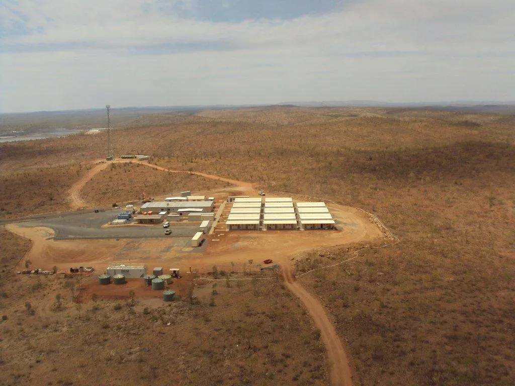
Not every project demands drone surveying. But for the right applications, it can deliver remarkable value in speed, safety and spatial insight. Drones have become indispensable for modern construction projects that require comprehensive site visualisation, progress tracking and real-time spatial intelligence. Their ability to generate high-resolution 2D maps, 3D models and volumetric analyses allows project teams to make decisions faster and with greater confidence.
The suitability of a drone survey depends on factors such as site size, accessibility, safety risks and project stage. While smaller or interior-focused projects may still rely on traditional surveying tools, larger developments benefit greatly from aerial mapping.
Earthworks and bulk excavation projects are among the most data-hungry phases of construction. Managing cut-and-fill operations, stockpile volumes and site levelling requires consistent surface data. Drone surveys excel in this environment by capturing broad terrain coverage quickly and producing detailed topographic models that help track material movement and surface changes over time.
Drone data supports progress monitoring by providing accurate, time-stamped records of earthworks over multiple stages. This assists in verifying subcontractor quantities and streamlines reporting for project managers, environmental consultants and local authorities. The efficiency and reliability of drone-based earthwork analysis make it an invaluable tool for early development and civil infrastructure phases.
Traditional roof or façade inspections often require scaffolding, elevated work platforms or rope access, all of which are time-consuming, costly and potentially unsafe. Drones provide a safer and faster alternative by enabling high-resolution visual inspections without the need for physical access. For builders and asset managers, this aerial insight offers enormous advantages:
Drone technology has redefined how progress is tracked and verified on building sites. Instead of relying solely on manual site walks or ground photos, drones provide high-resolution aerial imagery that captures the entire project area from multiple perspectives. This approach benefits multiple stakeholders:
When a project nears completion, consistency becomes critical for certification and final handover. Drone surveys play an important role in verifying whether the built structures match the approved design plans and site boundaries. The resulting models and orthophotos provide visual and quantitative evidence of compliance, which are essential for regulatory submissions, defect inspections and client assurance. Some advantages of post-completion drone verification include:
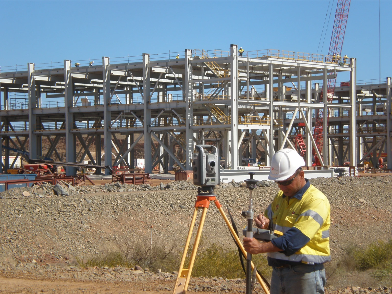
While drone technology has revolutionised the way spatial data is collected, the highest level of reliability still comes from integrating aerial and ground-based methods. Both methods have their strengths. Drones capture wide areas and context, while ground instruments provide the pinpoint detail needed for control points and fine measurements. The most dependable outcomes are achieved when both systems work together in a coordinated, data-verified process.
The foundation of a survey lies in the integration of multiple data collection methods. Drones equipped with LiDAR sensors capture millions of surface points across large or complex terrains, but to achieve engineering-grade consistency, this aerial data must be aligned with control points collected using total stations or GNSS equipment.
By combining LiDAR and total station data, we produce a unified, verified surface model that delivers the broad coverage of aerial mapping with the fine detail of ground control. This integration is vital for applications such as structural foundations, slope stability assessments and volume verification, where even small discrepancies can affect construction quality and compliance.
The rise of BIM and digital twin technologies has transformed how survey data is used in design and construction. Drone imagery and point clouds can now be integrated directly into these digital ecosystems, creating living 3D representations of both the site and its built environment. This integration allows teams to:
Data only has value when it’s traceable. Every dataset goes through strict quality and compliance checks before we share it with clients. Integrating drone and ground data allows us to cross-check measurements, identify discrepancies and document error margins transparently. Our QA framework involves:
Transparency transforms data into trust; that’s why every project deliverable includes comprehensive visual and analytical reports, providing a technical summary and an easy-to-understand overview. Our drone and ground data reports typically include:
Drone surveying has transformed how we view, measure and manage building sites. While ground-based methods remain indispensable for pinpoint detail, drones offer a scalable, safe and highly accurate way to gather spatial data quickly. Here at MCS Surveyors, our experience shows that the key to reliability lies not in choosing one method over another, but in integrating for maximum project confidence.