Fastest Turnaround Times In The Surveying Industry!


Natural features such as rivers, creeks, shorelines, cliffs and ridgelines often appear to form clear property boundaries, but in New South Wales, the legal position is not always straightforward. MCS Surveyors provides the experienced surveyors Sydney property owners, developers and legal professionals rely on when natural features create uncertainty about the legal extent of land.
Boundaries defined by watercourses, foreshores or other natural features may change over time because of erosion, accretion, flooding, coastal processes or human intervention. Where a title refers to the “bank” of a watercourse, the “centreline” of a creek or the “Mean High Water Mark” of tidal land, determining the legal boundary requires more than identifying the visible edge of the feature on the day of inspection. Historical plans, title records, survey evidence, legislation and common law principles may all need to be considered.
Understanding how natural boundaries affect survey plans in NSW is essential before proceeding with development, subdivision or a property transaction. The position of a natural boundary can influence building setbacks, water access, easement locations, fencing, site area and the amount of land available for development. This article explains how natural boundaries are interpreted, when some boundaries may move and how uncertainty can be investigated and resolved.
A natural property boundary follows a physical feature of the landscape rather than being defined solely by a straight line between fixed survey points. Depending on the wording of the title and the history of the parcel, the boundary may follow a riverbank, creek, shoreline, cliff, ridgeline or another identifiable natural feature.
Not every natural feature shown on a plan is automatically a legally moving boundary. Some features act as monuments or historical references that help identify the original survey position. Others, particularly certain water boundaries, may be ambulatory, meaning that the legal boundary may move with gradual natural changes to the feature.
The NSW Registrar-General’s Guidelines provide specific requirements for the survey definition of natural boundaries, including boundaries formed by stream banks, Mean High Water Mark, cliffs and other natural features.
The title description, original Crown grant, registered plan and available survey evidence must therefore be examined before the legal effect of a natural feature can be determined.
Natural boundaries encountered in NSW may include:
For tidal land, the relevant boundary may be described by reference to Mean High Water Mark. For non-tidal waterways, the title may refer to the bank, bed or centreline of the watercourse. A ridgeline or cliff may be used to identify a crest, break in slope or another physical feature that was apparent when the original survey was completed.
The precise legal position depends on the wording and history of the individual title. It should not be assumed that ownership extends to the visible edge, centre or opposite bank of a watercourse without investigating the underlying cadastral evidence.
Whether a feature controls the legal boundary depends heavily on how it is described in the title and registered plan.
Descriptions such as the following may indicate that the feature itself was intended to define the boundary:
In contrast, a boundary shown by fixed bearings and distances may remain in its surveyed position even where a nearby creek, shoreline or bank later moves.
Original Crown plans, deeds, deposited plans, survey field notes and adjoining title records can be critical when determining the original intention. Historical evidence is particularly important where an old plan contains limited dimensions or uses terminology that is no longer common.
Survey work and plan preparation must also comply with the Surveying and Spatial Information Regulation 2024, applicable Surveyor-General’s Directions and NSW Registrar-General’s Guidelines.
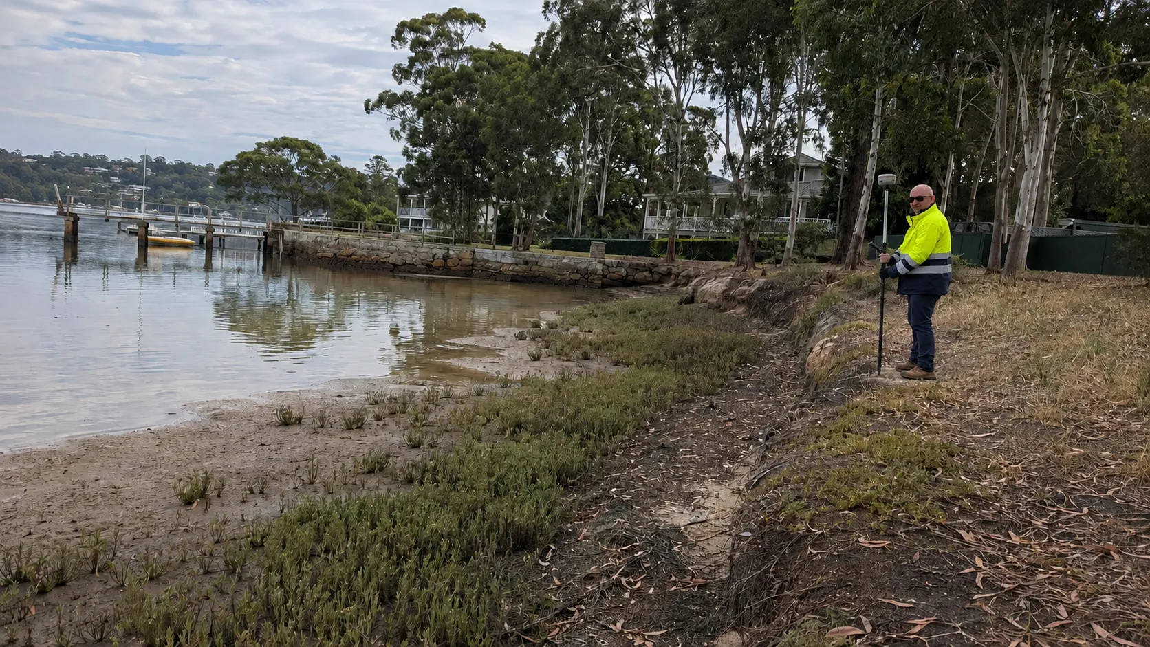
Tidal and non-tidal water boundaries are treated differently in NSW surveying practice. Correctly identifying the nature of the watercourse determines which evidence is relevant, how the boundary is interpreted and what information must be shown on the survey plan.
The distinction can affect private ownership, Crown land interests, waterfront structures, development setbacks and public access rights.
Along the NSW coast and beside tidal rivers and estuaries, a property boundary may be defined by Mean High Water Mark unless the title or plan provides another definition.
Mean High Water Mark is a legally recognised tidal boundary. It is not simply the highest wet line, storm mark or water level visible on the day of inspection. Its cadastral definition may require consideration of:
Physical indicators such as changes in vegetation, foreshore profile and erosion may assist the investigation, but they must be interpreted together with the legal and survey evidence.
Where private land adjoins Crown land, a waterway reserve or another public interest, the precise position of the tidal boundary can determine whether a retaining wall, jetty, pontoon, boat ramp or other improvement is within the private title. Separate authority, consent or licensing requirements may also apply to works below or beyond the title boundary.
It may also be necessary to distinguish between the present physical shoreline, the current survey definition of Mean High Water Mark and an older deed or title boundary shown on a registered plan.
For non-tidal rivers, creeks and streams, a title may refer to the bank, bed or centreline of the watercourse. The original Crown grant, title wording and survey evidence are critical when determining which feature controls the boundary.
A reference to the “bank” does not always identify a simple or clearly visible line. The surveyor may need to assess:
The centreline of a non-tidal stream should not be assumed to be the legal boundary merely because land adjoins the watercourse. Ownership of the bed may depend on the original grant, Crown reservations, title history and the possible application of common law principles.
Where the channel is braided, poorly defined, affected by flooding or substantially modified, historical plans and imagery may be needed to determine how the modern feature relates to the original title.
Some water boundaries may move over time where the title is legally tied to an ambulatory natural feature. The legal effect of that movement depends on how the change occurred, whether it was natural or artificial and how the original parcel was defined.
The principal concepts are erosion, accretion and avulsion.
Erosion occurs where water gradually removes soil or sediment from a riverbank, creek bank or shoreline. Accretion occurs where soil or sediment is deposited gradually, causing the land to build outward.
The Registrar-General’s NSW guidance on accretion and erosion explains how these principles may apply to tidal and non-tidal water boundaries, including rivers, streams, seas and inlets.
Where a title boundary is legally ambulatory, gradual and imperceptible erosion or accretion may cause the boundary to move with the natural feature. This can potentially result in a parcel gaining or losing land over time.
However, that result is not automatic in every waterfront situation. The surveyor must consider:
A visible increase or reduction in dry land does not, by itself, establish that the legal title area has changed.
Avulsion is a sudden and identifiable change to a watercourse or shoreline. Examples may include:
Unlike gradual erosion or accretion, sudden change does not generally move the legal boundary automatically. The former legal line may remain in place even though the watercourse or shoreline has shifted.
This can create situations where titled land is left beneath water or a newly formed area of dry land falls outside the existing title.
Human activity can significantly alter natural features. Examples include:
Artificially created land does not automatically become part of an adjoining private title. Similarly, moving or containing a watercourse through engineering works does not necessarily change the legal boundary.
Consent from Crown Lands, NSW Land Registry Services, a council or another authority may be required before an altered boundary can be formally recognised or recorded.
Investigating a natural boundary requires a combination of cadastral research, legal interpretation, field assessment and measurement. The objective is not simply to map the current physical feature. It is to determine how the feature relates to the legal boundary created by the title.
The investigation usually begins with a review of:
The surveyor uses this information to determine whether the boundary was intended to follow a natural feature or remain fixed by surveyed dimensions.
Where an old description is unclear, evidence from neighbouring parcels may help explain how the area was originally surveyed and how similar boundary descriptions were treated.
After establishing the likely legal intention, the surveyor inspects the site to identify the relevant natural feature and any surviving cadastral evidence.
The field investigation may include:
A fence, wall or apparent waterline is treated as evidence only. It is not assumed to be the legal boundary without support from the title and survey records.
Once the relevant feature has been interpreted, the surveyor measures it and relates it to the cadastral framework using appropriate survey equipment and control.
The boundary may be:
Additional spatial information, including historical imagery, terrain modelling or aerial survey data, may assist in complex coastal, riverine or steep sites. These tools support the investigation but do not replace cadastral evidence or professional boundary interpretation.
Where erosion, accretion, avulsion or artificial works are relevant, the survey plan should clearly explain how the adopted boundary was determined.
Uncertainty about a natural boundary can affect the actual use, value and development potential of a property. The visible area occupied by an owner may not correspond exactly with the legal title.
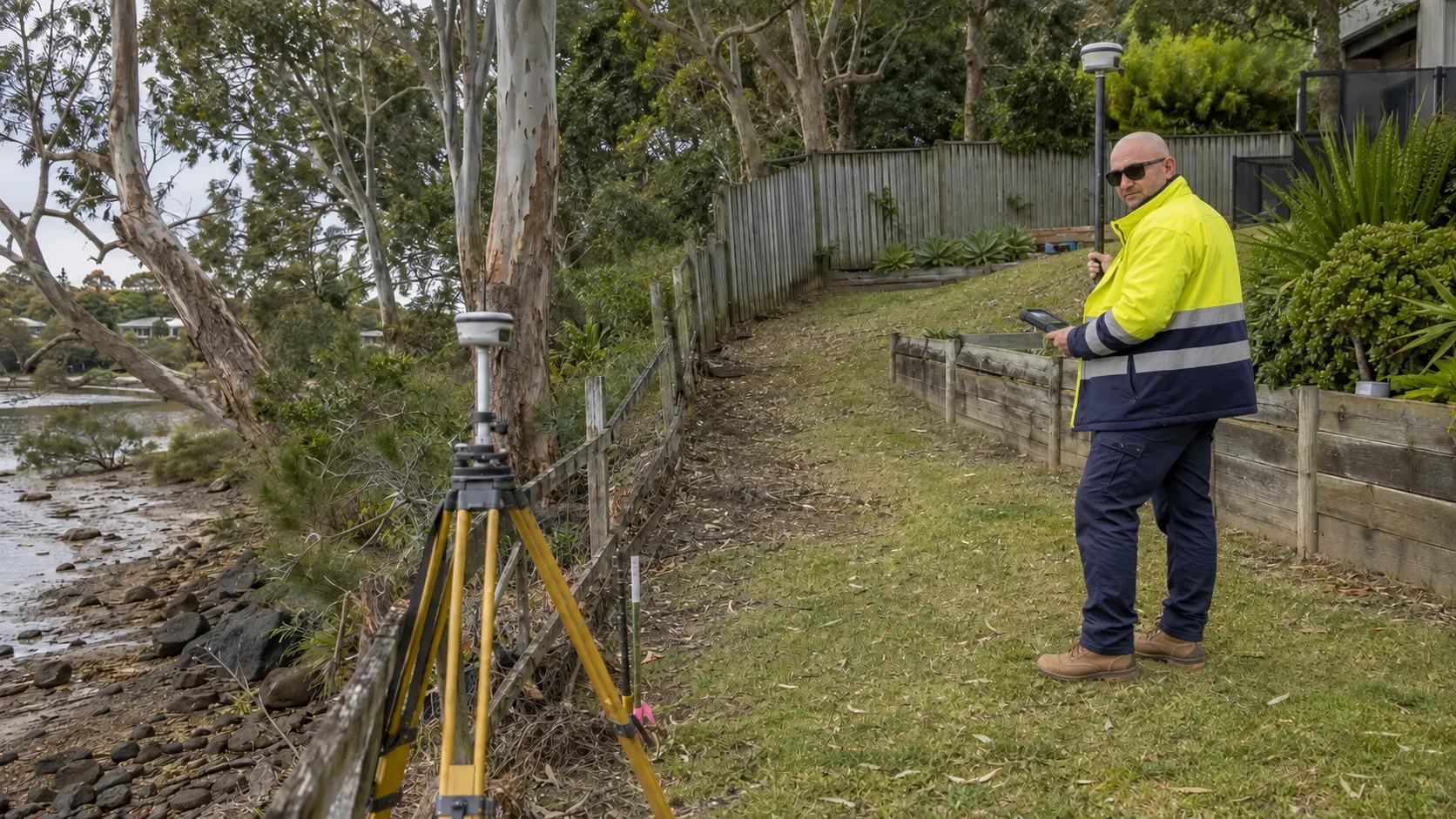
Where gradual natural movement legally alters an ambulatory boundary, the titled area may increase or decrease. In other situations, the physical landscape may change while the legal boundary remains in its earlier position.
This can create differences among:
Older title areas should therefore not always be treated as exact where the parcel is bounded by a moving natural feature.
Fences often follow creek banks, dune lines or other visible features. If the feature moves, the fence may no longer correspond with the legal boundary.
Natural boundary uncertainty can also affect:
An improvement may be partly outside the title, within Crown land or across a public reserve. This can create encroachment, licensing, planning or rebuilding issues.
Natural movement can alter the relationship between a boundary and an existing easement, accessway or service corridor.
For example, erosion may narrow the usable area between a creek and an access easement. A shifting shoreline may also affect practical access to waterfront structures even where the legal easement remains unchanged.
Updated survey information may be needed before creating, varying or relying on rights of access near a natural boundary.
Natural boundaries can significantly affect the design and approval of development in NSW. Planning controls may apply independently of the cadastral boundary, meaning that
confirming ownership is only one part of the assessment.
Councils and other consent authorities may also require natural features and hazard constraints to be accurately shown on development plans.
Land beside rivers, creeks, tidal waters, foreshores, cliffs or escarpments may be affected by:
These controls can reduce the usable building envelope even where the proposed structure remains within the legal title.
An accurate survey should show the relationship between the proposed works, the legal boundary, the current physical feature and any relevant setback or buffer.
Natural boundaries can influence lot size, frontage, access and the number of lots that can be created.
Subdivision design may be affected by:
An old plan may not provide sufficient information for current subdivision design. A new survey may be required to confirm the cadastral position and the present natural conditions.
Development near natural boundaries may require additional technical investigations, including:
These reports may lead to conditions relating to building exclusion zones, revegetation, stormwater management, excavation, filling or protection of the watercourse.
Reliable survey information provides the base data consultants and authorities need when assessing these issues.
Uncertainty should be resolved before relying on the visible position of a creek, shoreline, bank, cliff or other natural feature. A fence, retaining wall, vegetation line or waterline should not be assumed to represent the legal extent of the property.
The first step is generally to arrange a professional boundary survey with a registered land surveyor who can investigate the title, available cadastral evidence and present site conditions.
Before the current boundary can be assessed, the surveyor must determine how the parcel was originally defined.
A description such as “bank of the creek”, “Mean High Water Mark” or “top of cliff” may indicate that the feature controls the boundary. A fixed bearing and distance may instead indicate that the line remains in its surveyed position.
The surveyor may compare:
This helps determine whether the natural feature was intended to define the title or merely provide a general geographic reference.
Where the feature has moved, the cause, speed and nature of that movement must be assessed.
Relevant evidence may include:
This information helps distinguish gradual natural movement from sudden or artificial change.
The type of survey required will depend on the purpose of the investigation and the complexity of the boundary.
An identification survey may be suitable for preliminary due diligence, building design or checking the relationship between existing improvements and the title.
More complex circumstances may require:
Preparing a plan does not automatically resolve every natural-boundary issue. The surveyor must identify any consent, registration or legal process required before the adopted position can be formally recognised.
Natural boundary matters may involve more than the adjoining property owner. The land beyond a private title may be:
The surveyor may need to consult NSW Land Registry Services, Crown Lands, the relevant council or another authority.
Legal advice may also be required where:
Until the position has been properly investigated, owners should avoid moving fences, excavating land or constructing improvements close to the disputed area.
Natural-boundary uncertainty should be addressed before:
Resolving the issue early can reveal whether an existing improvement is outside the title, whether the usable land area has changed or whether approval from a government authority is required.
Natural boundaries can add significant complexity to property ownership, development and land transactions because the legal line does not always correspond with what is visible on site. Rivers, creeks and shorelines may change through erosion, accretion, avulsion or artificial works, while cliffs, ridgelines and other natural monuments may require careful interpretation against historical survey evidence.
Accurate analysis of the title, original plans, cadastral records and current site conditions is essential for protecting property rights, avoiding disputes and supporting informed development decisions.
Whether a project involves purchasing waterfront land, preparing a subdivision, investigating an encroachment or planning work near a natural feature, an accurate cadastral survey is an important first step. MCS Surveyors assists property owners, developers and legal professionals across New South Wales by investigating and defining natural boundaries using reliable historical, cadastral and on-ground evidence.
By combining detailed research, modern surveying methods and a thorough understanding of NSW surveying requirements, MCS Surveyors provides dependable information for compliant development, secure property transactions and greater confidence in property boundaries.
The treatment of a natural boundary depends on the wording and history of the individual title, the available survey evidence and the circumstances of any physical change. This article provides general information only and is not a substitute for cadastral surveying or legal advice.