Fastest Turnaround Times In The Surveying Industry!


A subdivision can be one of the most effective ways to unlock additional value from land, but it is also one of the most tightly regulated development processes in Australia. Before a council will approve a proposed subdivision, it requires precise and compliant survey information that clearly defines boundaries, site conditions and the proposed lot layout. For property owners and developers working with surveyors in Sydney, understanding exactly what councils expect can make the difference between a smooth approval process and costly delays.
At MCS Surveyors, our role is to translate planning controls and technical standards into clear, accurate survey documentation that satisfies council requirements. This article explains what a subdivision survey must demonstrate for council consideration and why each element matters. It outlines the core components councils expect to see, including boundary definition, existing features, easements, service access and lot configuration. It also clarifies how survey data links directly to planning controls, engineering design and eventual title registration. By understanding what councils assess, property owners and developers can plan with greater certainty and work more effectively with their surveyor from the outset.
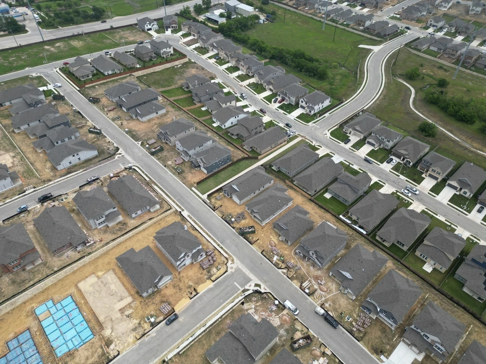
Local councils rely on subdivision surveys because they provide the precise technical information needed to decide if a proposed subdivision can be legally and safely approved. A compliant survey turns a concept plan into measurable boundaries, areas and constraints that council planners, engineers and legal teams can assess with confidence.
Without an accurate survey prepared by a licensed land surveyor, the council cannot be sure that new lots will comply with planning controls, protect neighbours’ rights or connect correctly to services and roads. The subdivision survey becomes the factual base for the planning permit, the subdivision certificate and ultimately the new titles.
Councils use subdivision surveys to check that each new lot meets the local planning scheme, development control plan and subdivision code. The survey must clearly show lot areas, dimensions, orientation and shape so the council can confirm compliance with minimum lot sizes, frontage requirements and site coverage rules.
Setbacks to boundaries, easements and existing buildings are plotted so the council can assess whether any future dwelling or extension can realistically achieve required setbacks, private open space and parking. Where overlays apply, such as flooding, bushfire or heritage, the survey helps the council check that the layout responds to those constraints and that any required building envelopes or restriction-on-use areas are accurately located.
A key reason councils insist on detailed subdivision surveys is to protect adjoining owners and public land. The survey identifies the true location of boundaries compared with existing fences or structures so councils can detect encroachments and prevent boundary disputes from being built into the new plan.
Easements for drainage, sewer, access or electrical infrastructure must be fully surveyed and shown so the council can ensure they remain accessible and functional after subdivision. If road widening, public reserves or pedestrian links are required, these are defined on the survey so council can secure appropriate land dedication and protect public access.
The survey also allows the council to assess overshadowing potential, privacy impacts and building separation by understanding how new lots will sit relative to neighbouring dwellings and private open space.
Councils rely on the subdivision survey to confirm that every new lot can be practically serviced and accessed. Survey information on levels, contours and existing infrastructure allows council engineers to check:
Accurate height and contour data help the council determine if significant cut or fill is needed, whether retaining walls will be required and if proposed drainage grades can work without creating nuisance flooding. By reviewing a precise survey plan, councils can ensure that the subdivision is not just compliant on paper but can be built and serviced in the real world without creating future problems for owners or council assets.
Council officers rely on the subdivision survey plan to understand exactly what exists on the land and how the proposed lots will function. To secure timely approval, the survey must clearly document all key site information in a way that matches council and planning scheme requirements. Any missing or unclear data can trigger requests for further information, which delay the process.
Surveyors focuses on presenting this information in a format that is accurate, consistent and easy for the council to assess. The following elements are typically essential for subdivision applications across Australia and are expected to be shown on or with the survey plan.
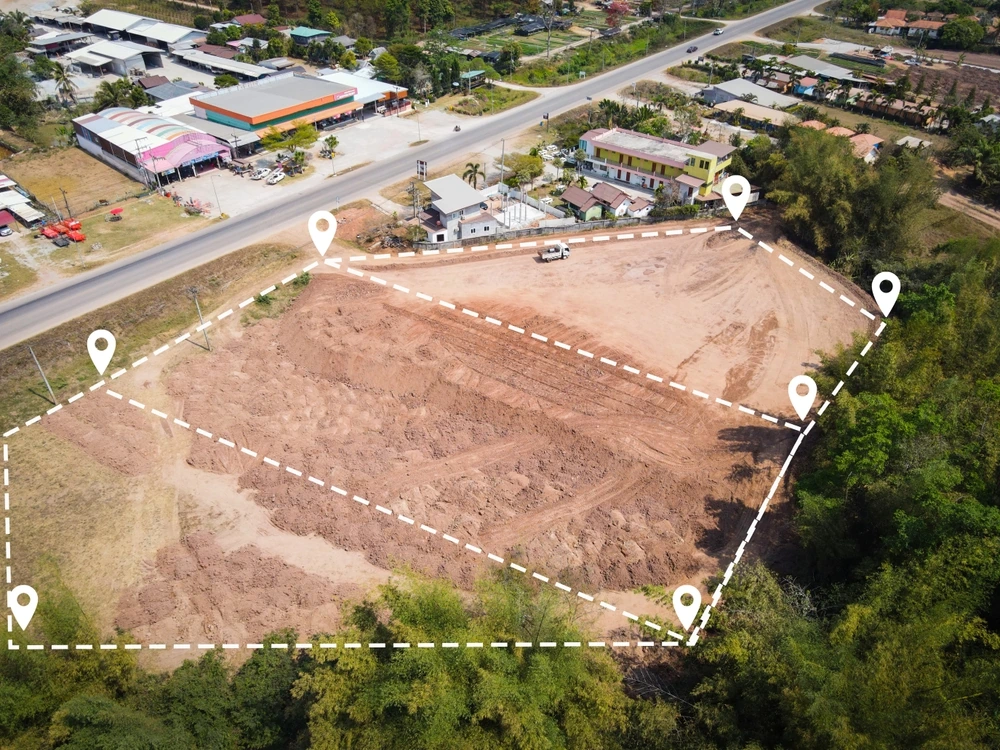
The starting point is an accurate definition of the existing land parcel. The survey must show:
For the proposed subdivision, the plan needs to clearly show new internal boundaries, lot numbers and lot areas together with any proposed road reserves or access handles. Councils look for clarity about how each lot is shaped, how it can be accessed from a public road and whether it can practically accommodate a future dwelling that complies with setbacks and private open space controls.
Councils expect a subdivision survey to document all relevant features that may affect future development or servicing of the new lots. Typically this includes existing buildings, sheds, garages, driveways, retaining walls and fences with their offsets from boundaries to confirm compliance with setback rules.
Essential services are also critical. The survey should identify sewer and stormwater mains, manholes, water metres, power poles, pits and overhead lines where they cross or adjoin the site. This allows council and service authorities to confirm that each lot can be separately serviced and that no structures encroach on assets. Existing and proposed easements for services or access must be precisely located and labelled with their purpose and width.
Subdivision approval often depends on how each lot will drain and whether it is suitable for building. For this reason many councils require detailed level information on the survey. Surveyors typically show spot levels, contours relative to a known datum and the location of existing drainage paths or low points. This helps demonstrate where stormwater can be directed and whether any lot may require fill, retaining or on-site detention.
Site constraints must also be identified. Common examples include significant trees, waterways, flood-prone areas, overland flow paths, heritage overlays and bushfire or landslip risk zones. These need to be clearly located in relation to proposed new boundaries so the council can see whether building envelopes will avoid constrained areas and whether additional reports or management measures will be required as conditions of subdivision approval.
A compliant subdivision survey must do more than show new lot boundaries. Councils expect the plan to clearly identify all planning controls and legal constraints that affect how the land can be divided and used. If these are missing or incomplete, council assessment will be delayed and additional survey work may be required.
Surveyors ensure these constraints are researched and then shown or referenced on the subdivision plan so council planners and certifiers can quickly see what is possible on the site and what conditions may need to be imposed.
Council will check the subdivision against the zoning of the land and any overlay controls that apply. The survey must therefore identify the planning scheme provisions that govern subdivision on the site.
The plan and supporting report typically need to reference the zoning of each part of the land, including where a site straddles two zones. Any relevant overlays such as heritage, flooding, bushfire, special character or environmental significance must be shown in relation to proposed lot boundaries so council can see where constraints fall.
Minimum lot size and frontage requirements are critical. Our survey work confirms that each proposed lot meets the minimum area and width prescribed in the planning scheme or any applicable development control plan. Where variation is sought, the survey must present accurate dimensions so a planner can assess the request.
Legal interests that affect the land are just as important as physical boundaries. Council needs to understand how easements and covenants will be protected or altered after subdivision.
The survey must show the exact position, width and purpose of existing easements for services access or drainage together with the benefiting and burdened lots. If new easements are required for relocated services shared, driveways or interallotment drainage, these must be designed and clearly shown on the plan.
Registered covenants or other title restrictions are checked on the current certificate of title. Our plans identify building envelope height or materials restrictions, vegetation protection covenants and any requirement for shared facilities. Where a proposed lot layout conflicts with an existing covenant, the survey information helps the planner determine if a variation or removal process is needed.
Planning approval also depends on safe access and the ability to service each lot. The subdivision survey must provide enough information for the council to be satisfied on these points.
Road frontages and proposed access points are accurately dimensioned, including existing or proposed vehicle crossings and shared driveways. Where battle axes or rear lots are proposed, the survey confirms that access handles meet minimum width and gradient requirements and that necessary right-of-carriageway easements are shown.
Existing utility services such as water, sewer, stormwater, electricity and telecommunications are located and plotted so the council can see how each new lot will be connected. Flood-level information, drainage paths and any overland flow paths are identified where relevant, as these may limit building areas or require specific engineering works that become conditions of approval.
Accurate survey data sits at the centre of a successful subdivision because councils rely on it to confirm that a design is practical, compliant and safe. Before a planner or designer can finalise lot layouts or prepare an application, the subdivision survey must clearly show the site’s physical features, legal boundaries and any constraints that affect how the land can be divided.
Surveyors use this information to guide both the design and the approval process. Good survey data reduces the risk of council refusal, redesign costs and construction variations because potential issues are identified and addressed early in the concept stage.
Subdivision design starts with how lots will function in practice. Survey data shows the exact ground levels, existing buildings, driveways, fences and vegetation, which allows the designer to position new boundaries and access points where they will work best.
Contour information is used to check that each lot will have suitable gradients for driveways, building platforms and stormwater drainage. Existing utility locations such as sewer, water, power and stormwater lines are mapped so that lots can be arranged to allow straightforward, compliant service connections. Easements required for shared access or services can then be accurately defined and shown on the plan.
By combining this detail, surveyors help ensure the subdivision layout satisfies council requirements for lot size, frontage, access and servicing before the application is lodged.
Councils assess subdivision proposals against zoning rules, minimum lot sizes, frontage standards and overlays such as flood, heritage or vegetation controls. Survey data provides the precise measurements that prove compliance.
The survey shows the legal title boundary and the existing site area which is critical where the proposed lots are close to minimum size thresholds. It also identifies encroachments, restrictive covenants and existing easements that may limit how land can be subdivided. Where height or setback controls apply, detailed levels and feature information allow designers to show how future buildings can fit within these controls on each new lot.
If an overlay or special control applies to only part of the site, the survey allows that area to be clearly defined so the design can either avoid it or address it with targeted planning documentation.
Councils usually require engineering plans for new roads, drainage and other infrastructure as part of subdivision approval. These designs depend on accurate survey data captured in a coordinated digital format.
Ground levels and surface features are used to design compliant road grades, intersections and stormwater systems that match existing council infrastructure. The survey also records connections to existing services and any constraints, such as steep batters or waterways, that influence how infrastructure is designed and staged.
During and after construction, survey data is used again for setout and for the final plan of subdivision that the council and the titles office will rely on to create the new lots. By keeping a consistent, accurate survey dataset from concept through to final approval, surveyors will help streamline each stage of the subdivision process.
Council approval timeframes are often pushed out not by complex planning problems but by avoidable survey issues. When key details are missing or unclear, councils will usually issue a request for further information, which can delay a subdivision by weeks or months. Understanding the most common survey problems helps ensure the first plan lodged is complete and ready for assessment.
Surveyors focuses on identifying and resolving these issues at the survey stage so clients are not surprised later in the approval process. The points below highlight where councils most often find gaps in subdivision surveys.
One of the most frequent causes of delay is uncertainty about the true position of existing boundaries. If the survey does not reconcile current fence lines with registered title dimensions or fails to pick up encroachments, councils may refuse to proceed until the conflict is resolved.
Typical issues include fences built inside or outside the title line, garages or sheds straddling boundaries and driveways that cross into neighbouring land. Councils usually require clear evidence of boundary redefinition based on an appropriate number of existing survey marks and title information. Where encroachments exist, the survey must show them accurately and often be accompanied by written agreements or proposed boundary adjustments so the council can understand how the issue will be addressed.
Councils rely on the subdivision plan to understand how essential services and legal constraints affect the new lots. Delays occur when these elements are missing, wrongly positioned or poorly labelled.
Common problems include underground services such as sewer, water, electricity or stormwater not being picked up in the field survey or not plotted to a standard that the service authority accepts. If a proposed lot does not have a clear and lawful way to connect to services, council will usually stop the assessment until the survey is corrected or redesigned.
Similarly, easements for drainage, sewer or access must match existing title documents and any new easements must be clearly shown with width, purpose and beneficiary. Overlooking a small drainage easement or a restriction on use like building envelopes or height limits often triggers further information requests or amendments to the plan.
Councils need to be satisfied that each proposed lot has practical vehicle access and a suitable building area. If the survey does not present this information clearly, it can add significant time to the approval process.
Surveys that omit existing driveways, road widths, verge features or sight lines make it difficult for traffic engineers and planners to assess safe access. On sloping or constrained sites, missing or sparse contour information can prevent the council from confirming that gradients are workable for driveways, building pads and stormwater drainage. In bushfire, flood or coastal areas, incomplete representation of hazard lines or nominated setback areas often results in requests for additional survey detail or rework of the subdivision layout.
By addressing these common problem areas at the outset, surveyors helps minimise council queries and keeps subdivision approvals moving as smoothly as possible.
A subdivision survey should be commissioned early in the planning process, ideally before a landowner lodges any formal subdivision application with the council. This avoids costly redesigns, identifies constraints up front and ensures the proposed new lots can actually be created and serviced in line with local planning rules.
MCS Surveyors recommends engaging a surveyor as soon as a landowner is serious about subdividing, whether for a simple two‑lot split or a multi‑lot development. The survey then becomes the foundation for town planning, civil design, service connections and the final plan lodged for council approval and registration.
The best time to undertake a subdivision survey is before any detailed layout is prepared or submitted. Without an accurate survey there is a real risk that proposed lot sizes, access locations or building envelopes will not comply with council controls.
A feature and level survey will show the exact boundaries, site levels, existing buildings, fences, easements and services. This information allows planners and designers to position new boundaries correctly, meet minimum lot size and frontage requirements and avoid existing infrastructure or restrictions on title. It also helps confirm whether an existing dwelling can stay on a lot while still meeting setback and private open space requirements.
In practical terms a landowner should organise a survey once they have decided they wish to subdivide but before engaging a designer to finalise the subdivision layout or lodging a development application.
A subdivision survey is also important when zoning or local planning controls have recently changed or are complex. Surveyors can map the actual land area and constraints against planning overlays so that any subdivision concept is realistic.
For example, if a planning scheme introduces minimum lot sizes, bushfire management overlays or flood controls, a current survey allows the planner to test how many lots are achievable and where new boundaries may be located. The survey will show natural surface levels and drainage paths which are critical where flood or overland flow constraints apply.
Undertaking the survey at this stage helps avoid preparing a subdivision that looks good on paper but cannot be approved in practice because of zoning, overlay or code requirements.
Once the council has given in-principle support or a development approval, the subdivision survey becomes even more important. Before any civil works or service installation starts, surveyors will peg proposed boundaries on site so contractors know exactly where roads, driveways, retaining walls and service trenches must sit in relation to future lot lines.
A final identification and subdivision survey is then required at the completion of works to mark and record the new lot boundaries, confirm compliance with the approved plan and prepare the formal plan of subdivision for council sealing and registration with the titles office. This final survey stage is essential for creating new titles and cannot be left until after construction is complete without risking delays or variations.
In summary, a successful subdivision is never just about drawing lines on a plan; it is about presenting the council with a clear, accurate and compliant picture of what is proposed and how it fits within every relevant planning, engineering and legal constraint. When the survey is done thoroughly and intelligently, it not only satisfies these expectations but also streamlines the approval pathway, reduces RFIs, minimises redesign and construction variations and protects the long-term value and usability of the lots being created. Ultimately, the quality of the subdivision survey is the foundation for a smooth council approval process and a successful project outcome for the developer, the future owners and the broader community.