Fastest Turnaround Times In The Surveying Industry!


Sustainable development has become a central consideration for communities aiming to grow without sacrificing the natural environment that supports them. Balancing expansion with ecological stewardship requires a measured approach where informed decisions are made at every stage of planning. All of us at MCS Surveyors in Sydney see this balance as more than a technical process and a responsibility to ensure that land use today does not compromise the wellbeing of future generations. Through careful surveying, the groundwork is laid for projects that respect both people and nature.
Surveying provides the vital link between human needs and environmental constraints, ensuring growth is supported by data-driven strategies. Surveyors play a critical role in shaping sustainable cities and communities with precise mapping and risk assessment together with collaborative planning. Their involvement extends beyond measuring boundaries since they also evaluate environmental risks while protecting biodiversity and align projects with regulatory and community expectations. This professional expertise ensures that progress is guided responsibly, fostering resilience and long-term prosperity.

Urban planning cannot be detached from the natural systems that sustain communities. Surveyors play a pivotal role in ensuring new developments integrate seamlessly with the environment while meeting the demands of growing populations. Their data-driven approach helps planners make decisions that preserve ecological values while allowing for carefully managed expansion. By aligning projects with environmental priorities, surveyors help create spaces that are both functional and sustainable.
Preserving biodiversity is fundamental to resilient urban design and surveyors contribute by identifying ecological assets that must be protected. They evaluate how green corridors or water systems and wildlife habitats interact with planned developments to ensure these elements are sustained. This integration supports the health of the natural environment while offering long-term benefits for communities.
Green infrastructure provides essential functions beyond aesthetics and surveyors contribute to its effective planning and placement. By understanding hydrology and terrain and land capacity, they support designs that enhance liveability while respecting environmental limits. This ensures that open spaces contribute both ecological and social value.
Growth often leads to higher-density development, but surveyors ensure this does not compromise natural systems. They help planners balance density with sustainability by measuring impacts on water and the soil where vegetation lay. This approach supports compact urban design while preserving essential ecological functions.
Environmental risks are intensifying due to climate variability and development must be prepared to withstand them. Surveyors play a critical role in identifying hazards early, guiding safer land use decisions. They provide essential data that reduces vulnerability through detailed terrain mapping and hydrological studies with fire risk assessments. These insights ensure that projects remain resilient while safeguarding communities and infrastructure.
Survey data forms the foundation for planning resilient developments that can endure environmental stresses. By incorporating detailed risk assessments, construction can proceed with confidence in its long-term safety. This proactive approach prevents costly damage and protects lives.
Soil quality and stability are essential for safe construction and surveyors provide detailed data to mitigate risks. By studying soil types and erosion potential, they ensure developments are placed on solid foundations. This prevents future structural damage and environmental harm.
As cities expand, heat islands and shifting microclimates pose significant health and environmental risks. Surveyors analyse land use patterns to help planners reduce these effects. This ensures communities remain healthy and resilient.
Choosing the right location is the first step in ensuring development proceeds with minimal environmental disruption. Surveyors assess land characteristics to ensure sites are both suitable and sustainable. Their expertise helps identify opportunities to align development with natural strengths while avoiding unnecessary ecological harm. This thoughtful approach supports growth that is long-lasting and environmentally responsible.
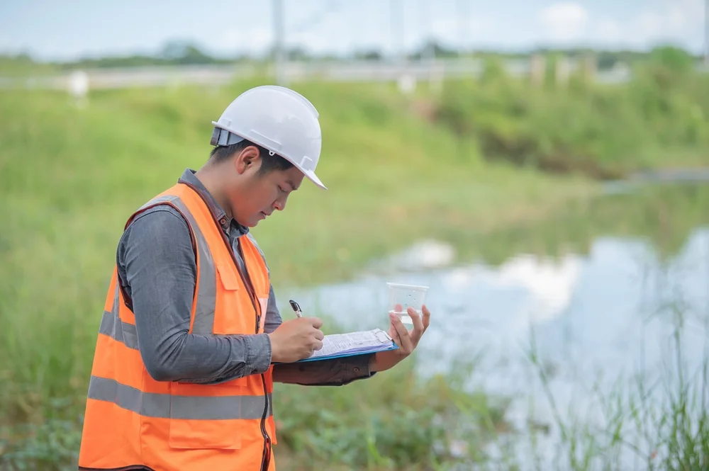
Water is central to both ecosystems and human communities and surveyors assess how it flows across landscapes. By understanding natural hydrology, developments can be designed to manage water sustainably. This supports ecosystems and ensures reliable water resources.
Preserving vegetation ensures ecological balance and protects communities from environmental risks. Surveyors provide essential data on natural features, helping planners make decisions that avoid unnecessary damage. This contributes to both environmental resilience and community wellbeing.
Site selection must balance environmental health with accessibility and liveability. Surveyors evaluate how sites connect with transport and infrastructure community services. This ensures developments are both practical and environmentally responsible.
Effective collaboration ensures development projects meet environmental expectations while serving community needs. Surveyors often act as the bridge between technical data and policy frameworks. They ensure projects are compliant and future-ready by working closely with councils and consultants. This cooperation builds trust and leads to outcomes that balance growth with responsibility.
Council planning frameworks set the tone for sustainable development and surveyors play a key role in meeting them. By translating technical data into actionable plans, they ensure alignment between project goals and community priorities. This helps avoid costly delays and builds community confidence.
Environmental consultants bring expertise in biodiversity and ecological systems which surveyors complement with detailed land data. They both create strategies that protect the environment while allowing for responsible development. This partnership enhances both compliance and long-term sustainability.
Communities are central stakeholders in sustainable development and surveyors help build trust by providing accurate information. Their data-driven approach ensures transparency, reducing resistance and fostering collaboration. This leads to projects that better reflect community values.
Sustainability standards continue to evolve as new environmental challenges emerge. Surveyors ensure projects not only comply with current regulations but also anticipate future requirements. This proactive approach supports long-term resilience and reduces costly retrofits. By aligning development with high standards, surveyors help ensure projects remain relevant and responsible.
Environmental impact assessments are critical in securing approvals and surveyors provide the essential data to meet them. By mapping risks and ecological assets, they ensure assessments are both thorough and accurate. This builds confidence in the project’s sustainability.
Sustainable standards increasingly require integration of renewable energy and low-carbon solutions. Surveyors contribute by providing the land and environmental data that enables these initiatives. This helps projects align with future-focused sustainability goals.
Environmental regulations evolve quickly and surveyors help projects anticipate these changes. By considering potential policy shifts, they ensure developments remain compliant and competitive. This proactive approach saves costs and builds resilience.
Technology has revolutionised surveying by enabling more accurate and sustainable practices. Tools such as GIS, drones and data analytics provide insights that were previously impossible to achieve. These innovations allow surveyors to reduce environmental impact while improving project outcomes. With advanced technology, surveying continues to evolve as a cornerstone of sustainable development.
GIS technology allows surveyors to capture and analyse environmental data with precision. It enables planners to visualise complex relationships between ecosystems and infrastructure. This helps ensure decisions are informed and sustainable.
Drones have become a powerful tool for surveyors, allowing for faster data collection with minimal environmental disruption. They provide detailed aerial imagery that enhances accuracy and efficiency. This reduces the need for intrusive fieldwork.
Data analytics transforms raw survey data into actionable insights for sustainable development. Surveyors help planners make smarter decisions by analysing trends and risks. This predictive approach supports long-term resilience.
Surveyors stand at the forefront of sustainable development, bridging the gap between growth and environmental responsibility. Through precise data collection, risk assessment and collaboration with stakeholders, they ensure that projects move forward without compromising natural systems. Their expertise makes it possible to balance community needs with ecological protection, shaping spaces that are resilient and sustainable.
The commitment of MCS Surveyors to sustainable development is embedded in every project. By leveraging advanced technology while working closely with councils and consultants and anticipating future regulatory demands, the business ensures that growth is achieved responsibly. This dedication supports thriving communities while protecting the environment for future generations.