Fastest Turnaround Times In The Surveying Industry!


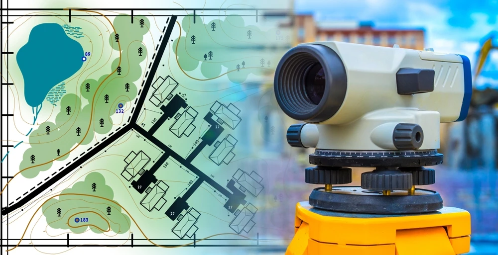
Technology is reshaping how land surveys are carried out in Sydney and across Australia. Traditional methods that relied heavily on manual measurements and extended time on site are now being supported by digital instruments, advanced positioning systems and integrated data platforms. For clients working with land surveyors in Sydney, this shift changes not just how measurements are taken, but how confidently projects can proceed from planning to construction.
At MCS Surveyors, these technologies influence how sites are measured, how data is processed and how plans are prepared for councils, certifiers and designers. In this article, we examine how modern surveying tools are changing fieldwork, documentation and compliance processes across Sydney projects, and what that means in practical terms for property owners, builders and developers.
For many years, land surveying relied on steel tapes, optical theodolites and handwritten field notes. These methods formed the foundation of cadastral and engineering surveying in Sydney, but they required significant manual calculation and multiple data transfers between field and office.
Modern surveying retains the same professional principles, but the tools have changed. Measurements are now recorded electronically, processed through specialised software and transferred directly into drafting and modelling platforms. This reduces manual handling and improves consistency between what is measured on site and what is documented in final plans.
Traditional practice relied on tapes or chains for distance measurement and optical instruments for angles. Corrections for slope and temperature were calculated manually and plotted by hand. On constrained Sydney sites, multiple intermediary setups were often required to capture a single boundary or feature.
Robotic total stations now combine electronic angle measurement, laser distance measurement and digital data recording in a single instrument. Observations are stored directly in a coordinate system aligned with the project requirements. This reduces the number of setup stages required and improves measurement consistency across the site.
In traditional workflows, measurements were recorded in field books and later transcribed into calculation sheets or drafting software. Each transfer step introduced the possibility of transcription error and made audit tracing more complex.
Modern instruments log observations directly into digital files, which are imported into surveying adjustment software before moving into CAD or BIM platforms. Coordinates and levels remain linked throughout the process, creating a consistent data chain from field capture to final plan. This improves traceability and simplifies revision if designs change.
Traditional surveys were often tied to local control marks specific to the site. While suitable for small projects, this limited how easily data could integrate with broader mapping systems.
Modern GNSS technology allows surveys to be related directly to the Geocentric Datum of Australia 2020 and NSW control networks. This enables consistent alignment between cadastral boundaries, infrastructure datasets and design models prepared by other consultants. As a result, survey information can integrate more reliably into planning and engineering workflows.
Modern surveying instruments collect observations with significantly tighter tolerances than earlier manual systems. High precision GNSS receivers, when connected to reference networks, allow coordinates to be fixed to centimetre or sub-centimetre accuracy under suitable conditions.
Robotic total stations measure angles and distances electronically while tracking prism movement automatically. When GNSS and total station observations are combined within the same adjustment software, discrepancies can be identified and resolved before plans are finalised.
Laser scanning further enhances precision in complex environments by capturing dense point clouds that allow detailed surface modelling. Rather than relying on selected spot measurements, surveyors can analyse comprehensive datasets to extract accurate dimensions and levels.
High precision Global Navigation Satellite System (GNSS) receivers now allow surveyors to fix positions to centimetre or even millimetre accuracy, provided they are correctly set up and connected to reference networks. In Sydney surveyors typically use real time kinematic (RTK) GNSS, which relies on permanent base stations to correct satellite signals so coordinates are reliable enough for cadastral and engineering work.
GNSS is often combined with total stations that measure angles and distances using lasers. Modern robotic total stations track a single surveyor holding a prism and automatically follow their movement around the site. This removes small reading errors that occurred when two people had to align and read instruments manually.
By integrating GNSS and total station data in the same software our team can cross check one system against the other. When the two agree within tight tolerances the surveyor can be confident that boundary corners, building setouts and level checks are in the right place.
Terrestrial laser scanners measure millions of points per second to capture existing conditions as a dense 3D “point cloud”. For complex structures, heritage facades or irregular natural ground this provides far more detail than traditional spot levels.
Because scanners capture so many points, random measurement error is reduced and outliers can be filtered out in processing. The surveyor can then extract very accurate floor levels, facade positions or volumes from the data. For architects and engineers this improves the fit between design and reality which lowers the risk of clashes on site.
Laser scanning is particularly useful in confined or busy areas where repeated return visits are difficult. A single scan campaign can provide enough accurate detail to answer future questions without needing to reoccupy the site.
Modern surveying software ties all these measurements together in a single digital workflow. Coordinates, observations and field notes are linked directly to the plan or model that is ultimately provided to the client.
Automated adjustment routines highlight measurements that do not fit the overall network so surveyors can investigate and correct issues before plans leave the office. Built in transformations also ensure data matches Sydney specific datums and council requirements which improves accuracy on paper as well as on the ground.
By combining advanced instruments with rigorous digital checks surveyors can deliver boundary and engineering surveys that stand up to regulatory scrutiny and provide a dependable base for design and construction.
Efficiency gains in modern surveying come from workflow integration rather than isolated instrument speed. Robotic total stations allow single-operator fieldwork, reducing crew coordination requirements. GNSS enables rapid pickup of larger open areas without repeated instrument setups.
Laser scanning captures extensive site detail in a single session, reducing the likelihood of return visits to capture missed information. UAV surveys, where permitted, allow broad terrain capture in a fraction of the time required for traditional ground methods.
Office workflows further improve efficiency. Field data transfers directly into adjustment and drafting software, reducing manual re-entry and accelerating plan preparation.
Robotic total stations allow a single surveyor to do work that used to require a two person crew. The instrument tracks the prism automatically which means the surveyor can move continuously around the site recording points without stopping to direct an operator. On constrained Sydney sites such as urban infill developments this dramatically reduces set up time and person hours on site.
High precision GNSS (GPS) receivers further increase speed on open or partly open sites. They allow rapid pickup of large areas such as rural lots, infrastructure corridors or industrial estates with centimetre level accuracy. Surveyors can often complete feature and level surveys in a fraction of the time that would be required with traditional methods alone. Integration of GNSS with total stations lets the team work efficiently in mixed environments such as streetscapes with both open sky and dense building cover.
Instruments now also perform many checks in real time. Onboard software flags potential errors in height or orientation on site so issues can be corrected immediately rather than discovered days later in the office.
3D laser scanners measure millions of points per second which captures complex structures and facades much faster than traditional detail survey methods. For projects such as heritage buildings, plant rooms or architecturally complex homes a single scan session can capture all visible surfaces. This reduces the need to return to site because something was missed and shortens the time from survey to deliverable models.
Unmanned aerial vehicles with survey grade sensors are increasingly used in suitable Sydney locations for bulk earthworks, quarries and larger land parcels. One flight can cover many hectares and provide detailed surface models, stockpile volumes and orthophotos. Processing workflows are now streamlined so data captured in the morning can be available for design or volume checks the same day depending on project complexity.
Major efficiency gains occur once data leaves the field. Modern survey instruments used by surveyors link directly to office software which means observations can be uploaded as soon as crews leave site. Automated adjustment, coding and drafting routines generate base plans, contours and models with minimal manual linework.
Because survey, CAD and BIM platforms now integrate more closely, survey outputs can slot directly into architects or engineers design environments. This reduces time spent reformatting files or redrawing data. Cloud based sharing also means project teams can access survey information as soon as it is checked rather than waiting for physical media or lengthy email transfers.
These combined technologies result in shorter survey programs, fewer site revisits and quicker handover of accurate information which supports faster decision making across Sydney projects.
Modern surveying technology supports compliance by maintaining consistent coordinate systems and documented audit trails. Instruments configured to GDA2020 and NSW control standards reduce the risk of datum or projection errors.
Digital workflows provide time-stamped observations, stored raw data and traceable adjustment reports. This enables survey plans to demonstrate alignment with statutory requirements for development applications, construction certificates and lodgement with NSW Land Registry Services.
Integration with GIS datasets and planning overlays also allows height, setback and easement constraints to be verified against measured site conditions before submission.
Modern survey instruments are designed to work directly with the Geocentric Datum of Australia 2020 (GDA2020) and the NSW Survey Control Network. GNSS rovers, robotic total stations and digital levels can be configured to use the correct datums, map projections and height systems from the outset.
Surveyors use field software that embeds these settings into each job template. This reduces the risk of human error when entering coordinate systems or scale factors and helps ensure that every boundary or construction set‑out relates correctly to NSW cadastre and planning controls. Automated checks in the software warn the surveyor if control does not meet positional tolerance requirements so issues are detected before plans are lodged.
Compliance often depends on proving what was done, when it was done and which data was used. Modern survey workflows support this through:
- Time‑stamped field observations linked to instrument IDs
- Centralised cloud storage of raw data, calculations and final plans
- Version control that tracks who edited what and when
If a council, certifier or LRS requires clarification surveyors can retrieve original GNSS logs, total station observations or adjustment reports. This level of traceability supports audits, reduces disputes and provides confidence that the survey complies with relevant legislation and practice directions.
Digital signatures and secure PDF outputs further protect the integrity of plans. They help ensure that any plan submitted electronically to council or LRS is exactly the one certified by the registered surveyor.
Surveying compliance no longer stops at the boundary. Technology allows planning and construction rules to be checked directly against the survey model. By integrating GIS datasets, LEP and DCP layers and design models in CAD or BIM, surveyors can verify:
- Building envelopes against height limits and setbacks
- Easements, restrictions and sewer mains against proposed works
- Finished floor levels against flood or overland flow requirements
On construction sites 3D machine control models and layout exported from the survey design help builders construct within specified tolerances. Mobile devices allow as‑built data to be captured and compared in real time with approved plans. Any non‑conformances can be identified early, documented with coordinates and photos then reported in a way that aligns with compliance and certification processes in NSW.

Modern surveying tools offer significant capability, but their performance depends on site conditions, regulatory settings and appropriate professional oversight. Each technology has operational limits that must be understood so results are interpreted correctly and applied appropriately within a project.
Effective surveying relies on selecting the right method for the environment. This may involve combining GNSS, laser scanning, robotic total stations or drone capture with traditional control techniques and independent checks.
High precision does not guarantee reliability in every situation. GNSS equipment can struggle in dense tree cover, near tall buildings or under bridges where satellite signals are blocked or reflected. In central Sydney, high-rise environments can introduce multipath errors that require identification and verification against established control.
Laser scanners and robotic total stations depend on clear line of sight. Fog, heavy rain, dust, reflective glass or very dark materials can reduce point quality or create gaps in the dataset. Drones are affected by wind, cloud cover and restricted airspace near airports or sensitive infrastructure. For example, operations near Sydney Airport are subject to strict CASA requirements and may require alternative ground-based approaches.
For this reason, surveyors validate digital measurements using control checks, redundant observations and reference to established geodetic frameworks such as GDA2020 and the Australian Height Datum.
Survey technology must operate within New South Wales legislation and council requirements. Not all datasets are legally suitable for every purpose.
Cadastral boundary surveys in NSW must be completed, certified and lodged by a Registered Surveyor. While GNSS, scanners and drones support boundary identification, they do not replace the legal processes of title investigation, field marking and formal plan preparation for NSW Land Registry Services.
High-resolution imagery and aerial surveys also raise privacy and safety considerations. Drone operations must comply with CASA regulations, including no-fly zones, altitude limits and visual line-of-sight requirements. In urban environments, flight paths and timing often need adjustment to avoid overlooking neighbouring properties and to meet community expectations.
Planning authorities, utility providers and infrastructure owners may specify required formats, coordinate systems and accuracy classifications. Data captured outside these specifications may not be accepted for approval or construction purposes.
Advanced equipment requires trained operators who understand both the technology and surveying fundamentals. Incorrect setup, unsuitable coordinate systems or inadequate ground control can produce datasets that appear precise but do not meet project requirements.
There are also practical cost and data management considerations. Laser scanning and drone surveys generate large volumes of information that require:
- Secure storage and backup
- Appropriate processing hardware and licensed software
- Structured workflows and version control
Misinterpretation of dense point clouds or terrain models can lead to misplaced confidence in tolerances that are not appropriate for legal boundary definition or construction set-out.
Surveyors assess the suitability and cost-benefit of each method in relation to the project objectives and document any relevant limitations so that project teams understand how the data can and cannot be relied upon.
For property owners, builders and developers in Sydney, these technologies provide clearer site information earlier in the project lifecycle. More reliable boundary definition, consistent height data and integrated digital models reduce uncertainty during planning and construction.
Rather than replacing professional judgement, modern tools enhance it. When applied correctly, they support better coordination between surveyors, designers and approval authorities, helping projects proceed with greater confidence and fewer avoidable disputes.
High precision equipment and digital records mean boundaries and easements are located and documented with far greater certainty. For a homeowner extending a dwelling in the Inner West, or a developer consolidating lots in Western Sydney, this level of confidence is critical.
Accurate surveys help to:
- Avoid encroachments onto neighbours or council land
- Confirm heights and setbacks meet LEP and DCP controls
- Provide reliable evidence in case a boundary is questioned later
Because field data is stored and processed digitally, surveyors can quickly reproduce plans, cross check previous surveys and support solicitors or planners with clear, current information. This reduces the chance of costly redesigns or legal disputes after construction has started.
Modern surveying workflows significantly shorten the time between booking a survey and receiving usable plans. GNSS and robotic instruments reduce field time, while automated processing and CAD integration speed up drafting.
For builders and developers this means:
- Site detail and contour surveys delivered sooner so architects can start design earlier
- Subdivision and strata plans prepared efficiently so lodgement to NSW Land Registry Services is not held up
- Setout services carried out quickly so trades have accurate reference points and do not wait for updated grids
In practical terms a builder in Sydney can schedule trades with more confidence because survey control, check surveys and as‑built confirmations can be turned around promptly. This reduces idle time on site and helps projects stay aligned with construction programs.
Sydney councils, certifiers and NSW Land Registry Services expect survey information to meet strict standards. New technology helps surveyors deliver data that aligns with those expectations from the start.
High resolution topographic data and precise height information assist designers to demonstrate compliance with:
- Maximum building height and FSR controls
- Overlooking and overshadowing requirements
- Flood, overland flow and stormwater design criteria
For developers, detailed digital terrain models support more accurate earthworks and stormwater design which can simplify negotiations with council engineers. For property owners, accurate inverte and ridge levels make BASIX, shadow diagrams and building height checks more straightforward.
Because the entire workflow is digital from field capture to final plan it is easier to ensure that what is submitted to council or NSW LRS exactly matches what exists on site. This reduces the risk of rejection, requests for clarification or compliance issues during occupation certificate or registration.
Modern surveying technology is now embedded in how projects across Sydney are measured, documented and approved. When combined with professional oversight and adherence to NSW standards, these tools strengthen reliability across planning and construction processes. For project teams, the value lies not in the technology alone, but in how effectively it is applied to reduce uncertainty and support informed decision-making.