Fastest Turnaround Times In The Surveying Industry!


Stormwater and drainage easements are often overlooked during early site planning, yet they can have a major influence on whether a development moves smoothly through design, approval and construction. For developers working with constrained land, ageing drainage networks, coastal rainfall patterns and changing authority requirements, easements can affect site layout, servicing options, construction staging and long-term maintenance access.
In this article, MCS Surveyors discusses how stormwater and drainage easements operate, when they are required and why early assessment by experienced surveyors in Shellharbour helps keep development projects compliant, serviceable and commercially viable.
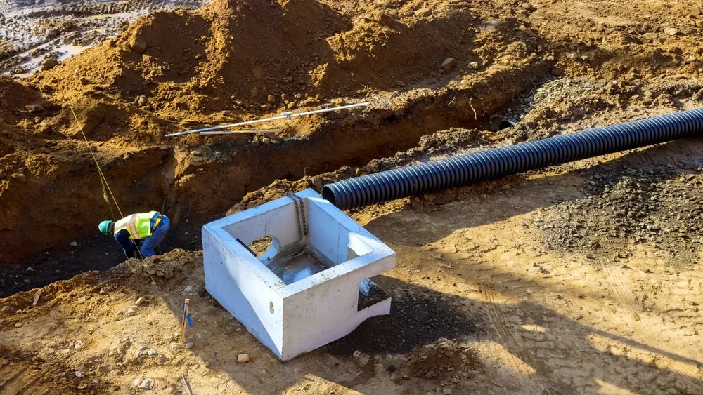
Stormwater and drainage easements are legally defined areas of land reserved for the movement, management or maintenance of stormwater infrastructure. They may contain underground pipes, pits, culverts, open channels, swales or overland flow paths. Although the land may remain in private ownership, its use is restricted so drainage assets can operate properly and remain accessible for inspection, repair or upgrade.
For developers, an easement is not just a line on a title plan. It can determine where buildings, driveways, retaining walls, landscaping and services can be placed. It can also influence whether a site can drain by gravity, whether off-site drainage rights are needed and whether additional approvals are required before construction can proceed.
The main purpose of a stormwater or drainage easement is to protect drainage infrastructure and preserve safe water flow across or through a property. In many cases, the easement grants rights to a council, water authority or neighbouring property owner to use part of the land for drainage purposes.
These rights may allow the benefiting party to install, inspect, repair or upgrade drainage assets. They may also prevent the landowner from building over the easement, blocking access or altering ground levels in a way that affects stormwater performance.
Because easements are usually registered on title, they continue to apply when the property changes ownership. This gives future owners, authorities and developers a clear legal framework for how the land can be used.
Stormwater and drainage easements are usually shown on a deposited plan, plan of subdivision or title document. They commonly include a defined width, a stated purpose and a benefiting authority or parcel of land.
The width of an easement may vary depending on the size, depth and type of drainage infrastructure involved. A small pipe may only require a narrow corridor, while deeper pipes, major trunk drainage lines or overland flow paths may require a much wider area.
Within the easement area, common restrictions may include limits on permanent structures, large tree planting, significant excavation, filling, retaining walls or heavy loading. These restrictions are designed to protect the drainage system and ensure future access remains practical.
Different easements serve different drainage functions. A pipe easement usually protects an underground stormwater pipe that carries runoff through private land to a lawful discharge point. An overland flow easement preserves a surface flow path for major storm events when pipe systems reach capacity. Shared or reciprocal drainage easements may allow multiple properties to use a common drainage route.
Understanding the type of easement is important because each one affects design in a different way. A pipe easement may mainly influence building setbacks and service clearances, while an overland flow easement may affect finished ground levels, fencing, landscaping and flood behaviour across the site.
Stormwater and drainage easements directly influence how land can be developed. They affect site feasibility, lot yield, building placement, infrastructure design and approval conditions. When they are not identified early, they can lead to redesign costs, approval delays, construction conflicts and disputes with councils or neighbouring owners.
In Shellharbour and surrounding coastal areas, drainage planning can be particularly important where development is influenced by intense rainfall, low-lying land, older stormwater systems, escarpment runoff or sites that discharge towards sensitive waterways and coastal environments.
Easements should be treated as fixed site constraints during feasibility planning. A drainage corridor through the centre of a site can reduce developable area, limit building envelopes or force changes to road, driveway and lot layouts.
For subdivision projects, easements can influence how many lots can be created and whether each lot can be properly serviced. For commercial and medium-density developments, they may affect basement layouts, loading areas, car parks, landscaped zones and service corridors.
If these constraints are not properly tested at the start, a design may appear workable on paper but later prove difficult or impossible to approve. This can result in reduced yield, unexpected engineering costs or the need for off-site drainage works.
Drainage easements also affect how stormwater systems are designed. Existing easements may determine where a development can connect, what levels are available and whether gravity drainage is possible. If the site cannot drain naturally to an approved discharge point, an easement through adjoining land may be required.
Engineers also need to confirm whether downstream drainage infrastructure has enough capacity to accept additional flows. Where a development increases runoff or changes natural flow paths, councils may require detention, upgraded drainage works, overland flow protection or additional easements to manage the impact.
A properly documented easement helps clarify who has the right to use, access and maintain drainage infrastructure. This reduces the risk of disputes between property owners, developers, councils and authorities.
Maintenance access is a major part of this. Pipes, pits and channels need to remain reachable if they block, fail or require upgrade. If buildings, fences, retaining walls or landscaping block access, the drainage system may become difficult to maintain and the property owner may face compliance issues or costly rectification works.
From a risk perspective, easements help ensure that underground systems and overland flow paths remain functional over the life of the development. This is particularly important where failure could contribute to flooding, property damage or downstream impacts.
A stormwater or drainage easement is usually required when water infrastructure, stormwater discharge or overland flow needs to pass through land that is not owned or controlled by the party relying on that drainage route. This can occur on new subdivisions, infill development sites, sloping land, battle-axe lots, low-lying properties or sites where natural flow paths cross boundaries.
Identifying the need for an easement early is important because it can affect design, negotiations with adjoining owners, council approval, legal documentation and project timing.
An easement may be needed where a proposed development cannot discharge stormwater directly to the street or an existing lawful drainage point. For example, a building pad may sit lower than the road, making gravity drainage to the kerb impossible. In that situation, stormwater may need to pass through a neighbouring property to reach an approved outlet.
Easements are also common where a subdivision creates internal drainage networks that will later be owned or maintained by council or another authority. Where new pipes, pits or open channels pass through private lots, those assets usually need to be protected by registered easements.
Other triggers include upgrading an existing private pipe to service additional lots, formalising an informal flow path, redirecting runoff across multiple properties or creating a shared drainage system between adjoining developments.
Easements may also be required to protect overland flow paths. These are surface routes that carry stormwater during heavy rainfall, particularly when underground pipes cannot manage the full volume of water.
Development that blocks, fills or redirects an overland flow path can increase flood risk for both the subject site and nearby properties. Councils may therefore require an easement or restriction on title to preserve the flow corridor and prevent future owners from building, fencing or landscaping in a way that obstructs water movement.
This is especially important on sites influenced by local catchments, steep terrain, natural gullies or low-lying drainage corridors. In these settings, the easement may be just as important as the pipe network because it provides a safe relief path during major storm events.
Not all easement work involves creating something new. Some projects require existing easements to be confirmed, widened, relocated or varied to match the proposed development. In other cases, an old easement may no longer align with the infrastructure on the ground and may need further investigation before design decisions are made.
Removing or extinguishing an easement is usually more complex because the benefiting authority or landowner must agree that the easement is no longer required. This often depends on drainage capacity, legal rights, asset ownership and whether alternative drainage arrangements are available.
For this reason, easement changes should be assessed early rather than left until the final stages of approval or registration.
Stormwater and drainage easements shape what can be built, where services can be installed and how construction work must be managed. They should be considered before building footprints, road levels, basements, retaining walls and major service routes are finalised.
Accurate survey information is essential at this stage because design teams need to know the exact location, width and conditions of every easement affecting the site.
Most drainage easements restrict permanent structures within their footprint. This can affect the placement of dwellings, commercial buildings, garages, swimming pools, retaining walls and basement car parks.
Basements require particular care because deep excavation near drainage infrastructure may affect pipe support, access or future upgrade requirements. Even where a structure does not sit directly over an easement, nearby footings, shoring or retaining systems may still need to be checked against council or authority requirements.
In subdivision projects, easements may reduce usable lot area or limit where future buildings can be positioned. This can influence minimum lot sizes, private open space, driveway design and overall project yield.
Drainage easements also affect how other services are coordinated. Designers need to maintain suitable separation between stormwater assets and other utilities, including sewer, water, electrical and telecommunications infrastructure.
Finished surface levels are another important consideration. Levels over and around an easement must allow water to move safely without directing runoff towards buildings or trapping water behind retaining walls. Where overland flow is involved, fencing, landscaping and driveway levels must be designed so they do not obstruct the intended flow path.
Access must also remain practical. A narrow strip between buildings may technically contain a pipe, but it may not provide enough room for maintenance equipment. Councils and authorities may require a wider or better-aligned easement if access is likely to be difficult.
Easements can also influence how work is staged on site. Construction near existing drainage infrastructure may require pre-start inspections, dilapidation records, protection measures and restrictions on heavy machinery.
Temporary works must not block overland flow paths or cover pits and manholes. Stockpiles, site sheds, spoil heaps and construction compounds should be kept clear of drainage corridors unless specific approval has been obtained.
Where a pipe upgrade, diversion or new drainage line is required, the construction programme needs to allow time for authority approvals, survey set-out, inspections, as-constructed surveys and any easement registration or variation required before the development can be completed.

Surveyors play a critical role in identifying, defining and documenting stormwater and drainage easements. Their work connects the physical features on the land with the legal boundaries, title conditions and approval requirements that govern development.
Without accurate survey work, easements may be mislocated, incorrectly sized or omitted from project documentation. This can cause conflicts during design, delay approvals or create long-term legal and maintenance issues after construction.
The first step is to confirm what already exists. Surveyors review title documents, deposited plans, subdivision plans and other land records to identify easements that burden or benefit the property.
They also locate physical drainage features on the ground, including pits, pipes, headwalls, channels, watercourses and visible overland flow paths. These features are related back to cadastral boundaries, buildings, levels and other site constraints.
This information helps engineers, planners and architects understand whether the legal easement matches the drainage infrastructure on the ground. Where there is a mismatch, further investigation may be needed before design decisions are made.
Where a new easement is required, surveyors prepare the plans and documentation needed for approval and registration. This may involve defining the easement’s exact location, width, bearings, dimensions and relationship to property boundaries.
The easement must be described in a way that satisfies council, referral authorities and the land titles office. It must also align with the engineering design and the intended long-term maintenance requirements.
For subdivision projects, surveyors ensure easements are properly shown on the relevant plans so future owners, builders and authorities can understand the restrictions that apply to each lot.
After drainage infrastructure is installed, surveyors may be required to prepare as-constructed surveys confirming the final location and levels of pipes, pits and other assets. This is particularly important where council or authority assets will be handed over or where easements need to be finalised before registration.
Accurate as-constructed information reduces uncertainty and helps ensure the legal easement reflects what has actually been built. This protects developers, authorities and future landowners from avoidable disputes.
Stormwater and drainage easements are closely reviewed because they affect flood risk, infrastructure access and neighbouring properties. Delays commonly occur when design information, survey plans, legal documents and authority expectations do not align.
Understanding these common problems helps developers prepare a stronger approval package from the outset.
One of the most common causes of delay is inconsistent information between survey plans, engineering drawings, hydrology reports and title documents. For example, the easement width shown on a survey plan may differ from the width shown on the drainage design, or the legal description may not match the plan of subdivision.
Even small discrepancies can trigger requests for further information. These issues can add weeks to the approval process, particularly where revised plans need to be prepared, reviewed and reissued to multiple parties.
Supporting calculations, stormwater reports and modelling summaries must also match the design drawings. If catchment areas, pipe sizes, design storm assumptions or discharge points are unclear, authorities may not be able to complete their assessment.
Authorities expect drainage infrastructure within an easement to meet relevant standards for capacity, grades, clearances, access and maintenance. Approval may be delayed if pipe sizes appear underspecified, overland flow paths are not clearly protected or the proposed easement does not provide practical access.
Designs that rely on drainage assets within private lots are often closely scrutinised. If maintenance would require entering enclosed private spaces, removing landscaping or accessing areas with insufficient clearance, councils may request redesign or additional easement rights.
Downstream capacity is another common issue. If the proposed development increases stormwater flows and the downstream system cannot safely receive them, further detention, infrastructure upgrades or additional legal drainage rights may be required.
Many easement delays occur because the design team relies on general assumptions rather than confirming the specific requirements of the local council or relevant authority. Different authorities may have particular expectations around easement width, alignment, pipe depth, access, overland flow protection and asset handover, which is why early reference to the Shellharbour Engineering Code can help reduce redesign and approval delays.
Early consultation can help identify these requirements before the design is too far advanced. Preliminary sketches, drainage concepts and survey information can be reviewed before formal lodgement, reducing the risk of major redesign later in the project.
Stormwater and drainage easements are not simply administrative details attached to a title. They are critical infrastructure corridors that influence site feasibility, drainage design, approval pathways, construction planning and long-term maintenance access.
By identifying easement requirements during the feasibility and planning stages, developers can reduce redesign risk, protect site value and avoid unnecessary approval delays. Accurate survey work gives engineers, planners, councils and landowners the information they need to position, document and protect drainage infrastructure properly.
For development projects in Shellharbour and surrounding areas, early easement assessment is an important part of building a compliant, practical and serviceable project from the start.