Fastest Turnaround Times In The Surveying Industry!


Townhouse developments depend on a clear understanding of the site long before construction begins. From initial feasibility assessments through to subdivision and occupation, accurate survey information ensures that design decisions, planning applications and construction work are based on reliable site conditions. Incomplete or poorly timed surveying can lead to issues that affect the progress and profitability of a project.
MCS Surveyors provides surveying expertise to support developers through the different stages of townhouse projects, helping ensure critical site information is captured and coordinated. For developers working with surveyors in Wollongong, understanding when different types of surveying are required can make it easier to plan each stage and avoid costly complications later.
Each survey serves a different purpose, but together they provide the information needed to turn an initial development concept into an accurate, compliant and buildable project.
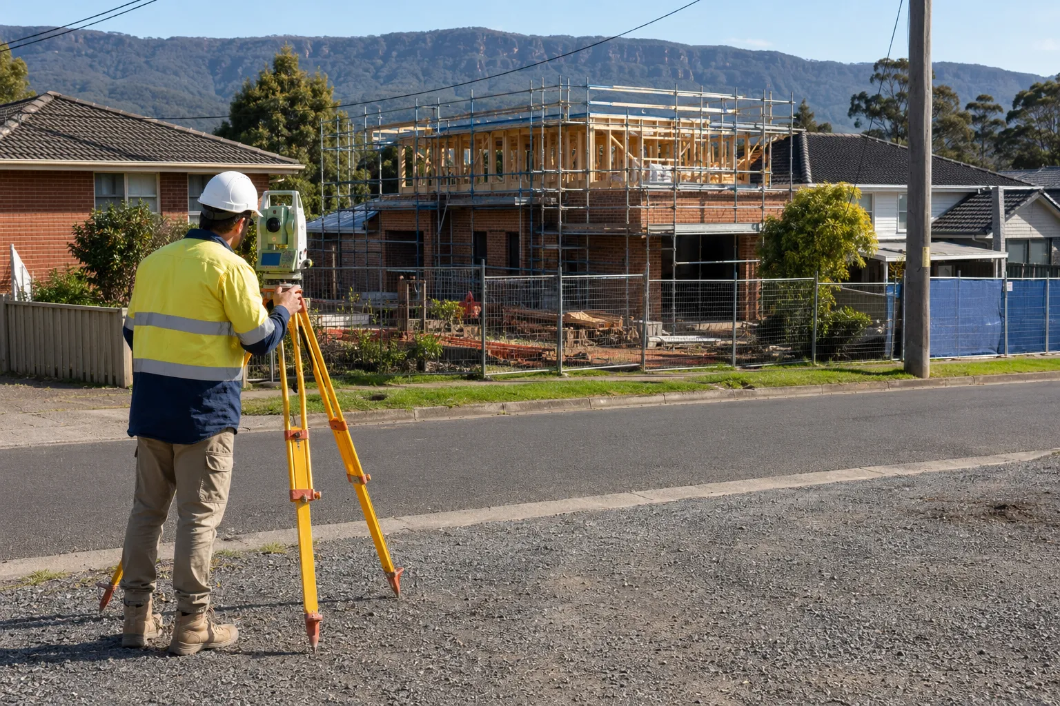
Surveying is a fundamental part of the development. Accurate site information helps developers understand what can be built, assess development potential and design around the property's physical and legal constraints. Without reliable survey data, decisions about setbacks, building levels, access, drainage and lot layouts may be based on assumptions that later require costly changes.
Surveying brings together information about property boundaries, levels, existing structures, services, easements and surrounding features. This gives architects, planners, engineers, certifiers and builders a consistent foundation for their work from initial feasibility through to construction and subdivision.
A detailed feature and level survey helps establish the site's existing conditions before designs are finalised. It can identify:
Accurate levels are important when assessing building height, floor levels, driveway grades, cut and fill, drainage and stormwater requirements. Identifying these conditions early allows the design team to resolve potential issues before a development application is lodged.
Townhouse developments often make efficient use of available land, meaning buildings and private open spaces may be positioned close to property boundaries. A boundary re-establishment survey confirms the legal property limits and can identify discrepancies between title information, existing fences and occupation on the ground.
Surveying can also help identify easements, rights of carriageway, restrictions and other title interests that may affect the development. These matters can influence building locations, access, services and construction methods, making them important considerations during the early design stage.
Surveying continues once the design is approved. Setout surveys help ensure buildings, driveways and other elements are constructed in their intended locations and to the required levels. Identification and as-built surveys can then document completed work and provide information for certification and subdivision processes.
Maintaining accurate survey information throughout the project can reduce the risk of encroachments, construction errors and subdivision complications while providing a clear record of the development.
Before architectural planning begins, a townhouse site should be surveyed thoroughly enough to establish its boundaries, levels, existing features and major constraints. This gives the architect, planner and engineering team reliable information for assessing development potential, testing yield and developing a practical concept.
Understanding the site information needed before design begins helps ensure boundaries, levels, access, drainage and surrounding features are considered before the townhouse layout is developed.
A typical pre-design survey process includes the following:
1. Complete a detail and contour survey
A contour and detail survey establishes the site’s existing conditions, including ground levels, contours, drainage patterns, buildings, driveways, fences, retaining walls, road features and visible services. Relevant features on neighbouring properties may also need to be captured where they could affect privacy, overshadowing or building design. The survey extent should be agreed with the project team and reflect the requirements of the relevant approval pathway.
2. Confirm the legal boundaries
A boundary re-establishment survey checks the property's legal limits against the deposited plan, survey marks and existing occupation. This is important where buildings, driveways or private open spaces will be positioned close to boundaries. Identifying discrepancies early can help prevent encroachments, redesigns and disputes while providing reliable information for future subdivision or strata planning.
3. Identify easements, services and other constraints
Title information and site investigations should be reviewed alongside the survey to identify matters that could affect the proposed layout. These may include sewer and stormwater infrastructure, electricity services, drainage and access easements, rights of carriageway, restrictions on use, overland flow paths and flood constraints. Sloping or flood-prone sites may require additional investigation to establish appropriate floor levels, access, parking and drainage requirements.
Completing these investigations before the design is finalised gives the project team a clearer understanding of what the site can accommodate and provides a reliable foundation for planning and engineering documentation.
Accurate survey information gives councils, architects, planners and certifiers a proper understanding of the existing site. Property boundaries, ground levels, setbacks, access and surrounding structures can influence the design and its ability to meet applicable planning controls.
Developers can use the NSW Planning Portal Spatial Viewer to review applicable zoning and planning maps, although project-specific controls and survey requirements should still be confirmed with the relevant council and consultants.
A current survey provides the base information used for architectural, engineering, stormwater and landscaping plans. Reliable reduced levels (RLs) help the design team assess building heights, finished floor levels, driveway grades and drainage, while information about adjoining buildings and windows can assist with privacy and overshadowing considerations.
Surveying can also identify potential issues, including easements, encroachments, steep grades, drainage infrastructure and overland flow paths. Addressing these matters before a DA or other approval is lodged allows the project team to adjust the design and resolve conflicts early, reducing the risk of avoidable amendments and delays.
Easements, underground services and physical site conditions can have a major impact on the feasibility and layout of a townhouse development. Surveyors combine field measurements with cadastral information, deposited plans, title records and available service data to identify constraints that may affect where buildings, driveways, drainage and other infrastructure can be located.
Existing stormwater and drainage easements can restrict building footprints, influence driveway and service locations and affect the proposed subdivision layout.
Surveying can identify legal interests such as drainage and sewer easements, rights of carriageway and restrictions on use, while fieldwork records features like sewer manholes, stormwater pits, utility infrastructure, retaining walls, trees and existing structures. Accurate levels can also help assess sloping sites, driveway grades, finished floor levels, cut and fill and potential overland flow paths.
Once identified, these constraints can be incorporated into the survey information used by architects, engineers and planners. This allows the proposed layout to be tested against the site's actual conditions before the design is finalised, helping reduce the risk of service conflicts, restricted building areas and inaccurate levels.
Surveying shifts from assessing development potential to verifying that the approved design is being built in the correct location and to the required levels. Construction surveys can help confirm building positions, boundaries, setbacks and other critical elements while identifying discrepancies before they become expensive to rectify.
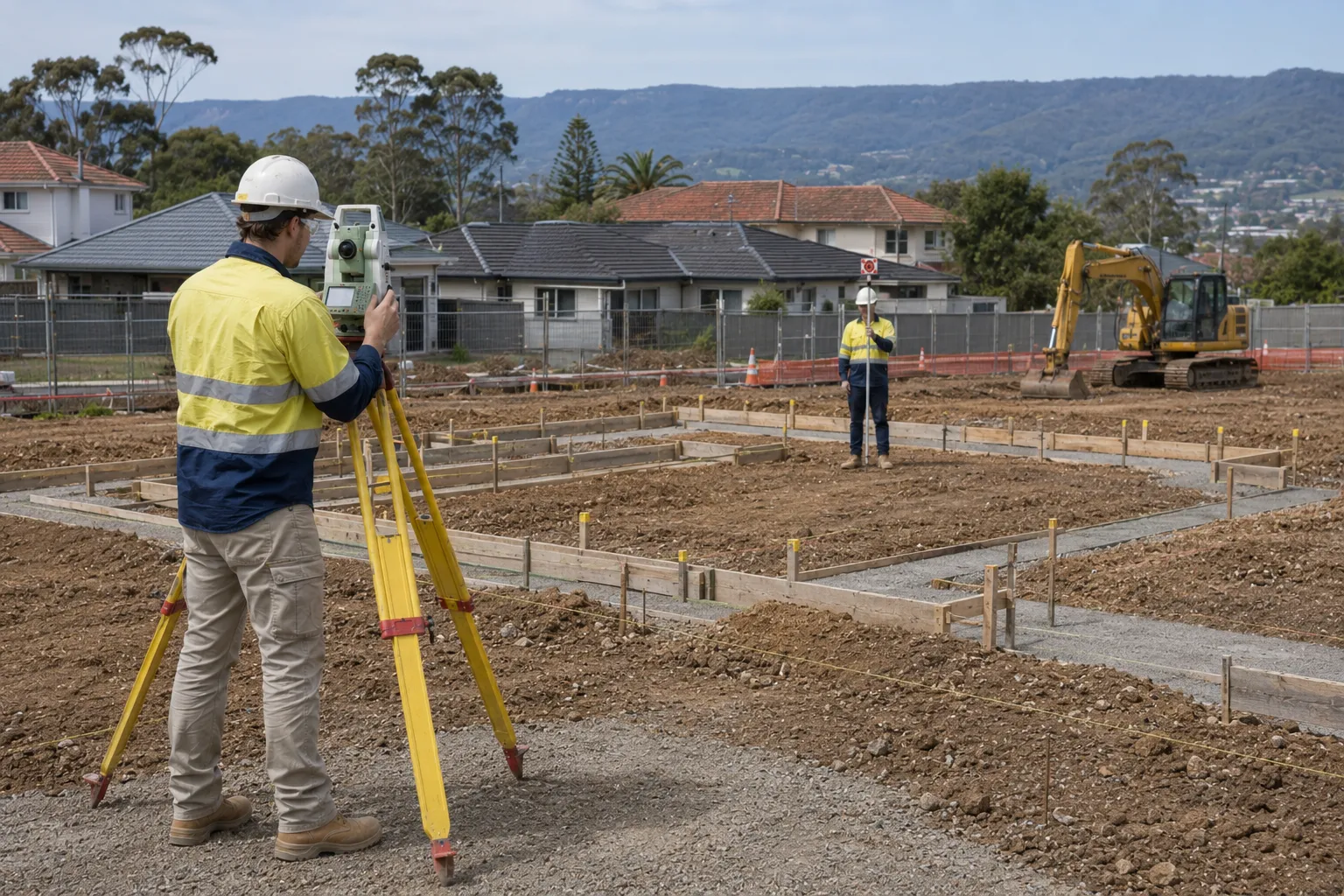
A setout survey establishes the precise location of each townhouse, including building footprints, party walls, setbacks and other critical elements. Surveyors may also set out driveways, parking areas, stormwater infrastructure, sewer connections and other services where required by the project.
As construction progresses, check or identification surveys can verify building positions, floor levels and heights against the approved plans. These checks are useful where townhouse sites have tight setbacks or height restrictions, as discrepancies can be identified while corrective action is still practical.
Towards completion, work-as-executed surveys can confirm the location and levels of relevant infrastructure. Depending on the project and approval requirements, this information may support certification, service connections or subdivision and strata documentation.
Maintaining survey control throughout construction provides a reliable record of the completed development and reduces the risk of boundary, level and compliance issues being discovered late in the project.
Accurate survey information gives architects, engineers, planners and builders the site data they need to design and construct a townhouse development. It establishes the property's boundaries, levels, existing features, services and other relevant constraints, allowing the project team to work from the same base information.
Architects typically use the survey as the foundation for developing the layout. It can show property boundaries, ground levels, existing structures, retaining walls, trees, driveways, vehicle crossings, visible services, easements and relevant features on adjoining properties. This information helps determine the position of dwellings, setbacks, parking, private open space and finished floor levels.
Engineers and planners use the same survey data to assess site constraints and develop supporting documentation. Detailed levels, drainage infrastructure and overland flow information can assist with stormwater and civil design, while boundaries and surrounding features help assess setbacks, privacy, overshadowing and access.
Using consistent survey information across the consultant team reduces discrepancies between plans and helps ensure that different aspects of the development are based on the same site conditions.
Once the design is approved, builders rely on survey information for accurate construction setout. Established boundaries, building footprints, setbacks and finished levels help ensure townhouses, party walls, driveways and services are constructed in the correct locations.
Survey checks during construction can verify floor levels, building positions and heights, while as-built surveys can document completed drainage, services and other infrastructure. This is vital on townhouse sites where buildings, boundaries and services often have limited separation.
Subdivision and strata surveying determines how a townhouse development is legally divided and how individual dwellings, common property and shared areas are defined. Depending on the project, a development may involve Torrens, strata or community title, where shared driveways, parking, services or common areas are required.
Developers should also review the applicable residential subdivision requirements in Wollongong, including the council controls relevant to Torrens, strata and community title proposals.
The surveyor works with the development team to translate the approved design into a practical subdivision arrangement. This can involve establishing individual lot boundaries, common property, accessways, easements and service areas while ensuring the proposed layout reflects the approved development.
Considering the intended title structure early can also help identify potential impacts on lot sizes, access, parking, private open space and the future use or sale of individual properties.
1. Preliminary subdivision planning
A preliminary plan can be used during the design and approval process to test proposed lot boundaries, access arrangements and common areas. Making adjustments at this stage is easier than changing the layout after construction.
2. Construction and identification surveys
Once the townhouses are built, surveying can confirm the position of buildings, driveways and other relevant features against the approved design and proposed boundaries. This helps ensure the final subdivision or strata documentation reflects what has actually been constructed.
3. Final subdivision or strata plans
The surveyor prepares the required plans and documentation for certification and registration. Depending on the project, these may define individual lots, common property, easements and other relevant interests. In strata schemes, the plan establishes the relationship between private lots and common property, while community schemes can involve shared association property and other defined areas.
Accurate surveying throughout this process helps ensure that access, services and legal interests are properly defined and that individual townhouses can be separately titled where the approved subdivision structure allows.
Townhouse developments can be sensitive to boundary, title and physical site constraints. Issues that are overlooked during feasibility can affect setbacks, development yield, access, fire separation and drainage, potentially leading to redesigns, disputes or approval delays.
Existing fences, retaining walls and structures do not always align with the legal property boundary. A boundary re-establishment survey compares title information, deposited plans, survey marks and occupation on the ground to confirm the property's legal limits.
Identifying encroachments or boundary discrepancies early allows the design team to address them before they affect setbacks, building separation or the approval process.
Easements, rights of carriageway, restrictive covenants and existing services can limit where townhouses, driveways and infrastructure can be positioned. Reviewing these matters alongside relevant title and service information allows architects and engineers to account for them during design and reduce the likelihood of conflicts later.
Site levels and surrounding conditions can influence townhouse layouts, particularly on sloping or flood-affected properties. Accurate survey information helps establish driveway grades, finished floor levels, retaining requirements and drainage paths.
Adjoining buildings, windows and private open spaces may also need to be considered when assessing privacy and overshadowing. Understanding these conditions early gives the project team a clearer picture of what can realistically be built.
The cost of surveying varies depending on the site, survey scope and number of project stages involved. A straightforward feature and level survey will involve less work than a project requiring boundary re-establishment, easement investigation, construction setout, check surveys and final subdivision or strata plans.
Rather than treating surveying as a single upfront expense, developers should allow for survey work across the different stages of the project. Costs can be influenced by:
Because the scope can vary between projects, a surveyor should provide a quotation based on the actual site and proposed development rather than relying on a generic price. Developers should confirm what will be surveyed, whether adjoining features are included, what deliverables and digital formats are provided and which construction or subdivision services are included.
Include surveying in the development budget from the feasibility stage, with a contingency for additional work if site conditions or project requirements change. The cost of obtaining reliable survey information is easier to manage when planned from the beginning than when unexpected boundary, level or construction issues require urgent additional work later.
.webp)
A registered land surveyor should be involved early in a townhouse development and at key stages throughout the project. Engaging the surveyor at the appropriate time helps establish reliable site information, identify constraints and coordinate surveying requirements with the wider project team.
Surveying should ideally begin before purchasing the site or as soon as feasibility work starts. A detail and level survey, together with boundary investigation where required, can confirm property limits, ground levels, existing structures, services, easements and other site constraints.
This information allows developers to test potential yield, setbacks, access, privacy and overshadowing before committing to a design or acquisition.
A current survey provides the base information needed for architectural, planning and engineering documentation. At this stage, the surveyor may confirm boundaries and easements, provide detailed levels and prepare information in formats suitable for the project team's design software.
For multi-lot or battle-axe sites, preliminary subdivision information may also help test whether the proposed layout can accommodate access, parking and private open space requirements.
Once construction begins, surveyors may be engaged to set out building footprints, boundaries, walls, driveways and other critical elements, followed by check surveys to verify positions and levels. At completion, as-built and identification surveys can support relevant certification, subdivision or strata documentation and plan registration.
Bringing the surveyor back at these key stages helps confirm that the completed development reflects the approved design and that the information required for the next stage is accurate.
Surveying is a critical part of townhouse development in NSW, providing the site information needed to guide feasibility, design, approvals, construction and subdivision. Establishing boundaries, levels, easements, services and other constraints early can help developers decide and reduce the risk of redesigns, delays and disputes.
MCS Surveyors supports developers throughout the surveying process, helping turn development concepts into accurate, compliant and buildable projects. By engaging an experienced surveying practice and coordinating survey work with the wider project team, developers can achieve greater certainty from initial planning through to construction and final subdivision.