Fastest Turnaround Times In The Surveying Industry!


A survey drawing can look complete even when parts of the site were hidden behind stored materials, locked gates or dense vegetation. If you are developing or designing a project in Sydney, that distinction matters. A smoothly drawn contour through an obscured area does not necessarily mean the ground beneath it was directly measured.
Understanding survey coverage helps you determine whether the information available is suitable for your design or certain areas need further investigation. MCS Surveyors helps clarify how site conditions and measurement limitations affect the information provided in a survey.
This article explains how measured points differ from inferred surfaces, which site conditions can restrict coverage and when supplementary measurements may resolve gaps without repeating the entire survey.
A detailed survey drawing brings individual observations together to create a representation of a site. However, it does not mean every part of every surface was accessible or visible during the survey.
A plan can show the features that were measured while containing areas where ground conditions remain partly unknown. Recognising these limitations is important before using the drawing to establish building positions, floor levels or excavation requirements.
A surveyor may be able to observe the edge of a storage container, the top of a material stockpile or the face of a fence without being able to measure the ground behind or beneath it. Recording the visible obstruction does not establish the concealed surface.
This distinction matters when a drawing contains numerous nearby details. Several measurements around an obstruction might describe surrounding structures and exposed surfaces without providing information about the terrain underneath. The presence of detailed features does not necessarily establish the condition of the entire site.
The survey scope also matters. A survey prepared for one purpose may not include the observations required for another. Understanding the different types of land surveys and when they are needed clarifies if an information gap relates to site access or the original survey requirements.
Contours are derived from selected measured points and the relationships between those observations within a surface model. They represent changes in elevation rather than continuous measurements of every location along each line.
Interpolation is a normal part of this process. It estimates elevations between measured points based on the available observations and the assumed shape of the terrain. Where the ground has a reasonably consistent slope, this can provide a useful representation for the intended purpose.
However, consider a survey where the ground has been measured on either side of a concealed strip. The observations might suggest a gradual slope between those locations, allowing the software to generate connecting contours. If the hidden section contains a depression, raised section or retaining edge, the estimated surface may not reflect the actual terrain.
The issue is not that interpolation is inherently unreliable. It is that the available observations may not reveal changes that occur between them. Ask how obscured areas are represented and whether the drawing includes notes or qualifications identifying those limitations.
Access and visibility are separate constraints. A surveyor might be able to enter an area but have no clear view of the ground or see part of a site without being able to safely reach suitable observation positions.
These conditions can change quickly on an active site. An area that is accessible during an initial visit might become covered by deliveries later, while a previously obstructed section may become available after site activities are completed. Survey coverage reflects the conditions encountered at the time of measurement.
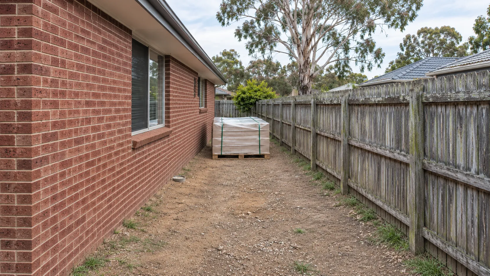
Pallets, soil stockpiles, equipment and site sheds can conceal surfaces that are important to the proposed design. A stockpile may hide the existing ground level and any changes in grade beneath it. Similarly, a temporary structure can block observations along a narrow side passage, leaving limited information about the surface between a building and boundary fence.
An alternative observation position may resolve some obstructions, but it cannot necessarily reveal ground that is physically covered. This is why distinguishing between a blocked line of sight and a completely concealed surface is important.
Dense vegetation can create similar difficulties. Foliage may obscure the ground, a drainage channel or the base of a retaining feature. Measuring the top of the vegetation would describe a different feature from the underlying terrain.
Before the survey visit, inform the surveyor about known obstructions and whether they are expected to remain. If improved coverage requires moving materials or changing site arrangements, coordinate this with the responsible site personnel. Do not assume the survey visit includes relocating stored items or dismantling temporary structures.
Locked courtyards, secured storage areas and separately occupied parts of a property can prevent access even when the terrain itself is straightforward. Permission to survey one part of a property does not automatically provide access to every enclosure or adjoining site.
Safety restrictions may also limit coverage around unstable ground, open excavations, damaged structures or operating machinery. A surveyor should not enter an unsafe area simply to fill a gap on a drawing. Appropriate access arrangements need to be established before further measurements can be taken.
Where excavations or operating machinery restrict access, coordinate the survey visit with the person managing the site, taking account of SafeWork NSW’s excavation and earthmoving safety guidance.
Where access is restricted, ask what information can still be established from safe, authorised observation positions and what remains unknown. For example, measuring the upper edge of a retaining feature may not establish the ground level at its concealed base.
If restrictions are temporary, identify what needs to change before arranging another visit. Making the main gate accessible may not resolve the problem if a separate enclosure remains locked or materials continue to obstruct the required observation area.
Measured observations provide information about specific locations or features. An inferred surface connects those observations to represent the terrain between them. Both are useful, but they do not provide the same level of information about site conditions.
Understanding the difference also helps clarify why survey accuracy and survey completeness are separate considerations.
A measured point establishes information about the feature observed at a position and time, subject to the survey method and its stated limitations. A point on exposed ground provides information about the ground at that location. A point on a concrete slab describes the slab surface, not necessarily the soil beneath it.
This distinction becomes important near obstructions. Several measured points around a stockpile can establish surrounding levels without revealing whether the concealed ground contains a hollow, raised section or sudden change in elevation.
The number and distribution of observations also matter. A survey can contain many accurate measurements across an open part of the property while providing limited information about a critical enclosed corner. A high number of measured points does not automatically mean every important area has been covered.
Measurement accuracy refers to how closely an observation represents the actual position or level of the feature being measured. Survey completeness concerns whether the relevant features and areas have been captured in the first place. A survey can provide accurate measurements where observations were possible while still having incomplete coverage elsewhere.
If a particular area is important to the proposed design, ask the surveyor which observations support the information shown there. This helps establish whether the available data is sufficient for the intended decision.
Interpolation estimates conditions between observations using an assumed relationship between them. That relationship may be reasonable across a broadly uniform slope but less certain where the terrain could contain an unobserved change.
For example, measurements above and below a concealed strip might support a general slope across it. They would not necessarily identify a small terrace or drainage depression within that area. If the feature could affect a proposed floor level, driveway gradient or excavation assessment, the uncertainty deserves attention before the design relies on the model.
Observed changes in slope, retaining edges and other terrain features can help a surface model represent the site more faithfully. Where those features are hidden, their position and shape may remain unresolved. Making a model visually smoother does not supply the missing observations.
NSW Spatial Services’ elevation data guidance provides a broader example: its photogrammetric elevation model includes interpolated areas where vegetation, shadows or steep slopes prevented complete data capture.
This is why accurate site levels on sloped or complex blocks depend on capturing relevant terrain changes rather than simply generating contours across the entire property.
Ask whether an inferred area is suitable for the current design stage and what qualifications apply. A surface that supports an early layout discussion may need additional observations before it can support more sensitive decisions about building levels or earthworks.
A gap matters when uncertainty within it could change a design decision. Its physical size alone is not a reliable measure of its significance. A small concealed change besides a proposed building may matter more than a much larger unmeasured area elsewhere.
Your designer and surveyor should assess missing information against the intended use of the survey. There is no universal amount of incomplete coverage that is acceptable for every property or project stage.
Where a proposed building overlaps an obscured area, existing ground levels may influence floor planning, excavation assumptions and the relationship between the building and surrounding land.
Consider a proposed extension over an area currently occupied by stored materials. Measurements around its edges might establish the general fall of the site, but they may not reveal a local depression beneath the materials. Whether that uncertainty affects the design depends on the proposed building levels and how the ground will be treated.
The same reasoning applies around the building footprint. A narrow gap near a proposed entrance, driveway transition or retaining interface may be important even though it sits outside the building outline.
The most useful approach is to identify the design decision first, then establish if the available observations are sufficient to support it. For broader preparation, reviewing the site information needed before designing a new home helps place survey coverage questions within the overall design brief.
An obscured patch well away from proposed works may have little bearing on the current design. If no level-sensitive decision depends on it, further measurement might not be an immediate priority.
However, an area outside the building footprint could still affect the interpretation of a drainage path, driveway connection or relationship with adjoining ground. Distance from the proposed structure does not automatically make a coverage gap irrelevant.
A useful assessment considers what could reasonably be concealed, which design decision might be affected and whether that decision can wait. This prevents every missing area from being treated as equally urgent while ensuring smaller but consequential uncertainties are not overlooked.
Keep any acceptance of limited coverage tied to the current design stage and intended use. If the layout changes or proposed works extend into a previously unimportant area, reassess the available information. Survey data that was adequate for an early concept may not be sufficient for later design decisions.
Targeted supplementary measurements may resolve a vital coverage gap without repeating all earlier survey work. Whether this is practical depends on access, changes to the site and the suitability of the existing survey information.
The starting point is to identify precisely what is missing. Requesting measurements of ground levels within a concealed area is more useful than simply asking for a more detailed survey.
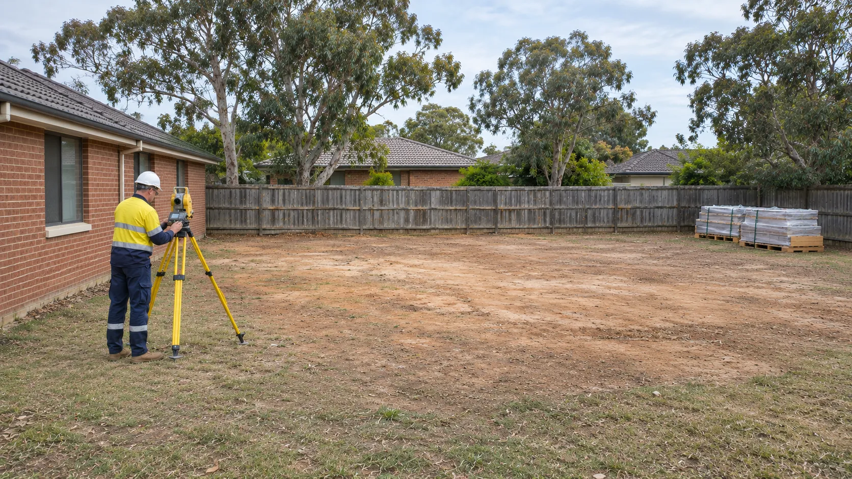
A return visit may be worthwhile after stored materials have been relocated through normal site arrangements, access permission has been obtained or a previously restricted area has been made safely accessible. The surveyor can then assess whether the newly available area can be measured for the intended purpose.
Timing matters. If an obstruction is removed but the ground is excavated before measurements are taken, the original concealed surface may no longer be available to observe. New measurements would describe the changed conditions rather than establish what previously existed beneath the obstruction.
Before requesting supplementary work, prepare the following information:
The surveyor may need observations beyond the exact gap to understand how the newly exposed terrain connects with surrounding features. A defined request does not always mean a single measurement will provide enough information.
New observations need to align with the existing survey’s coordinate and level reference. Otherwise, apparent differences may result from inconsistent references rather than actual changes on site.
The surveyor should assess the available records and whether suitable reference information can be verified. The condition of the original survey control, the age of the measurements and any intervening site works can affect how confidently supplementary data can be connected.
Where the existing information remains suitable, additional observations may support an updated drawing or surface model. If the original records are incomplete, cannot be reliably connected or no longer represent current site conditions, broader remeasurement may be necessary.
Clarify how the updated information will be issued and which earlier material it replaces. If a surface model changes, the designer needs to know which area was revised and if the new measurements affect previously selected levels.
Any remaining qualifications should also be preserved. Resolving one inaccessible area does not establish every other concealed surface on the property. The supplementary deliverable should distinguish newly measured features from areas that remain inferred or outside the available coverage.
Coverage is easier to manage when it is discussed before the site visit. Explain where the design will depend on ground levels and physical features, then ask what access and visibility are needed to capture that information.
The conversation should focus on the actual property and proposed work rather than an assumption that every detailed survey provides identical coverage. Clear expectations help the surveyor identify foreseeable limitations and allow the designer to avoid relying on information that was never established.
Provide the available concept layout and identify locations where small differences in elevation could matter. These might include a proposed building platform, an entrance transition or the junction between new works and an existing retaining feature.
The surveyor can then discuss which observations are relevant to those areas and if any access arrangements are needed before measurement begins.
Also explain known site constraints. A locked enclosure, occupied storage area or heavily vegetated section may require arrangements before measurement is possible. Early notice gives the project team an opportunity to coordinate access rather than discover the restriction after the drawing has been delivered.
If the layout is not settled, explain that as well. Coverage suitable for one proposed footprint may leave questions unanswered if the building moves to another part of the property. The survey scope should reflect the likely design area without suggesting that every possible future arrangement has been covered.
When discussing surveyors in Sydney services, explain the proposed work and areas that may be difficult to access. Ask how those conditions could affect the information available for the design and whether any parts of the survey scope depend on improved site access.
Discuss how measured coverage, inferred surfaces and unresolved areas will be distinguished in the final deliverables. Depending on the survey and file format, this may involve drawing notes, marked areas or explanatory information accompanying the digital data.
The distinction needs to remain understandable when information moves between project participants. A qualification explained verbally to one person may not reach the designer working from a later drawing or digital file. Ask where limitations will be recorded so they can be considered alongside the relevant geometry.
Where digital surfaces are supplied, discuss how excluded or uncertain areas will be represented. A model that can be displayed continuously should not be mistaken for confirmation that every part of the ground was observed.
Also, agree on how important gaps will be raised if they become apparent during the survey. Your designer may need to decide whether to proceed with a qualified assumption, defer a decision or request additional observations.
If access later improves or the design changes, provide the surveyor with the revised information so coverage can be reassessed against the new requirements.
A detailed survey drawing is only as useful as the information available to support the decisions being made. Concealed ground, restricted access and inferred surfaces do not automatically make a survey unsuitable, but they do need to be recognised before building levels, excavation requirements or other design details are finalised. MCS Surveyors understands survey requirements, site constraints and the information needed to support the next stage of a project.